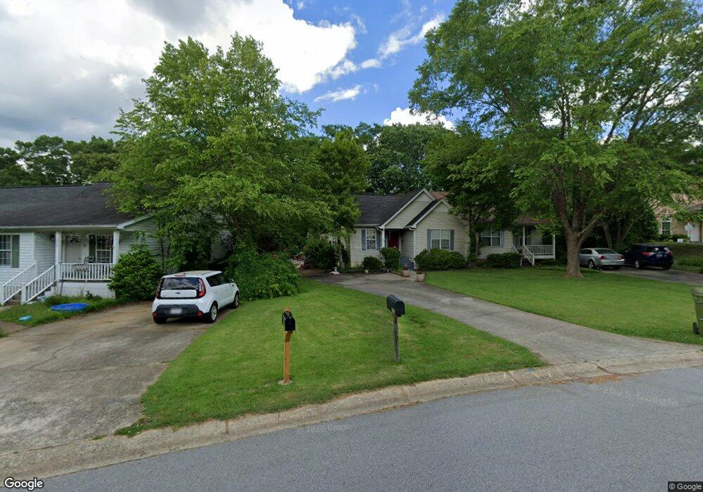
213 Corporate Dr Carrollton, GA 30117
Estimated Value: $202,000 - $218,000
2
Beds
2
Baths
1,042
Sq Ft
$201/Sq Ft
Est. Value
About This Home
This home is located at 213 Corporate Dr, Carrollton, GA 30117 and is currently estimated at $209,657, approximately $201 per square foot. 213 Corporate Dr is a home located in Carroll County with nearby schools including Carrollton Elementary School, Carrollton Upper Elementary School, and Carrollton Middle School.
Ownership History
Date
Name
Owned For
Owner Type
Purchase Details
Closed on
Aug 15, 2022
Sold by
Mcgovern Barbara Nicole
Bought by
Toney Beth
Current Estimated Value
Purchase Details
Closed on
Nov 24, 1999
Sold by
Cain Jay
Bought by
Yow Hubert
Purchase Details
Closed on
Dec 2, 1993
Sold by
Norton Dev
Bought by
Cain Jay
Purchase Details
Closed on
Apr 20, 1992
Sold by
Adams
Bought by
Norton Dev
Purchase Details
Closed on
May 3, 1990
Bought by
Adams
Create a Home Valuation Report for This Property
The Home Valuation Report is an in-depth analysis detailing your home's value as well as a comparison with similar homes in the area
Home Values in the Area
Average Home Value in this Area
Purchase History
| Date | Buyer | Sale Price | Title Company |
|---|---|---|---|
| Toney Beth | -- | -- | |
| Yow Hubert | $78,500 | -- | |
| Cain Jay | $48,000 | -- | |
| Norton Dev | $48,700 | -- | |
| Adams | $48,500 | -- |
Source: Public Records
Tax History Compared to Growth
Tax History
| Year | Tax Paid | Tax Assessment Tax Assessment Total Assessment is a certain percentage of the fair market value that is determined by local assessors to be the total taxable value of land and additions on the property. | Land | Improvement |
|---|---|---|---|---|
| 2024 | $480 | $57,005 | $4,000 | $53,005 |
| 2023 | $463 | $52,781 | $4,000 | $48,781 |
| 2022 | $1,260 | $43,181 | $4,000 | $39,181 |
| 2021 | $1,119 | $38,324 | $4,000 | $34,324 |
| 2020 | $984 | $33,674 | $4,000 | $29,674 |
| 2019 | $929 | $31,494 | $4,000 | $27,494 |
| 2018 | $851 | $28,439 | $4,000 | $24,439 |
| 2017 | $856 | $28,439 | $4,000 | $24,439 |
| 2016 | $860 | $28,439 | $4,000 | $24,439 |
| 2015 | $723 | $23,400 | $4,000 | $19,400 |
| 2014 | $726 | $23,400 | $4,000 | $19,400 |
Source: Public Records
Map
Nearby Homes
- 114 Green Point Way
- 325 Almon Rd
- 123 Autumn Glen Dr
- 111 Lakeview Dr
- 119 Oxford Square
- 123 Cedar Park Way
- 0 Carroll Cir Unit LOTS 4-8 10571562
- 816 Stewart St
- 201 Stewart St
- 403 Burns Rd
- 541 N White St Unit 12
- 541 N White St
- 3 Burns Rd
- 2 Burns Rd
- 0 Carroll Cir- Lots 4-8 Unit 148012
- 150 Cedar Park Way
- 231 N Lakeshore Dr
- 223 N Lakeshore Dr
- 0 Burns Rd Unit LOT 2 10571612
- 0 Burns Rd Unit LOT 3 10571635
- 211 Corporate Dr
- 215 Corporate Dr
- 217 Cottage Ct
- 105 Cottage Ct
- 108 Cottage Ct
- 208 Corporate Dr Unit B
- 208 Corporate Dr Unit A
- 208 Corporate Dr
- 208 Corporate Dr Unit B
- 208 Corporate Dr Unit A
- 208 Corporate Dr
- 106 Cottage Ct
- 104 Cottage Ct
- 102 Cottage Ct
- 311 Corporate Dr
- 116 Corporate Dr
- 313 Corporate Dr
- 104 Greenpointe Way
- 104 Green Point Way
- 114 Corporate Dr