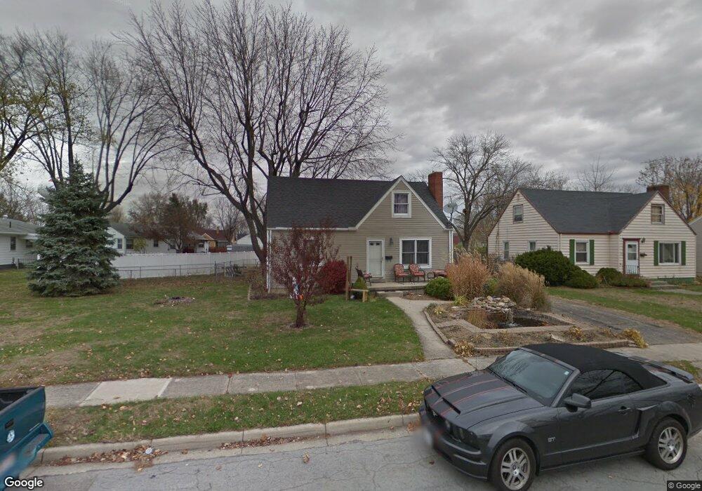
213 Curtiss Wright Blvd Vandalia, OH 45377
Estimated Value: $181,000 - $231,483
4
Beds
2
Baths
1,322
Sq Ft
$161/Sq Ft
Est. Value
About This Home
This home is located at 213 Curtiss Wright Blvd, Vandalia, OH 45377 and is currently estimated at $213,371, approximately $161 per square foot. 213 Curtiss Wright Blvd is a home located in Montgomery County with nearby schools including Demmitt Elementary School, Smith Middle School, and Butler High School.
Ownership History
Date
Name
Owned For
Owner Type
Purchase Details
Closed on
Apr 25, 2005
Sold by
Garman Laraine S and Garman Robert E
Bought by
Waldron James
Current Estimated Value
Home Financials for this Owner
Home Financials are based on the most recent Mortgage that was taken out on this home.
Original Mortgage
$99,550
Outstanding Balance
$51,933
Interest Rate
6.05%
Mortgage Type
VA
Estimated Equity
$161,438
Create a Home Valuation Report for This Property
The Home Valuation Report is an in-depth analysis detailing your home's value as well as a comparison with similar homes in the area
Home Values in the Area
Average Home Value in this Area
Purchase History
| Date | Buyer | Sale Price | Title Company |
|---|---|---|---|
| Waldron James | $97,500 | None Available |
Source: Public Records
Mortgage History
| Date | Status | Borrower | Loan Amount |
|---|---|---|---|
| Open | Waldron James | $99,550 |
Source: Public Records
Tax History Compared to Growth
Tax History
| Year | Tax Paid | Tax Assessment Tax Assessment Total Assessment is a certain percentage of the fair market value that is determined by local assessors to be the total taxable value of land and additions on the property. | Land | Improvement |
|---|---|---|---|---|
| 2024 | $3,163 | $60,570 | $19,200 | $41,370 |
| 2023 | $3,163 | $60,570 | $19,200 | $41,370 |
| 2022 | $2,682 | $41,490 | $13,150 | $28,340 |
| 2021 | $2,684 | $41,490 | $13,150 | $28,340 |
| 2020 | $2,685 | $41,490 | $13,150 | $28,340 |
| 2019 | $2,486 | $35,170 | $13,150 | $22,020 |
| 2018 | $2,490 | $35,170 | $13,150 | $22,020 |
| 2017 | $2,463 | $35,170 | $13,150 | $22,020 |
| 2016 | $2,460 | $34,520 | $13,150 | $21,370 |
| 2015 | $2,429 | $34,520 | $13,150 | $21,370 |
| 2014 | $2,429 | $34,520 | $13,150 | $21,370 |
| 2012 | -- | $37,440 | $12,940 | $24,500 |
Source: Public Records
Map
Nearby Homes
- 314 N American Blvd
- 365 Inverness Ave
- 214 Marview Ave
- 552 Tionda Dr N
- 0 Northwoods Blvd
- 106 Grosbeck St
- 545 Koch Ave
- 416 Attica St
- 92 Waller Ave
- 465 Pilot Point Unit 1-302
- 626 W National Rd
- 475 Pilot Point Unit 1-300
- 1015 van Arden Dr
- 485 Pilot Point Unit 1-301
- 461 Poplar Grove Dr
- 113 Village Trail Dr Unit 6
- 113 Village Trail Dr Unit 2B
- 775 Cassel Creek Dr
- 415 Pilot Point Unit 1-304
- 246 Crest Hill Ave
- 219 Curtiss Wright Blvd
- 206 N American Blvd
- 225 Curtiss Wright Blvd
- 218 N American Blvd
- 228 N American Blvd
- 234 N American Blvd
- 214 Curtiss Wright Blvd
- 208 Curtiss Wright Blvd
- 220 Curtiss Wright Blvd
- 240 N American Blvd
- 231 Curtiss Wright Blvd
- 126 Curtiss Wright Blvd
- 246 N American Blvd
- 234 Curtiss Wright Blvd
- 239 Curtiss Wright Blvd
- 209 N American Blvd
- 120 Curtiss Wright Blvd
- 215 Skyview Dr
- 256 N American Blvd
- 209 Skyview Dr