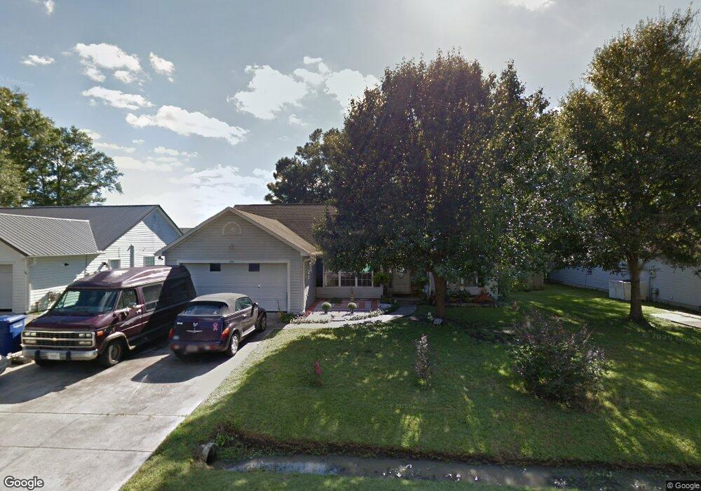
213 Deer Trace Cir Myrtle Beach, SC 29588
Burgess NeighborhoodEstimated Value: $294,000 - $315,000
3
Beds
2
Baths
1,622
Sq Ft
$187/Sq Ft
Est. Value
About This Home
This home is located at 213 Deer Trace Cir, Myrtle Beach, SC 29588 and is currently estimated at $303,365, approximately $187 per square foot. 213 Deer Trace Cir is a home located in Horry County with nearby schools including Burgess Elementary School, St. James Intermediate, and St. James High School.
Ownership History
Date
Name
Owned For
Owner Type
Purchase Details
Closed on
Aug 12, 2008
Sold by
Schick Jack W
Bought by
Costner Lynne S
Current Estimated Value
Purchase Details
Closed on
Jul 21, 1999
Sold by
Zazzaro Rocco J and Zazzaro Kimberly T
Bought by
Schick Jack W and Schick Georgia M
Home Financials for this Owner
Home Financials are based on the most recent Mortgage that was taken out on this home.
Original Mortgage
$67,500
Interest Rate
7.66%
Mortgage Type
Purchase Money Mortgage
Create a Home Valuation Report for This Property
The Home Valuation Report is an in-depth analysis detailing your home's value as well as a comparison with similar homes in the area
Home Values in the Area
Average Home Value in this Area
Purchase History
| Date | Buyer | Sale Price | Title Company |
|---|---|---|---|
| Costner Lynne S | $170,000 | -- | |
| Schick Jack W | $123,500 | -- |
Source: Public Records
Mortgage History
| Date | Status | Borrower | Loan Amount |
|---|---|---|---|
| Previous Owner | Schick Jack W | $67,500 |
Source: Public Records
Tax History
| Year | Tax Paid | Tax Assessment Tax Assessment Total Assessment is a certain percentage of the fair market value that is determined by local assessors to be the total taxable value of land and additions on the property. | Land | Improvement |
|---|---|---|---|---|
| 2025 | $780 | $0 | $0 | $0 |
| 2024 | $780 | $11,077 | $2,600 | $8,477 |
| 2023 | $780 | $6,541 | $1,198 | $5,343 |
| 2021 | $708 | $8,595 | $1,299 | $7,296 |
| 2020 | $613 | $8,595 | $1,299 | $7,296 |
| 2019 | $613 | $8,595 | $1,299 | $7,296 |
| 2018 | $554 | $5,687 | $1,039 | $4,648 |
| 2017 | $477 | $4,995 | $1,039 | $3,956 |
| 2016 | -- | $4,995 | $1,039 | $3,956 |
| 2015 | $486 | $4,996 | $1,040 | $3,956 |
| 2014 | $450 | $4,996 | $1,040 | $3,956 |
Source: Public Records
Map
Nearby Homes
- 1606 Palmina Loop Unit A
- 1201 Eagle Creek Dr
- 8268 Tartan Ln
- 1534 Palmina Loop Unit D
- 544 Fanciful Way
- 425 Tiburon Dr
- 199 Empyrean Cir
- 179 Empyrean Cir
- 315 Kildare Ct
- 845 Bonita Loop
- 322 Kildare Ct
- 165 Osprey Cove Loop
- 6469 Royal Pine Dr
- 617 Towhee Ct
- 160 Lazy Willow Ln Unit 202
- 160 Lazy Willow Ln Unit 103
- 160 Lazy Willow Ln Unit 101
- 273 Copper Leaf Dr
- 1725 Boyne Dr
- 1724 Boyne Dr
- 215 Deer Trace Cir
- 211 Deer Trace Cir
- 217 Deer Trace Cir Unit 217 Deer Trace Circl
- 217 Deer Trace Cir
- 209 Deer Trace Cir
- 204 Deer Trace Cir
- 219 Deer Trace Cir
- 206 Deer Trace Cir
- 1501 Palmina Loop Unit C
- 1501 Palmina Loop Unit 104
- 1501 Palmina Loop Unit 103
- 1501 Palmina Loop
- 1501 Palmina Loop Unit D
- 1501 Palmina Loop Unit A
- 1501 Palmina Loop Unit 101
- 1501 Palmina Loop Unit 102
- 207 Deer Trace Cir Unit Cedar Trace
- 207 Deer Trace Cir
- 208 Deer Trace Cir
- 210 Deer Trace Cir
Your Personal Tour Guide
Ask me questions while you tour the home.