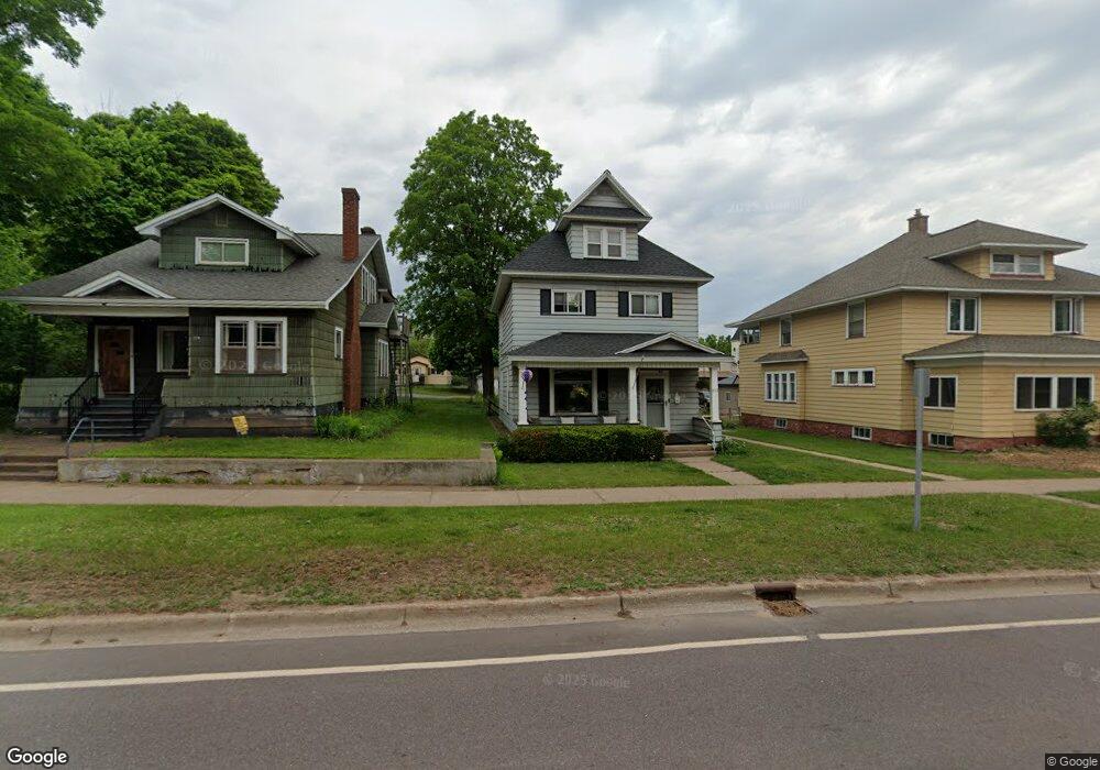
213 E Main St Negaunee, MI 49866
Estimated Value: $218,000 - $275,000
3
Beds
1
Bath
1,712
Sq Ft
$142/Sq Ft
Est. Value
About This Home
This home is located at 213 E Main St, Negaunee, MI 49866 and is currently estimated at $243,792, approximately $142 per square foot. 213 E Main St is a home located in Marquette County with nearby schools including Lakeview Elementary School, Negaunee Middle School, and Negaunee High School.
Ownership History
Date
Name
Owned For
Owner Type
Purchase Details
Closed on
Oct 30, 2018
Sold by
Vivian David K
Bought by
Carlson Todd C and Carlson Lindsey C
Current Estimated Value
Home Financials for this Owner
Home Financials are based on the most recent Mortgage that was taken out on this home.
Original Mortgage
$224,459
Outstanding Balance
$191,855
Interest Rate
3.9%
Mortgage Type
New Conventional
Estimated Equity
$51,937
Create a Home Valuation Report for This Property
The Home Valuation Report is an in-depth analysis detailing your home's value as well as a comparison with similar homes in the area
Home Values in the Area
Average Home Value in this Area
Purchase History
| Date | Buyer | Sale Price | Title Company |
|---|---|---|---|
| Carlson Todd C | $145,000 | Odea Nordeen Burink And Picken |
Source: Public Records
Mortgage History
| Date | Status | Borrower | Loan Amount |
|---|---|---|---|
| Open | Carlson Todd C | $224,459 |
Source: Public Records
Tax History
| Year | Tax Paid | Tax Assessment Tax Assessment Total Assessment is a certain percentage of the fair market value that is determined by local assessors to be the total taxable value of land and additions on the property. | Land | Improvement |
|---|---|---|---|---|
| 2025 | $1,437 | $107,450 | $0 | $0 |
| 2024 | $14 | $92,100 | $0 | $0 |
| 2023 | $1,330 | $87,250 | $0 | $0 |
| 2022 | $2,713 | $68,500 | $0 | $0 |
| 2021 | $2,634 | $73,000 | $0 | $0 |
| 2020 | $2,563 | $68,500 | $0 | $0 |
| 2019 | $2,517 | $60,550 | $0 | $0 |
| 2018 | $1,661 | $58,500 | $0 | $0 |
| 2017 | $1,636 | $58,100 | $0 | $0 |
| 2016 | $1,609 | $55,300 | $0 | $0 |
| 2015 | -- | $55,300 | $0 | $0 |
| 2014 | -- | $51,700 | $0 | $0 |
| 2012 | -- | $45,750 | $0 | $0 |
Source: Public Records
Map
Nearby Homes
- 112 E Clark St
- 516 Prince St
- 212 Patch Rd
- 406 Gold St
- 812 Burt St
- TBD E Wilderness Rd
- 604 County Rd
- 000000 Us Highway 41
- 408 Maas St
- 207 Sunset Dr
- 211 Sunset Dr
- 209 Sunset Dr
- 213 Sunset Dr
- 260 Water St
- 108 Woodland Dr
- 205 Sunset (Lot 9 Foxglove) Dr
- TBD Sunset (Foxglove Floor Plan) Dr
- TBD Sunset (Tulip Floor Plan) Dr
- 349 Us Highway 41
- 0000 County Road 492
Your Personal Tour Guide
Ask me questions while you tour the home.