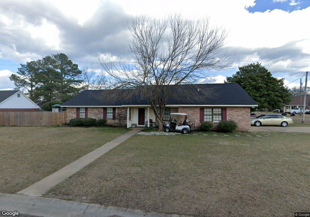
213 E Swoope Dr Columbus, MS 39702
Estimated Value: $222,824 - $244,000
Studio
--
Bath
1,845
Sq Ft
$127/Sq Ft
Est. Value
About This Home
This home is located at 213 E Swoope Dr, Columbus, MS 39702 and is currently estimated at $234,706, approximately $127 per square foot. 213 E Swoope Dr is a home.
Ownership History
Date
Name
Owned For
Owner Type
Purchase Details
Closed on
Jul 23, 2021
Sold by
Moore-Owen Ella L and Owen Jacob R
Bought by
Suter Fred N and Sanders Brittany N
Current Estimated Value
Home Financials for this Owner
Home Financials are based on the most recent Mortgage that was taken out on this home.
Original Mortgage
$152,552
Outstanding Balance
$137,856
Interest Rate
2.78%
Estimated Equity
$96,850
Purchase Details
Closed on
Nov 17, 2006
Sold by
Williams David
Bought by
Williams Cristal
Purchase Details
Closed on
Jun 2, 2006
Sold by
Morgan Charlie R and Morgan Rebecca P
Bought by
Williams David and Williams Cristal
Home Financials for this Owner
Home Financials are based on the most recent Mortgage that was taken out on this home.
Original Mortgage
$142,500
Interest Rate
6.51%
Create a Home Valuation Report for This Property
The Home Valuation Report is an in-depth analysis detailing your home's value as well as a comparison with similar homes in the area
Home Values in the Area
Average Home Value in this Area
Purchase History
We collect this data history from publicly available records. To have your information removed, we recommend requesting removal directly through your county’s website.
| Date | Buyer | Sale Price | Title Company |
|---|---|---|---|
| Suter Fred N | -- | None Available | |
| Williams Cristal | -- | -- | |
| Williams David | -- | -- |
Source: Public Records
Mortgage History
We collect this data history from publicly available records. To have your information removed, we recommend requesting removal directly through your county’s website.
| Date | Status | Borrower | Loan Amount |
|---|---|---|---|
| Open | Suter Fred N | $152,552 | |
| Previous Owner | Williams David | $142,500 |
Source: Public Records
Tax History
| Year | Tax Paid | Tax Assessment Tax Assessment Total Assessment is a certain percentage of the fair market value that is determined by local assessors to be the total taxable value of land and additions on the property. | Land | Improvement |
|---|---|---|---|---|
| 2025 | $921 | $12,484 | $0 | $0 |
| 2024 | $911 | $12,484 | $0 | $0 |
| 2023 | $770 | $11,075 | $0 | $0 |
| 2022 | $766 | $11,025 | $0 | $0 |
| 2021 | $727 | $11,025 | $0 | $0 |
| 2020 | $670 | $11,025 | $0 | $0 |
| 2019 | $696 | $11,018 | $0 | $0 |
| 2018 | $696 | $10,983 | $0 | $0 |
| 2017 | $0 | $10,983 | $0 | $0 |
| 2016 | $652 | $10,983 | $0 | $0 |
| 2015 | -- | $11,297 | $0 | $0 |
| 2014 | -- | $11,297 | $0 | $0 |
Source: Public Records
Map
Nearby Homes
- 35 Fowler Dr
- 164 Sleepy Fawn Park
- 249 Ruby Ln
- 241 Sleepy Fawn Park
- 823 Donna Ln
- 836 Oswalt Rd
- 346 Williams Place
- 338 Pinewood Dr
- 16 Jenny Ln
- 79 Jenny Ln
- 0 Mckay Dr
- 525 Lakeover Dr W
- 9 Monticello Cir
- 139 Lakeover Dr W
- Lot 3 Lost Lake Hills Rd
- 0 Lost Lake Hills Rd
- 19 Savannah St
- 248 Lakeover Dr W
- 59 Savannah St
- 76 Richardson Rd
Your Personal Tour Guide
Ask me questions while you tour the home.