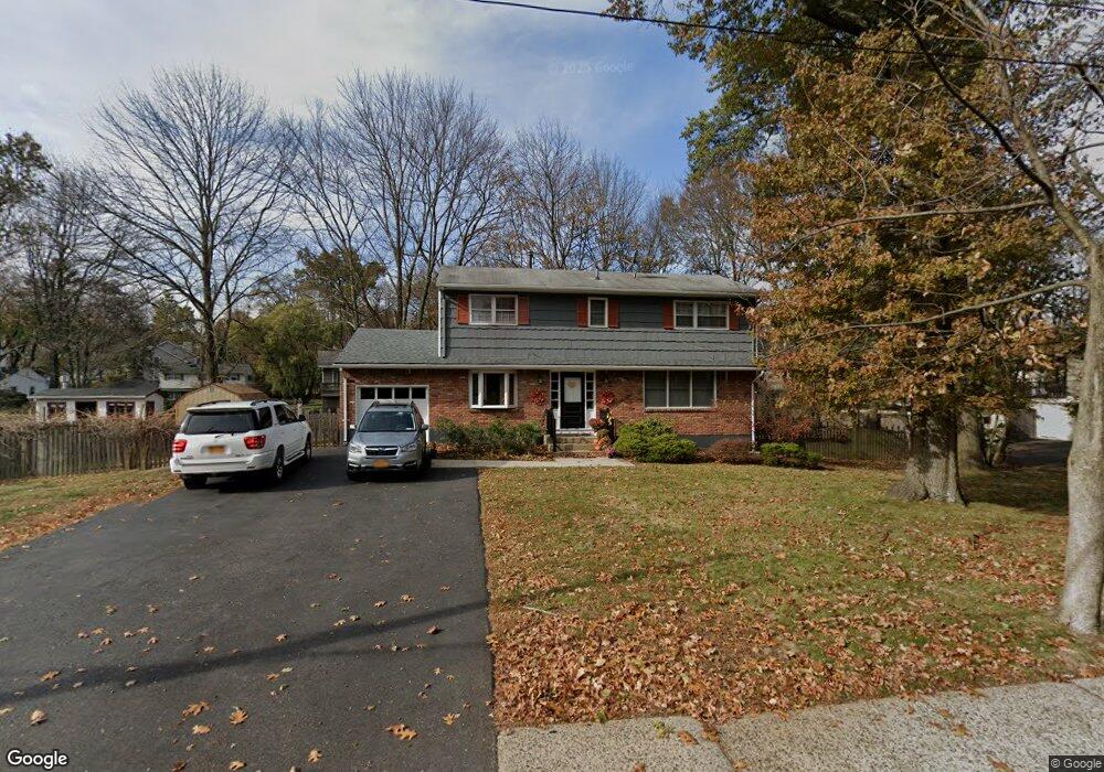
213 Ehrhardt Rd Pearl River, NY 10965
Estimated Value: $710,000 - $812,000
4
Beds
3
Baths
1,872
Sq Ft
$402/Sq Ft
Est. Value
About This Home
This home is located at 213 Ehrhardt Rd, Pearl River, NY 10965 and is currently estimated at $752,758, approximately $402 per square foot. 213 Ehrhardt Rd is a home located in Rockland County with nearby schools including Pearl River High School and St Anthony School.
Ownership History
Date
Name
Owned For
Owner Type
Purchase Details
Closed on
Sep 27, 2007
Sold by
Hendrick Michael and Leoniak Hendrick Tammy
Bought by
Leoniak Tammy
Current Estimated Value
Home Financials for this Owner
Home Financials are based on the most recent Mortgage that was taken out on this home.
Original Mortgage
$378,000
Outstanding Balance
$228,522
Interest Rate
5.62%
Mortgage Type
Purchase Money Mortgage
Estimated Equity
$524,236
Purchase Details
Closed on
Feb 10, 1999
Sold by
Gurney Lawrence F and Gurney Ann M
Bought by
Hendrick Michael and Leoniak Hendrick Tammy
Home Financials for this Owner
Home Financials are based on the most recent Mortgage that was taken out on this home.
Original Mortgage
$188,000
Interest Rate
6.78%
Create a Home Valuation Report for This Property
The Home Valuation Report is an in-depth analysis detailing your home's value as well as a comparison with similar homes in the area
Home Values in the Area
Average Home Value in this Area
Purchase History
We collect this data history from publicly available records. To have your information removed, we recommend requesting removal directly through your county’s website.
| Date | Buyer | Sale Price | Title Company |
|---|---|---|---|
| Leoniak Tammy | -- | Blackacre Title Agency Corp | |
| Hendrick Michael | $248,000 | -- |
Source: Public Records
Mortgage History
We collect this data history from publicly available records. To have your information removed, we recommend requesting removal directly through your county’s website.
| Date | Status | Borrower | Loan Amount |
|---|---|---|---|
| Open | Leoniak Tammy | $378,000 | |
| Closed | Hendrick Michael | $188,000 |
Source: Public Records
Tax History
| Year | Tax Paid | Tax Assessment Tax Assessment Total Assessment is a certain percentage of the fair market value that is determined by local assessors to be the total taxable value of land and additions on the property. | Land | Improvement |
|---|---|---|---|---|
| 2024 | $16,276 | $206,700 | $50,000 | $156,700 |
| 2023 | $16,276 | $206,700 | $50,000 | $156,700 |
| 2022 | $5,105 | $206,700 | $50,000 | $156,700 |
| 2021 | $13,844 | $206,700 | $50,000 | $156,700 |
| 2020 | $13,197 | $206,700 | $50,000 | $156,700 |
| 2019 | $4,756 | $206,700 | $50,000 | $156,700 |
| 2018 | $12,518 | $206,700 | $50,000 | $156,700 |
| 2017 | $12,088 | $206,700 | $50,000 | $156,700 |
| 2016 | $11,708 | $206,700 | $50,000 | $156,700 |
| 2015 | -- | $206,700 | $50,000 | $156,700 |
| 2014 | -- | $206,700 | $50,000 | $156,700 |
Source: Public Records
Map
Nearby Homes
- 315 Manor Blvd
- 21 Arlene Ct
- 448 Somerset Dr Unit H
- 166 E Crooked Hill Rd Unit 166
- 13 Venter Ln
- 33 Marion Place
- 235 N Middletown Rd Unit D
- 422 Somerset Dr Unit B
- 34 E Allison Ave
- 352 Holt Dr
- 126 E Lewis Ave
- 1 Alexa Ct
- 31 Townline Rd
- 127 Bogert Ave
- 84 Townline Rd
- 22 Hovenkamp Ave
- 9 Summer Ct
- 94 Bogert Ave
- 77 Hunt Ave
- 34 Mountainview Ave
- 110 Lombardi Rd
- 193 Ehrhardt Rd
- 203 Ehrhardt Rd
- 102 Lombardi Rd
- 111 Lombardi Rd
- 118 Lombardi Rd
- 185 Ehrhardt Rd
- 99 Lombardi Rd
- 361 Manor Blvd
- 34 Lang Terrace
- 119 Lombardi Rd
- 355 Manor Blvd
- 181 Ehrhardt Rd
- 200 Ehrhardt Rd
- 128 Lombardi Rd
- 42 Lang Terrace
- 206 Ehrhardt Rd
- 91 Lombardi Rd
- 221 Ehrhardt Rd
- 196 Ehrhardt Rd
Your Personal Tour Guide
Ask me questions while you tour the home.