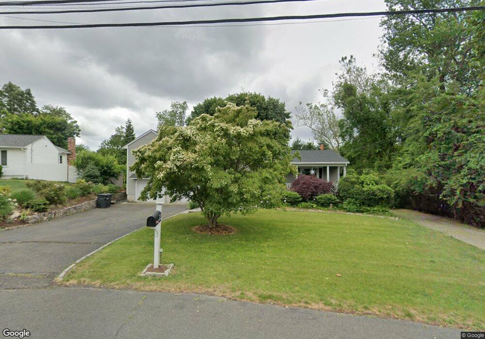
213 Farist Rd Fairfield, CT 06825
Fairfield Woods NeighborhoodEstimated Value: $855,734 - $987,000
5
Beds
4
Baths
2,103
Sq Ft
$428/Sq Ft
Est. Value
About This Home
This home is located at 213 Farist Rd, Fairfield, CT 06825 and is currently estimated at $899,184, approximately $427 per square foot. 213 Farist Rd is a home located in Fairfield County with nearby schools including Jennings Elementary School, Fairfield Woods Middle School, and Fairfield Warde High School.
Ownership History
Date
Name
Owned For
Owner Type
Purchase Details
Closed on
Jul 6, 2005
Sold by
Zelazy Jeffrey and Zelazy Toni
Bought by
Kupchick Peter G and Kupchick Brenda L
Current Estimated Value
Home Financials for this Owner
Home Financials are based on the most recent Mortgage that was taken out on this home.
Original Mortgage
$359,000
Interest Rate
5.71%
Purchase Details
Closed on
Sep 30, 1992
Sold by
Rothman Joseph
Bought by
Zeleny Jeffrey
Create a Home Valuation Report for This Property
The Home Valuation Report is an in-depth analysis detailing your home's value as well as a comparison with similar homes in the area
Home Values in the Area
Average Home Value in this Area
Purchase History
| Date | Buyer | Sale Price | Title Company |
|---|---|---|---|
| Kupchick Peter G | $648,000 | -- | |
| Kupchick Peter G | $648,000 | -- | |
| Zeleny Jeffrey | $170,000 | -- | |
| Zeleny Jeffrey | $170,000 | -- |
Source: Public Records
Mortgage History
| Date | Status | Borrower | Loan Amount |
|---|---|---|---|
| Open | Zeleny Jeffrey | $531,577 | |
| Closed | Zeleny Jeffrey | $536,000 | |
| Closed | Zeleny Jeffrey | $359,000 |
Source: Public Records
Tax History Compared to Growth
Tax History
| Year | Tax Paid | Tax Assessment Tax Assessment Total Assessment is a certain percentage of the fair market value that is determined by local assessors to be the total taxable value of land and additions on the property. | Land | Improvement |
|---|---|---|---|---|
| 2025 | $10,451 | $368,130 | $241,780 | $126,350 |
| 2024 | $10,271 | $368,130 | $241,780 | $126,350 |
| 2023 | $10,127 | $368,130 | $241,780 | $126,350 |
| 2022 | $10,028 | $368,130 | $241,780 | $126,350 |
| 2021 | $9,932 | $368,130 | $241,780 | $126,350 |
| 2020 | $9,045 | $337,610 | $207,760 | $129,850 |
| 2019 | $9,045 | $337,610 | $207,760 | $129,850 |
| 2018 | $8,899 | $337,610 | $207,760 | $129,850 |
| 2017 | $8,717 | $337,610 | $207,760 | $129,850 |
| 2016 | $8,592 | $337,610 | $207,760 | $129,850 |
| 2015 | $8,437 | $340,340 | $218,680 | $121,660 |
| 2014 | $8,304 | $340,340 | $218,680 | $121,660 |
Source: Public Records
Map
Nearby Homes
- 31 High Ridge Rd
- 706 Judd St
- 210 Pansy Rd
- 3 Old Black Rock Turnpike
- 27 Bloomfield Dr
- 115 Mayfair Rd
- 270 Oakwood Dr
- 67 Campfield Dr
- 332 Szost Dr
- 242 Valleyview Rd
- 34 Ridgedale Rd
- 1009 High St
- 285 Old Black Rock Turnpike
- 152 Roseville St
- 148 Roseville St
- 244 Tunxis Hill Cut Off
- 327 Lucille St
- 143 Sawyer Rd
- 359 Reid St
- 24 Warsaw St
- 193 Farist Rd
- 15 Barryscott Dr
- 252 Farist Rd
- 220 Farist Rd
- 175 Farist Rd
- 139 Barryscott Dr
- 102 Barryscott Dr
- 103 Barryscott Dr
- 132 Barryscott Dr
- 55 Barryscott Dr
- 164 Farist Rd
- 148 Barryscott Dr
- 22 Barryscott Dr
- 153 Farist Rd
- 178 Farist Rd
- 270 Farist Rd
- 167 Barryscott Dr
- 289 Farist Rd
- 131 Farist Rd
- 46 Barryscott Dr