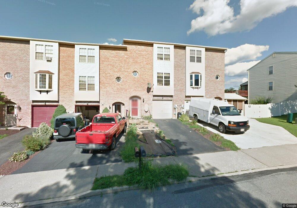
213 Flint Hill Rd Alburtis, PA 18011
Lower Macungie Township West NeighborhoodEstimated Value: $306,869 - $327,000
3
Beds
2
Baths
1,956
Sq Ft
$160/Sq Ft
Est. Value
About This Home
This home is located at 213 Flint Hill Rd, Alburtis, PA 18011 and is currently estimated at $313,717, approximately $160 per square foot. 213 Flint Hill Rd is a home located in Lehigh County with nearby schools including Alburtis Elementary School, Lower Macungie Middle School, and Emmaus High School.
Ownership History
Date
Name
Owned For
Owner Type
Purchase Details
Closed on
Feb 27, 2020
Sold by
Rebner Michael
Bought by
Williams Thomas P
Current Estimated Value
Purchase Details
Closed on
Sep 19, 2008
Sold by
Brunetti Robert M
Bought by
Rebner Michael
Home Financials for this Owner
Home Financials are based on the most recent Mortgage that was taken out on this home.
Original Mortgage
$171,492
Interest Rate
6.43%
Mortgage Type
FHA
Purchase Details
Closed on
Jun 19, 1995
Sold by
Keiser Timothy E and Keiser Kathleen M
Bought by
Brunetti Robert M
Purchase Details
Closed on
Nov 7, 1991
Sold by
Hornstein Enterprises Inc
Bought by
Keiser Timothy E and Keiser Kathleen M
Purchase Details
Closed on
Aug 14, 1990
Bought by
Hornstein Enterprises Inc
Create a Home Valuation Report for This Property
The Home Valuation Report is an in-depth analysis detailing your home's value as well as a comparison with similar homes in the area
Home Values in the Area
Average Home Value in this Area
Purchase History
| Date | Buyer | Sale Price | Title Company |
|---|---|---|---|
| Williams Thomas P | $142,000 | Abe Settlement Services | |
| Rebner Michael | $173,000 | -- | |
| Brunetti Robert M | $95,500 | -- | |
| Keiser Timothy E | $86,100 | -- | |
| Hornstein Enterprises Inc | $708,500 | -- |
Source: Public Records
Mortgage History
| Date | Status | Borrower | Loan Amount |
|---|---|---|---|
| Previous Owner | Rebner Michael | $171,492 |
Source: Public Records
Tax History Compared to Growth
Tax History
| Year | Tax Paid | Tax Assessment Tax Assessment Total Assessment is a certain percentage of the fair market value that is determined by local assessors to be the total taxable value of land and additions on the property. | Land | Improvement |
|---|---|---|---|---|
| 2025 | $3,864 | $131,600 | $9,300 | $122,300 |
| 2024 | $3,765 | $131,600 | $9,300 | $122,300 |
| 2023 | $3,591 | $131,600 | $9,300 | $122,300 |
| 2022 | $3,516 | $131,600 | $122,300 | $9,300 |
| 2021 | $3,449 | $131,600 | $9,300 | $122,300 |
| 2020 | $3,420 | $131,600 | $9,300 | $122,300 |
| 2019 | $3,402 | $131,600 | $9,300 | $122,300 |
| 2018 | $3,363 | $131,600 | $9,300 | $122,300 |
| 2017 | $3,312 | $131,600 | $9,300 | $122,300 |
| 2016 | -- | $131,600 | $9,300 | $122,300 |
| 2015 | -- | $131,600 | $9,300 | $122,300 |
| 2014 | -- | $131,600 | $9,300 | $122,300 |
Source: Public Records
Map
Nearby Homes
- 215 Flint Hill Rd
- 241 Flint Hill Rd
- 108 W 2nd St
- 121 S Main St Unit 123
- 3371 Mathews Ln
- 108 E 2nd St
- 428 Thomas St
- 317 Lockridge Ln
- 31 Barbara Dr
- 8312 Mertztown Rd
- 8975 Mertztown Rd
- 1108 S Barbara Dr
- 1716 Brookstone Dr
- 8051 Heritage Dr
- 7528 Buttercup Rd
- 7699 Catalpa Dr
- 7687 Catalpa Dr
- 1649 Thorndale Rd
- 1649 Thorndale Rd Unit LOT 70
- 1702 Windmill Ln