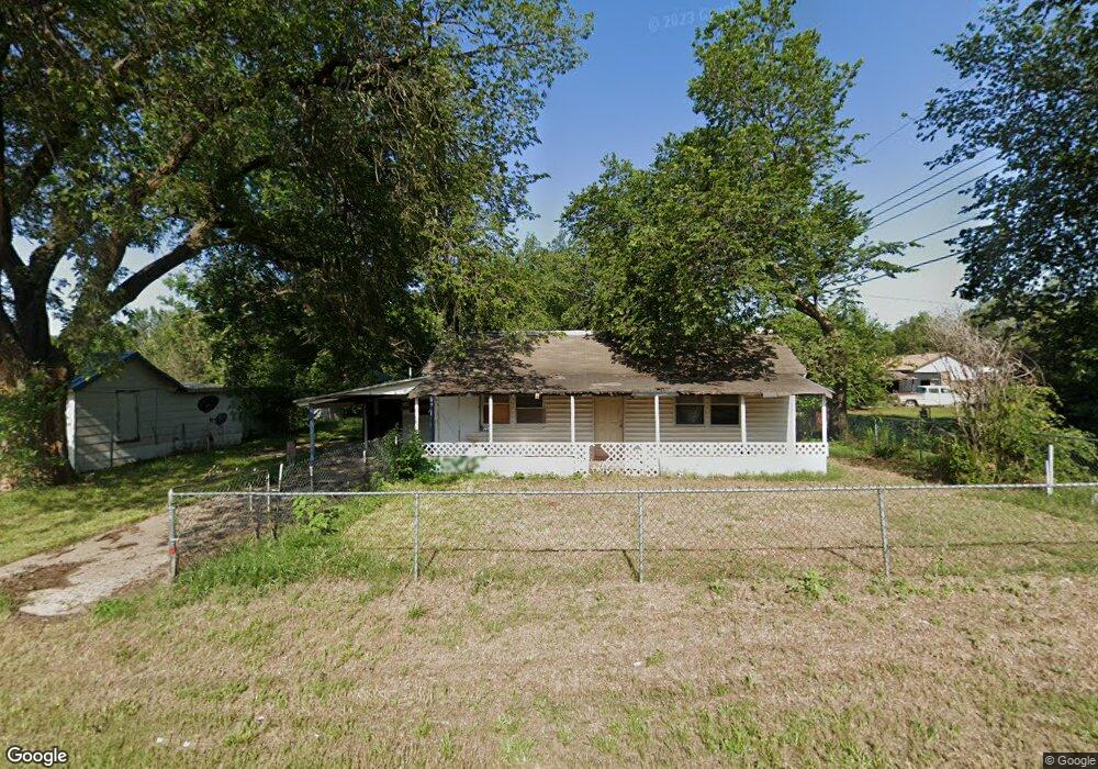
213 Flynn Ave Watonga, OK 73772
Estimated Value: $46,000 - $73,000
2
Beds
1
Bath
864
Sq Ft
$65/Sq Ft
Est. Value
About This Home
This home is located at 213 Flynn Ave, Watonga, OK 73772 and is currently estimated at $56,434, approximately $65 per square foot. 213 Flynn Ave is a home located in Blaine County with nearby schools including Watonga Elementary School, Watonga Middle School, and Watonga High School.
Ownership History
Date
Name
Owned For
Owner Type
Purchase Details
Closed on
Feb 2, 2003
Sold by
Lopez Roberto Et-Al
Bought by
Simmons Terri L
Current Estimated Value
Purchase Details
Closed on
May 13, 1994
Sold by
Nault Walter and Nault Shelly
Bought by
Lopez Roberto
Purchase Details
Closed on
Oct 7, 1993
Sold by
Deimer Earl
Bought by
Nault Walter and Nault Shelly
Purchase Details
Closed on
Feb 27, 1990
Sold by
Wilhite Leslie
Create a Home Valuation Report for This Property
The Home Valuation Report is an in-depth analysis detailing your home's value as well as a comparison with similar homes in the area
Home Values in the Area
Average Home Value in this Area
Purchase History
| Date | Buyer | Sale Price | Title Company |
|---|---|---|---|
| Simmons Terri L | $12,000 | -- | |
| Lopez Roberto | $9,000 | -- | |
| Nault Walter | $13,000 | -- | |
| -- | $12,000 | -- |
Source: Public Records
Tax History Compared to Growth
Tax History
| Year | Tax Paid | Tax Assessment Tax Assessment Total Assessment is a certain percentage of the fair market value that is determined by local assessors to be the total taxable value of land and additions on the property. | Land | Improvement |
|---|---|---|---|---|
| 2024 | $244 | $2,518 | $362 | $2,156 |
| 2023 | $250 | $2,572 | $510 | $2,062 |
| 2022 | $293 | $2,694 | $510 | $2,184 |
| 2021 | $255 | $2,595 | $510 | $2,085 |
| 2020 | $240 | $2,472 | $510 | $1,962 |
| 2019 | $234 | $2,354 | $510 | $1,844 |
| 2018 | $234 | $2,264 | $668 | $1,596 |
| 2017 | $230 | $2,157 | $317 | $1,840 |
| 2016 | $233 | $2,054 | $317 | $1,737 |
| 2015 | $197 | $1,957 | $317 | $1,640 |
| 2014 | $150 | $1,864 | $317 | $1,547 |
Source: Public Records
Map
Nearby Homes
- 321 N Flynn
- 617 W 3rd St
- 720 W 3rd St
- 409 W 3rd St
- 319 N Wikoff Ave
- 114 N Leach Ave Unit 116 118 & 120 N Leac
- 401 N Leach Ave
- 711 Villa Place Unit 181A
- 1221 W Main St
- 401 Russworm Dr
- 220 Russworm Dr
- 100 W 3rd St
- 400 S Leach Ave Unit 400 S Prouty
- 117 S Noble Ave
- 121 E Main St
- 704 N Prouty Ave
- 101 E 5th St Unit 103 E 5th St
- 834 Mimosa Dr
- 503 S Prouty Ave
- 815 N Prouty Ave