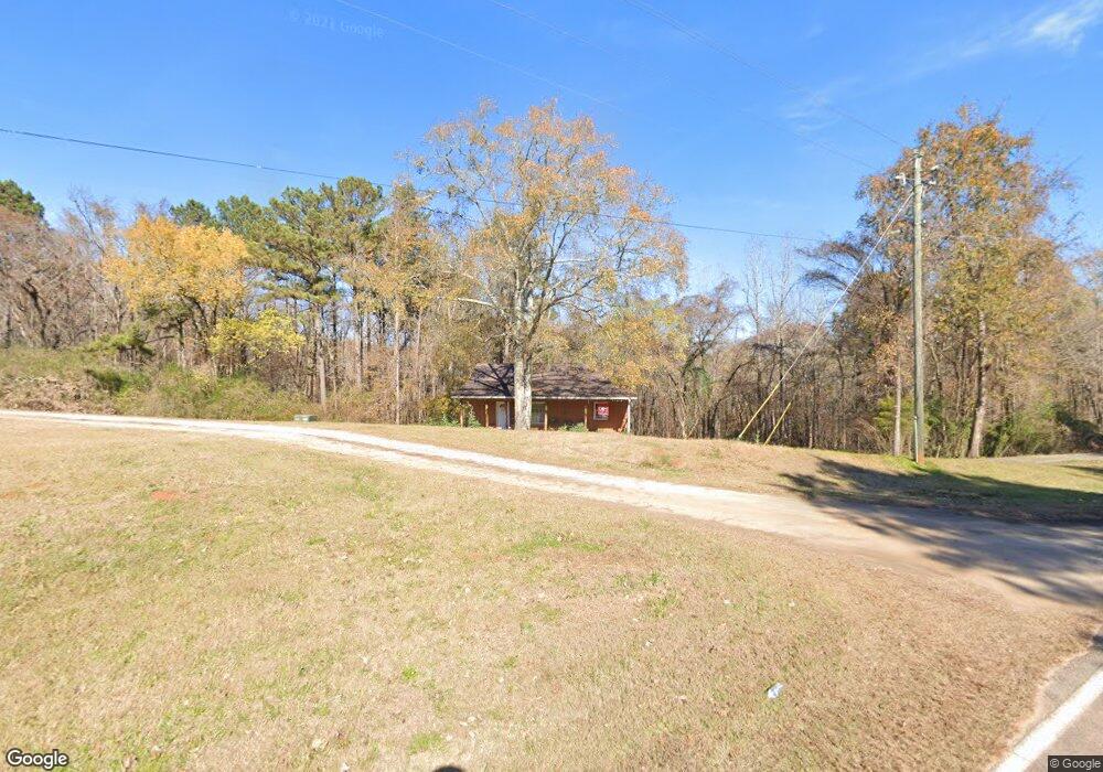
213 Garrett Rd Lagrange, GA 30240
Estimated Value: $123,000 - $513,853
3
Beds
2
Baths
1,200
Sq Ft
$278/Sq Ft
Est. Value
About This Home
This home is located at 213 Garrett Rd, Lagrange, GA 30240 and is currently estimated at $333,213, approximately $277 per square foot. 213 Garrett Rd is a home with nearby schools including Hillcrest Elementary School, Franklin Forest Elementary School, and Hollis Hand Elementary School.
Ownership History
Date
Name
Owned For
Owner Type
Purchase Details
Closed on
Jul 12, 2023
Sold by
Foster Claude Frank
Bought by
Foster Lindsey Hilton
Current Estimated Value
Purchase Details
Closed on
May 8, 2015
Sold by
Foster Claude Frank
Bought by
Foster Lindsey Hilton
Purchase Details
Closed on
Nov 19, 1997
Sold by
Ellis Caudle Smith
Bought by
Foster C Frank
Purchase Details
Closed on
Feb 3, 1997
Sold by
Phillip Stribling
Bought by
Ellis Caudle Smith
Purchase Details
Closed on
Jul 28, 1992
Sold by
Smith Ellis C
Bought by
Phillip Stribling
Purchase Details
Closed on
Oct 17, 1990
Sold by
Keener Lynn
Bought by
Smith Ellis C
Purchase Details
Closed on
Oct 16, 1990
Sold by
Theodore Benson
Bought by
Keener Lynn
Purchase Details
Closed on
Sep 14, 1984
Sold by
Hazel Bailey
Bought by
Theodore Benson
Create a Home Valuation Report for This Property
The Home Valuation Report is an in-depth analysis detailing your home's value as well as a comparison with similar homes in the area
Purchase History
| Date | Buyer | Sale Price | Title Company |
|---|---|---|---|
| Foster Lindsey Hilton | $80,000 | -- | |
| Foster Lindsey Hilton | $240,000 | -- | |
| Foster C Frank | $60,000 | -- | |
| Ellis Caudle Smith | -- | -- | |
| Phillip Stribling | -- | -- | |
| Smith Ellis C | -- | -- | |
| Keener Lynn | $55,000 | -- | |
| Theodore Benson | -- | -- |
Source: Public Records
Tax History
| Year | Tax Paid | Tax Assessment Tax Assessment Total Assessment is a certain percentage of the fair market value that is determined by local assessors to be the total taxable value of land and additions on the property. | Land | Improvement |
|---|---|---|---|---|
| 2025 | $1,244 | $58,960 | $6,800 | $52,160 |
| 2024 | $1,244 | $45,600 | $6,800 | $38,800 |
| 2023 | $1,083 | $39,720 | $6,800 | $32,920 |
| 2022 | $1,052 | $37,680 | $6,800 | $30,880 |
| 2021 | $972 | $32,240 | $5,040 | $27,200 |
| 2020 | $972 | $32,240 | $5,040 | $27,200 |
| 2019 | $982 | $32,560 | $5,040 | $27,520 |
| 2018 | $906 | $30,040 | $5,040 | $25,000 |
| 2017 | $906 | $30,040 | $5,040 | $25,000 |
| 2016 | $885 | $29,334 | $5,044 | $24,290 |
| 2015 | $886 | $29,334 | $5,044 | $24,290 |
| 2014 | -- | $28,055 | $5,044 | $23,011 |
| 2013 | -- | $29,621 | $5,044 | $24,577 |
Source: Public Records
Map
Nearby Homes
- 47 Fish Camp
- 50 Fish Camp
- 341 Retreat Trail
- 325 Retreat Trail
- 280 Wolf Creek Cove
- 291 Retreat Trail
- 353 Retreat Trail
- 261 Retreat Trail
- 33 Wolf Creek Cove
- 227 Retreat Trail
- 105 Wolf Creek Cove
- 115 Wolf Creek Cove
- 40 Wolf Creek Cove
- 100 Wolf Creek Cove
- 144 Wolf Creek Cove
- 147 Wolf Creek Cove
- 178 Wolf Creek Cove
- 116 Firefly Run
- 110 Firefly Run
- 96 Firefly Run
- 246 Garrett Rd
- 196 Garrett Rd
- 81 Garrett Rd
- 215 Garrett Rd
- 1524 Liberty Hill Rd
- 1612 Liberty Hill Rd
- 1612 Liberty Hill Rd
- 1580 Liberty Hill Rd
- 1427 Liberty Hill Rd Unit TRACT C-B
- 1427 Liberty Hill Rd
- 304 AC Liberty Hill Rd
- 1395 Liberty Hill Rd
- 1666 Liberty Hill Rd
- 1425 Liberty Hill Rd
- 1551 Liberty Hill Rd
- 1767 Liberty Hill Rd
- 0 Retreat On West Point Lake Unit MULTIPLE INTERIOR LO
- 0 Retreat On West Point Lake Unit MULTIPLE LAKE LOTS
- 56 Fish Camp
- 56 Fish Camp Rd
Your Personal Tour Guide
Ask me questions while you tour the home.