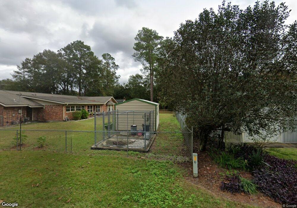
213 General Stewart Way Hinesville, GA 31313
Estimated Value: $231,000 - $259,000
3
Beds
2
Baths
2,503
Sq Ft
$99/Sq Ft
Est. Value
About This Home
This home is located at 213 General Stewart Way, Hinesville, GA 31313 and is currently estimated at $247,189, approximately $98 per square foot. 213 General Stewart Way is a home located in Liberty County with nearby schools including Button Gwinnett Elementary School, Snelson-Golden Middle School, and Bradwell Institute.
Ownership History
Date
Name
Owned For
Owner Type
Purchase Details
Closed on
Aug 29, 2007
Sold by
Carter Funeral Home Inc
Bought by
Carter Sanford L and Carter Donald M
Current Estimated Value
Purchase Details
Closed on
Sep 15, 2003
Sold by
Carter Donald M
Bought by
Carter Nila M
Purchase Details
Closed on
Aug 21, 1975
Bought by
Carter Donald M
Create a Home Valuation Report for This Property
The Home Valuation Report is an in-depth analysis detailing your home's value as well as a comparison with similar homes in the area
Home Values in the Area
Average Home Value in this Area
Purchase History
| Date | Buyer | Sale Price | Title Company |
|---|---|---|---|
| Carter Sanford L | -- | -- | |
| Carter Donald M | -- | -- | |
| Carter Donald M | -- | -- | |
| Carter Donald M | -- | -- | |
| Carter Donald M | -- | -- | |
| Carter Donald M | -- | -- | |
| Carter Donald M | -- | -- | |
| Carter Nila M | -- | -- | |
| Carter Donald M | $27,400 | -- |
Source: Public Records
Tax History Compared to Growth
Tax History
| Year | Tax Paid | Tax Assessment Tax Assessment Total Assessment is a certain percentage of the fair market value that is determined by local assessors to be the total taxable value of land and additions on the property. | Land | Improvement |
|---|---|---|---|---|
| 2024 | $3,144 | $85,082 | $14,000 | $71,082 |
| 2023 | $3,144 | $84,494 | $12,000 | $72,494 |
| 2022 | $2,597 | $68,055 | $12,000 | $56,055 |
| 2021 | $2,160 | $57,769 | $12,000 | $45,769 |
| 2020 | $2,209 | $58,430 | $12,000 | $46,430 |
| 2019 | $2,004 | $54,402 | $12,000 | $42,402 |
| 2018 | $2,024 | $54,996 | $12,000 | $42,996 |
| 2017 | $1,831 | $55,590 | $12,000 | $43,590 |
| 2016 | $1,967 | $55,590 | $12,000 | $43,590 |
| 2015 | $2,120 | $60,410 | $12,000 | $48,410 |
| 2014 | $2,120 | $58,336 | $12,000 | $46,336 |
| 2013 | -- | $65,350 | $12,000 | $53,350 |
Source: Public Records
Map
Nearby Homes
- 103 Stewart Terrace
- 215 Collins Ln
- 215 Collins Ln Unit A
- 108 W General Stewart Way
- 604 Caroline St
- 622 Ogden Ave
- 4 Lots Memorial Dr
- 205 Wilson Ave
- 213 Honey Lane Cir
- 0 General Stewart Way
- 76 Boundary Hall Way
- 86 Boundary Hall Way
- 64 Boundary Hall Way
- 128 Boundary Hall Way
- 1238 Grayson Ave
- 1277 Grayson Ave
- 804 Barrington Dr
- 707 Marlborough Ct
- 411 Woodland Dr
- 301 Lakeview Dr
- 113 Stewart Terrace
- 111 Stewart Terrace
- 114 Stewart Terrace
- 209 W General Stewart Way
- 112 Stewart Terrace
- 0 Stewart Terrace Unit 7542781
- 0 Stewart Terrace
- 109 Stewart Terrace
- 110 Stewart Terrace
- 210 General Stewart Way
- 212 General Stewart Way
- 207 W General Stewart Way Unit n/a
- 207 W General Stewart Way
- 208 W General Stewart Way
- 331 N Gause St
- 600 Georgia Ave
- 411 Rebecca St
- 206 W General Stewart Way
- 205 W General Stewart Way
- 205 General Stewart Way