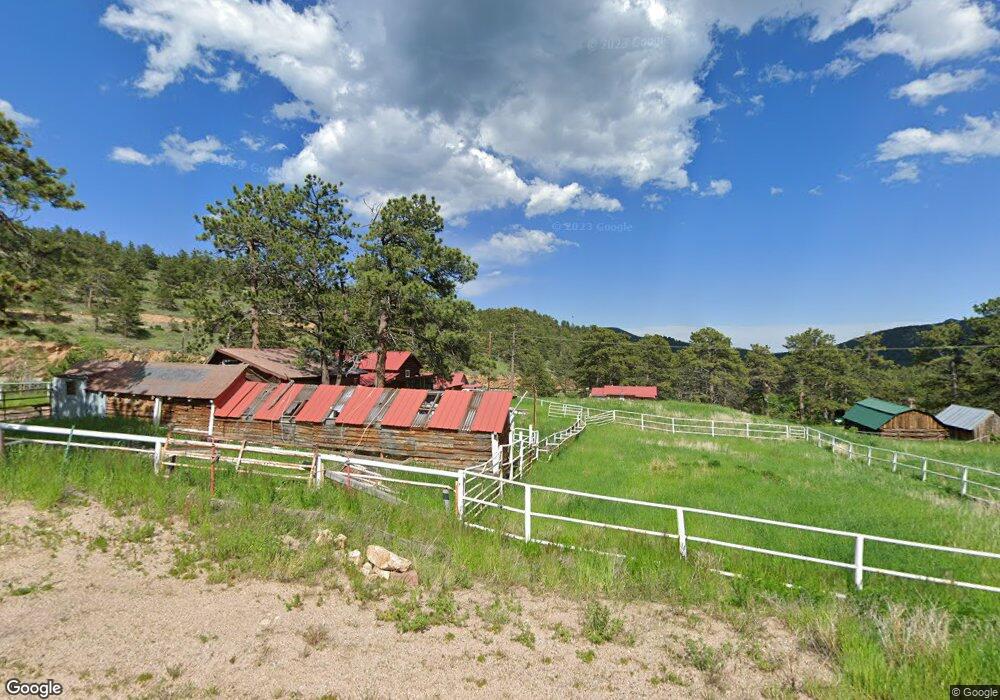
213 Highway 7 Business Allenspark, CO 80510
Allenspark NeighborhoodEstimated Value: $305,000 - $415,000
1
Bed
2
Baths
544
Sq Ft
$633/Sq Ft
Est. Value
About This Home
This home is located at 213 Highway 7 Business, Allenspark, CO 80510 and is currently estimated at $344,312, approximately $632 per square foot. 213 Highway 7 Business is a home with nearby schools including Estes Park K-5 School, Estes Park Options School, and Estes Park Middle School.
Ownership History
Date
Name
Owned For
Owner Type
Purchase Details
Closed on
Jun 30, 2000
Sold by
Sutherland Scott O and Smith James
Bought by
Yakutat Land Corp
Current Estimated Value
Home Financials for this Owner
Home Financials are based on the most recent Mortgage that was taken out on this home.
Original Mortgage
$110,000
Interest Rate
8.66%
Mortgage Type
Purchase Money Mortgage
Purchase Details
Closed on
Jun 10, 1983
Bought by
Yakutat Land Corporation
Purchase Details
Closed on
Dec 20, 1966
Bought by
Yakutat Land Corporation
Create a Home Valuation Report for This Property
The Home Valuation Report is an in-depth analysis detailing your home's value as well as a comparison with similar homes in the area
Home Values in the Area
Average Home Value in this Area
Purchase History
| Date | Buyer | Sale Price | Title Company |
|---|---|---|---|
| Yakutat Land Corp | $110,000 | Land Title | |
| Yakutat Land Corporation | -- | -- | |
| Yakutat Land Corporation | -- | -- |
Source: Public Records
Mortgage History
| Date | Status | Borrower | Loan Amount |
|---|---|---|---|
| Closed | Yakutat Land Corp | $110,000 |
Source: Public Records
Tax History Compared to Growth
Tax History
| Year | Tax Paid | Tax Assessment Tax Assessment Total Assessment is a certain percentage of the fair market value that is determined by local assessors to be the total taxable value of land and additions on the property. | Land | Improvement |
|---|---|---|---|---|
| 2025 | $1,161 | $19,763 | $5,544 | $14,219 |
| 2024 | $1,161 | $19,763 | $5,544 | $14,219 |
| 2023 | $1,123 | $17,963 | $4,717 | $16,931 |
| 2022 | $1,145 | $16,729 | $4,705 | $12,024 |
| 2021 | $1,168 | $17,211 | $4,841 | $12,370 |
| 2020 | $1,060 | $15,373 | $6,078 | $9,295 |
| 2019 | $1,027 | $15,373 | $6,078 | $9,295 |
| 2018 | $922 | $13,507 | $6,408 | $7,099 |
| 2017 | $913 | $14,933 | $7,084 | $7,849 |
| 2016 | $926 | $13,977 | $7,084 | $6,893 |
| 2015 | $906 | $12,807 | $1,910 | $10,897 |
| 2014 | $874 | $12,807 | $1,910 | $10,897 |
Source: Public Records
Map
Nearby Homes
- 104 County Road 90
- 251 Haugen Slide Rd
- 839 Ski Rd
- 494 N Skinner Rd
- 254 Arrowood Dr
- 928 Ski Rd
- 246 Tahosa Park Rd S
- 223 Taylor Rd
- 585 Taylor Rd
- 212 Valley Rd
- 427 Saint Vrain Rd
- 84 County Road 113n
- 357 Big John Rd
- 165 Sutherland Rd
- 470 Big John Rd
- 177 Bill Waite Rd
- 761 Cabin Creek Rd
- 1217 Big Owl Rd
- 747 Coyote Hill Rd
- 18673 Colorado 7
- 211 Colorado 7 Business
- 441 Highway 7 Business
- 416 Colorado 7 Business
- 12680 Colorado 7
- 199 Highway 7 Business
- 233 Highway 7 Business
- 449 Highway 7 Business
- 237 Highway 7 Business
- 223 Highway 7 Business
- 199 Highway 7 Business
- 272 Colorado 7 Business
- 292 Colorado 7 Business
- 184 Colorado 7 Business
- 436 Business Highway 7
- 436 Highway 7 Business
- 454 Highway 7 Business
- 420 Business Highway 7
- 416 Highway 7 Business
- 245 Colorado 7 Business
- 239 Highway 7 Business