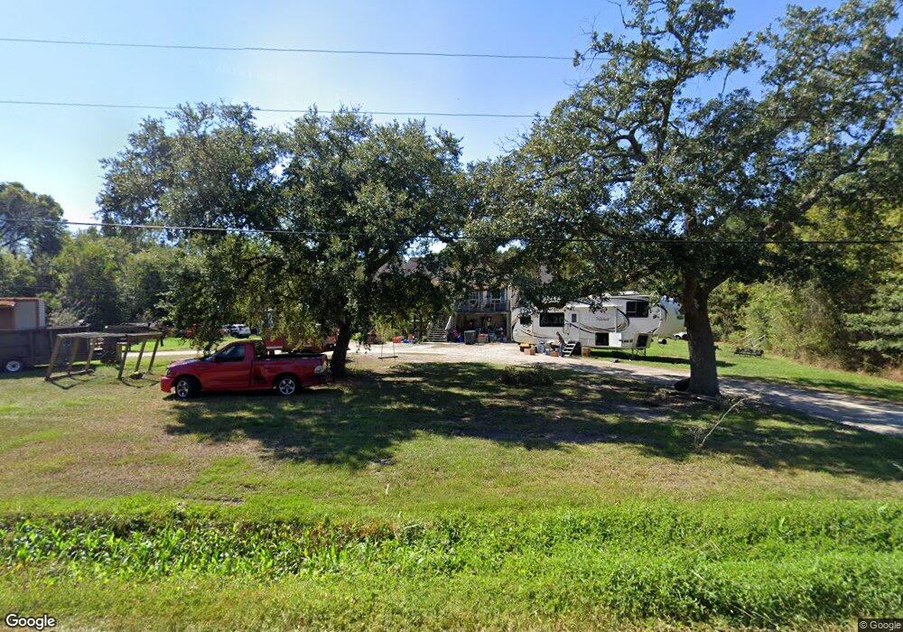
213 Honey Dew Dr Slidell, LA 70461
Estimated Value: $201,357 - $224,000
3
Beds
2
Baths
1,741
Sq Ft
$125/Sq Ft
Est. Value
About This Home
This home is located at 213 Honey Dew Dr, Slidell, LA 70461 and is currently estimated at $216,839, approximately $124 per square foot. 213 Honey Dew Dr is a home located in St. Tammany Parish with nearby schools including Cypress Cove Elementary School, Honey Island Elementary School, and Little Oak Middle School.
Ownership History
Date
Name
Owned For
Owner Type
Purchase Details
Closed on
Oct 8, 2025
Sold by
Couste Amanda Hudspeth and Couste John Joseph
Bought by
St Tammany Parish Government
Current Estimated Value
Purchase Details
Closed on
Dec 22, 2010
Sold by
Peterson Peter J and Plessala Connie Molero
Bought by
Couste Amanda Hudspeth and Couste John Joseph
Home Financials for this Owner
Home Financials are based on the most recent Mortgage that was taken out on this home.
Original Mortgage
$134,971
Interest Rate
4.41%
Mortgage Type
FHA
Create a Home Valuation Report for This Property
The Home Valuation Report is an in-depth analysis detailing your home's value as well as a comparison with similar homes in the area
Home Values in the Area
Average Home Value in this Area
Purchase History
| Date | Buyer | Sale Price | Title Company |
|---|---|---|---|
| St Tammany Parish Government | $229,000 | Team Title | |
| Couste Amanda Hudspeth | $139,000 | Mahony Title & Land Services |
Source: Public Records
Mortgage History
| Date | Status | Borrower | Loan Amount |
|---|---|---|---|
| Previous Owner | Couste Amanda Hudspeth | $134,971 |
Source: Public Records
Tax History Compared to Growth
Tax History
| Year | Tax Paid | Tax Assessment Tax Assessment Total Assessment is a certain percentage of the fair market value that is determined by local assessors to be the total taxable value of land and additions on the property. | Land | Improvement |
|---|---|---|---|---|
| 2024 | $1,355 | $17,975 | $550 | $17,425 |
| 2023 | $1,409 | $12,983 | $700 | $12,283 |
| 2022 | $81,650 | $12,983 | $700 | $12,283 |
| 2021 | $815 | $12,983 | $700 | $12,283 |
| 2020 | $811 | $12,983 | $700 | $12,283 |
| 2019 | $1,858 | $12,444 | $1,040 | $11,404 |
| 2018 | $1,865 | $12,444 | $1,040 | $11,404 |
| 2017 | $1,877 | $12,444 | $1,040 | $11,404 |
| 2016 | $1,921 | $12,444 | $1,040 | $11,404 |
| 2015 | $1,901 | $11,965 | $1,000 | $10,965 |
| 2014 | $1,865 | $11,965 | $1,000 | $10,965 |
| 2013 | -- | $11,965 | $1,000 | $10,965 |
Source: Public Records
Map
Nearby Homes
- 208 Pine Hazel Dr
- Lot 4 Avery Dr
- 0 Avery Dr
- 0 Downey Rd Unit 2478417
- 0 Downey Rd
- 0 Downey Rd Unit NO2492999
- 0 Richards Dr
- 41748 E Hwy 190 None
- 42232 Surrey Ln
- 0 Business 190 Hwy
- 0 Mcmanus Rd
- 0 Lot Hwy 190 Sect 28 T95 R15e
- 0 Lot Hwy 190 Sect 28 T95 R15e None
- 40613 Cara Mae St
- 0 Apple Pie Ridge Rd Unit 2249190
- 1085 Claire Dr
- 1024 Claire Dr
- 0 Marple Ln Unit 2469273
- 00 Marple Ln
- 214 Schokley Dr
- 312 Smokey Hollow Dr
- 210 Honey Dew Dr
- 306 Smokey Hollow Dr
- 0 Smokey Hollow Dr
- 210 Schokley Dr
- 211 Sea Spray Dr
- 214 Pine Hazel Dr
- 213 Seaspray Dr
- 213 Sea Spray Dr
- 215 Sea Spray Dr
- 215 Seaspray Other
- 0 Honey Dew Dr
- 207 Honey Dew Dr
- 208 Schokley Dr
- 0 Avery Estates Dr
- 318 Avery Dr
- 209 Schokley Dr
- 207 Seaspray Dr
- 303 Smokey Hollow Dr