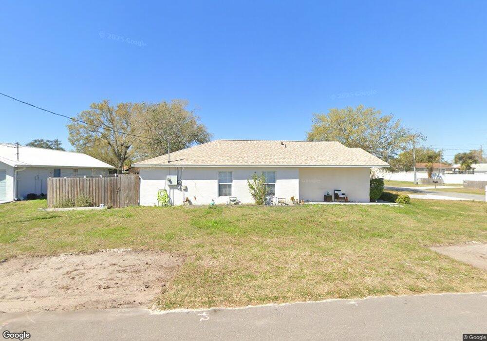
213 Howes St Port Orange, FL 32127
Allandale NeighborhoodEstimated Value: $219,000 - $273,138
3
Beds
2
Baths
1,219
Sq Ft
$206/Sq Ft
Est. Value
About This Home
This home is located at 213 Howes St, Port Orange, FL 32127 and is currently estimated at $250,785, approximately $205 per square foot. 213 Howes St is a home located in Volusia County with nearby schools including Port Orange Elementary School, Silver Sands Middle School, and Spruce Creek High School.
Ownership History
Date
Name
Owned For
Owner Type
Purchase Details
Closed on
Aug 31, 2005
Sold by
K & L Homes Llc
Bought by
Nass Richard and Nass Theresa
Current Estimated Value
Purchase Details
Closed on
Jan 14, 2005
Sold by
Lambert Richard R and Lambert Patricia S
Bought by
K & L Homes Llc
Purchase Details
Closed on
May 5, 2004
Sold by
Lambert Richard R and Lambert Patricia S
Bought by
Lambert Richard R and Lambert Patricia S
Purchase Details
Closed on
Aug 25, 2003
Sold by
Cannady Mary
Bought by
Merrifield Angela
Purchase Details
Closed on
Sep 16, 1996
Sold by
Merrifield Kenneth Stanley
Bought by
Merrifield Angela
Create a Home Valuation Report for This Property
The Home Valuation Report is an in-depth analysis detailing your home's value as well as a comparison with similar homes in the area
Home Values in the Area
Average Home Value in this Area
Purchase History
| Date | Buyer | Sale Price | Title Company |
|---|---|---|---|
| Nass Richard | $189,900 | Adams Cameron Title Svcs Inc | |
| K & L Homes Llc | -- | -- | |
| Lambert Richard R | -- | -- | |
| Merrifield Angela | -- | -- | |
| Merrifield Angela | -- | -- | |
| Merrifield Angela | -- | -- | |
| Merrifield Angela | -- | -- |
Source: Public Records
Tax History Compared to Growth
Tax History
| Year | Tax Paid | Tax Assessment Tax Assessment Total Assessment is a certain percentage of the fair market value that is determined by local assessors to be the total taxable value of land and additions on the property. | Land | Improvement |
|---|---|---|---|---|
| 2025 | $3,545 | $269,909 | $32,250 | $237,659 |
| 2024 | $3,545 | $267,232 | $32,250 | $234,982 |
| 2023 | $3,545 | $243,880 | $28,000 | $215,880 |
| 2022 | $3,240 | $221,745 | $22,500 | $199,245 |
| 2021 | $2,877 | $157,839 | $21,000 | $136,839 |
| 2020 | $2,660 | $153,863 | $12,750 | $141,113 |
| 2019 | $2,406 | $138,513 | $16,500 | $122,013 |
| 2018 | $2,204 | $118,830 | $13,500 | $105,330 |
| 2017 | $2,133 | $117,356 | $13,446 | $103,910 |
| 2016 | $1,946 | $98,204 | $0 | $0 |
| 2015 | $1,824 | $86,283 | $0 | $0 |
| 2014 | $1,667 | $75,321 | $0 | $0 |
Source: Public Records
Map
Nearby Homes
- 5146 Pineland Ave
- 187 Tanglewood Ave
- 5123 Pineland Ave
- 2 Tanglewood Ave
- 181 Tanglewood Ave
- 83 Crowell St
- 5180 Taylor Ave
- 152 Wall St
- 68 Andrews St
- 9 Tanglewood Ave
- 69 Andrews St
- 10 Beverly St
- 91 Howes St
- 148 Wall St
- 108 Williams St
- 5207 Orange Ave
- 142 Young St
- 27 Frederick Ave
- 189 Orchard St
- 160 Wall St
- 217 Howes St
- 5142 Pineland Ave
- 5139 Pineland Ave
- 5144 Pineland Ave
- 5144 Pineland Ave
- 5145 Orange Ave
- 165 Howes St
- 5147 Orange Ave
- 5141 Pineland Ave
- 5149 Orange Ave
- 5145 Pineland Ave
- 5148 Pineland Ave Unit A
- 5140 Pineland Ave
- 5150 Pineland Ave
- 5153 Orange Ave
- 5149 Pineland Ave
- 161 Howes St
- 5138 Pineland Ave
- 5140 Taylor Ave
- 5152 Pineland Ave