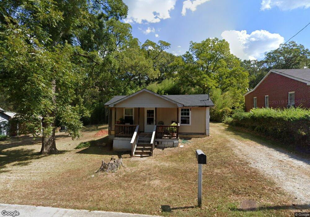
213 Jenkins St Barnesville, GA 30204
Estimated Value: $66,898 - $117,000
1
Bed
1
Bath
651
Sq Ft
$136/Sq Ft
Est. Value
About This Home
This home is located at 213 Jenkins St, Barnesville, GA 30204 and is currently estimated at $88,475, approximately $135 per square foot. 213 Jenkins St is a home with nearby schools including Lamar County Primary School, Lamar County Elementary School, and Lamar County Middle School.
Ownership History
Date
Name
Owned For
Owner Type
Purchase Details
Closed on
May 15, 2014
Sold by
Robinson John W
Bought by
Robinson John W and Cook Terry
Current Estimated Value
Purchase Details
Closed on
Nov 20, 2012
Sold by
Southcrest Bank
Bought by
Robinson John W
Purchase Details
Closed on
Jul 3, 2012
Sold by
Bradley Roger
Bought by
Bank Of Upson
Purchase Details
Closed on
Oct 30, 2006
Sold by
Not Provided
Bought by
Bradley Roger
Purchase Details
Closed on
Nov 20, 2003
Sold by
Cherry Douglas Stanl
Bought by
United Bank Fbo Harry D Waller
Purchase Details
Closed on
Aug 10, 1992
Bought by
Cherry Douglas Stanl
Create a Home Valuation Report for This Property
The Home Valuation Report is an in-depth analysis detailing your home's value as well as a comparison with similar homes in the area
Home Values in the Area
Average Home Value in this Area
Purchase History
| Date | Buyer | Sale Price | Title Company |
|---|---|---|---|
| Robinson John W | -- | -- | |
| Robinson John W | $4,000 | -- | |
| Bank Of Upson | -- | -- | |
| Bradley Roger | $16,500 | -- | |
| United Bank Fbo Harry D Waller | $12,000 | -- | |
| Cherry Douglas Stanl | $9,700 | -- |
Source: Public Records
Tax History Compared to Growth
Tax History
| Year | Tax Paid | Tax Assessment Tax Assessment Total Assessment is a certain percentage of the fair market value that is determined by local assessors to be the total taxable value of land and additions on the property. | Land | Improvement |
|---|---|---|---|---|
| 2025 | $263 | $11,290 | $2,400 | $8,890 |
| 2024 | $263 | $9,172 | $1,200 | $7,972 |
| 2023 | $289 | $9,376 | $1,200 | $8,176 |
| 2022 | $232 | $8,412 | $1,200 | $7,212 |
| 2021 | $229 | $7,606 | $1,200 | $6,406 |
| 2020 | $214 | $6,749 | $1,200 | $5,549 |
| 2019 | $214 | $6,749 | $1,200 | $5,549 |
| 2018 | $219 | $7,180 | $1,200 | $5,980 |
| 2017 | $218 | $7,180 | $1,200 | $5,980 |
| 2016 | $218 | $7,180 | $1,200 | $5,980 |
| 2015 | $107 | $3,536 | $1,200 | $2,336 |
| 2014 | $104 | $3,536 | $1,200 | $2,336 |
| 2013 | -- | $8,197 | $1,144 | $7,052 |
Source: Public Records
Map
Nearby Homes
- 101 3rd St
- 107 1st St
- 0 Mill St Unit 10420113
- 202 Northside Dr
- 4 Jackson St
- 250 Mill St
- 303 Carleeta St
- 245 Atlanta St
- 339 Atlanta St
- 205 Mathews St
- 308 Moye St
- 420 Zebulon St
- 531 Thomaston St
- 150 Georgia Ave
- 125 Byrd St
- 205 Georgia Ave
- 0 Bush St Unit 10582678
- 13 Brown St
- 295 Grove St
- 0 Roberts Rd Unit 10593586