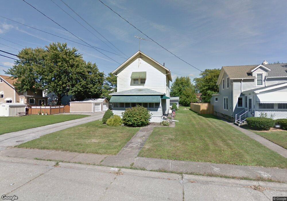
213 Kentucky Ave Lorain, OH 44052
Estimated Value: $161,556 - $189,000
3
Beds
2
Baths
1,710
Sq Ft
$107/Sq Ft
Est. Value
About This Home
This home is located at 213 Kentucky Ave, Lorain, OH 44052 and is currently estimated at $182,139, approximately $106 per square foot. 213 Kentucky Ave is a home located in Lorain County with nearby schools including Larkmoor Elementary School, Longfellow Middle School, and Lorain High School.
Ownership History
Date
Name
Owned For
Owner Type
Purchase Details
Closed on
Aug 6, 2013
Sold by
Farmer Marilyn
Bought by
Farmer Jeremy J
Current Estimated Value
Purchase Details
Closed on
Nov 25, 2008
Sold by
Farmer Nay June L
Bought by
Farmer Jeremy J
Purchase Details
Closed on
Oct 9, 2002
Sold by
Farmer Marilyn and Farmer James Edward
Bought by
Farmer Jeremy James
Purchase Details
Closed on
Oct 25, 2000
Sold by
Beck Roy F
Bought by
Beck Roy F and The Roy F Beck Trust
Create a Home Valuation Report for This Property
The Home Valuation Report is an in-depth analysis detailing your home's value as well as a comparison with similar homes in the area
Home Values in the Area
Average Home Value in this Area
Purchase History
| Date | Buyer | Sale Price | Title Company |
|---|---|---|---|
| Farmer Jeremy J | -- | Brickstone Title Inc | |
| Farmer Jeremy J | -- | None Available | |
| Farmer Jeremy James | -- | -- | |
| Beck Roy F | -- | -- |
Source: Public Records
Tax History Compared to Growth
Tax History
| Year | Tax Paid | Tax Assessment Tax Assessment Total Assessment is a certain percentage of the fair market value that is determined by local assessors to be the total taxable value of land and additions on the property. | Land | Improvement |
|---|---|---|---|---|
| 2024 | $1,738 | $42,147 | $5,233 | $36,915 |
| 2023 | $1,139 | $22,117 | $6,839 | $15,278 |
| 2022 | $1,129 | $22,117 | $6,839 | $15,278 |
| 2021 | $1,129 | $22,117 | $6,839 | $15,278 |
| 2020 | $1,050 | $17,860 | $5,520 | $12,340 |
| 2019 | $1,044 | $17,860 | $5,520 | $12,340 |
| 2018 | $1,106 | $17,860 | $5,520 | $12,340 |
| 2017 | $1,167 | $18,820 | $4,800 | $14,020 |
| 2016 | $1,158 | $18,820 | $4,800 | $14,020 |
| 2015 | $1,092 | $18,820 | $4,800 | $14,020 |
| 2014 | $1,089 | $18,820 | $4,800 | $14,020 |
| 2013 | $1,081 | $18,820 | $4,800 | $14,020 |
Source: Public Records
Map
Nearby Homes
- 313 Kansas Ave
- 1651 E Erie Ave
- 1336 E Erie Ave
- 423 Kansas Ave
- 1318 Maryland Ave
- 1943 G St
- 1330 Maryland Ave
- 207 Georgia Ave
- 906 E Erie Ave
- 2235 E Erie Ave
- 723 E St
- 2500 S Jefferson Blvd
- 642 F St
- 2625 E Erie Ave
- 413 Nebraska Ave
- 2236 Randall St
- 2730 S Jefferson Blvd
- 2612 Larkmoor St
- 374 Bascule Dr
- 2637 Jackson St
- 217 Kentucky Ave
- 221 Kentucky Ave
- 1512 E Erie Ave
- 1520 E Erie Ave
- 1506 E Erie Ave
- 1530 E Erie Ave
- 1602 E Erie Ave
- 1517 D St
- 214 Louisiana Ave
- 229 Kentucky Ave
- 218 Louisiana Ave
- 1531 D St
- 1612 E Erie Ave
- 1462 E Erie Ave
- 228 Louisiana Ave
- 228 Louisiana Ave
- 1541 D St
- 1622 E Erie Ave
- 216 Kentucky Ave
- 1456 E Erie Ave