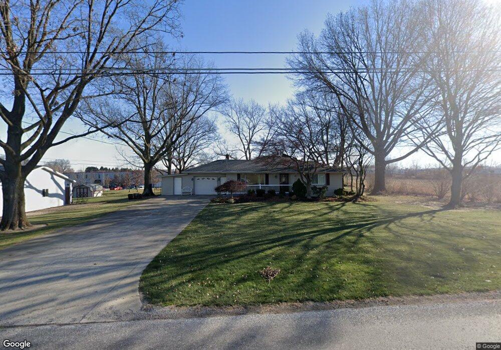
213 Kurzen Rd N Dalton, OH 44618
Estimated Value: $229,370 - $312,000
3
Beds
2
Baths
1,220
Sq Ft
$223/Sq Ft
Est. Value
About This Home
This home is located at 213 Kurzen Rd N, Dalton, OH 44618 and is currently estimated at $272,593, approximately $223 per square foot. 213 Kurzen Rd N is a home located in Wayne County with nearby schools including Dalton Elementary School, Dalton Middle School, and Dalton High School.
Ownership History
Date
Name
Owned For
Owner Type
Purchase Details
Closed on
Sep 17, 2010
Sold by
Bates James M
Bought by
Bates Melinda D
Current Estimated Value
Purchase Details
Closed on
Jan 30, 2009
Sold by
Bates Melinda D and Bates James M
Bought by
Bates Melinda D and Bates James M
Purchase Details
Closed on
May 26, 2000
Sold by
Nussbaumer Theresa E
Bought by
Bates Melinda D
Home Financials for this Owner
Home Financials are based on the most recent Mortgage that was taken out on this home.
Original Mortgage
$124,100
Outstanding Balance
$43,469
Interest Rate
8.13%
Mortgage Type
New Conventional
Estimated Equity
$229,124
Purchase Details
Closed on
Aug 8, 1994
Sold by
Ostetler John D
Bought by
Nussbaumer Theresa E
Home Financials for this Owner
Home Financials are based on the most recent Mortgage that was taken out on this home.
Original Mortgage
$83,600
Interest Rate
8.53%
Mortgage Type
New Conventional
Create a Home Valuation Report for This Property
The Home Valuation Report is an in-depth analysis detailing your home's value as well as a comparison with similar homes in the area
Home Values in the Area
Average Home Value in this Area
Purchase History
| Date | Buyer | Sale Price | Title Company |
|---|---|---|---|
| Bates Melinda D | -- | Attorney | |
| Bates Melinda D | -- | None Available | |
| Bates Melinda D | $128,000 | -- | |
| Nussbaumer Theresa E | $90,000 | -- |
Source: Public Records
Mortgage History
| Date | Status | Borrower | Loan Amount |
|---|---|---|---|
| Open | Bates Melinda D | $124,100 | |
| Previous Owner | Nussbaumer Theresa E | $83,600 |
Source: Public Records
Tax History Compared to Growth
Tax History
| Year | Tax Paid | Tax Assessment Tax Assessment Total Assessment is a certain percentage of the fair market value that is determined by local assessors to be the total taxable value of land and additions on the property. | Land | Improvement |
|---|---|---|---|---|
| 2024 | $2,517 | $68,850 | $13,800 | $55,050 |
| 2023 | $2,517 | $68,850 | $13,800 | $55,050 |
| 2022 | $1,928 | $47,810 | $9,580 | $38,230 |
| 2021 | $1,949 | $47,810 | $9,580 | $38,230 |
| 2020 | $1,976 | $47,810 | $9,580 | $38,230 |
| 2019 | $1,706 | $42,620 | $8,550 | $34,070 |
| 2018 | $1,709 | $42,620 | $8,550 | $34,070 |
| 2017 | $1,584 | $42,620 | $8,550 | $34,070 |
| 2016 | $1,514 | $38,740 | $7,770 | $30,970 |
| 2015 | $1,478 | $38,740 | $7,770 | $30,970 |
| 2014 | $1,492 | $38,740 | $7,770 | $30,970 |
| 2013 | $1,553 | $39,260 | $6,570 | $32,690 |
Source: Public Records
Map
Nearby Homes
- 14003 Highview Dr
- 13946 Highview Dr
- 13877 Highview Dr
- 209 Greenbriar Ln
- 223 Tanglewood Dr
- 119 Briarwood Dr
- 14533 Arnold Rd
- 740 Kidron Rd
- 29 Mill St N
- 0 Dalton Fox Lake Rd
- 12428 Arnold Rd
- 589 Wadsworth Rd
- 1342 Wadsworth Rd
- 16450 Church Rd
- 712 Homestead Pointe Dr
- 110 S Kansas Rd
- 548 Center St
- 738 S Mill St
- 600 E Paradise St
- 110 NW Lebanon Rd Unit Lot 62
- 329 Kurzen Rd N
- 300 Kurzen Rd N
- 61 Kurzen Rd N
- 100 Kurzen Rd N
- 431 Kurzen Rd N
- 14232 Lincoln Way E
- 14501 Lincoln Way E
- 38 Kurzen Rd S
- 62 Kurzen Rd S
- 493 Kurzen Rd N
- 433 Kurzen Rd N
- 14585 Lincoln Way E
- 72 Kurzen Rd S
- 508 Kurzen Rd N
- 537 Kurzen Rd N
- 14179 Bair Rd
- 14666 Lincoln Way E
- 235 Pres Vannes Dr
- 14750 Lincoln Way E
- 213 Pres Vannes Dr