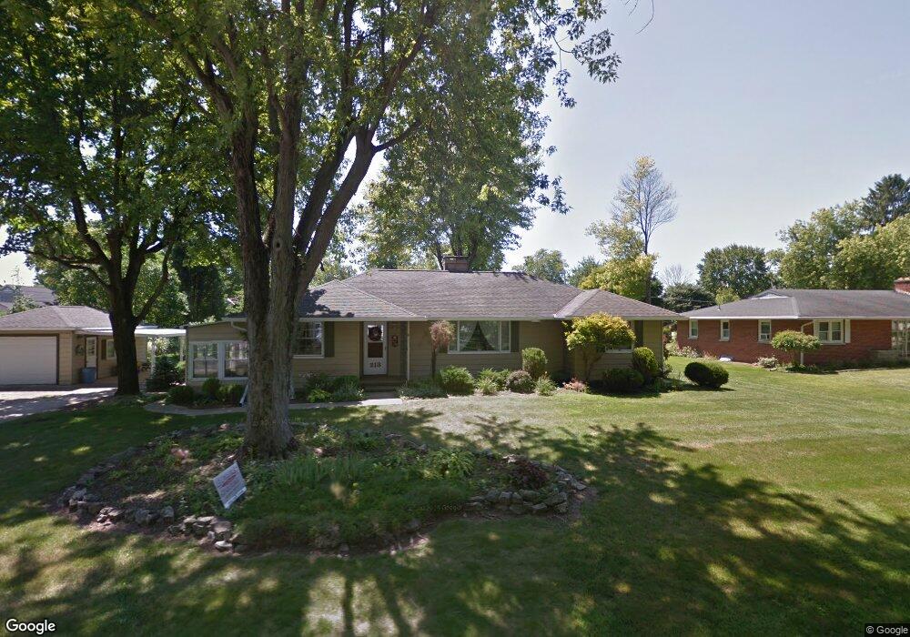
213 Leonard St West Liberty, OH 43357
Estimated Value: $239,000 - $274,000
3
Beds
2
Baths
1,612
Sq Ft
$158/Sq Ft
Est. Value
About This Home
This home is located at 213 Leonard St, West Liberty, OH 43357 and is currently estimated at $253,957, approximately $157 per square foot. 213 Leonard St is a home located in Logan County with nearby schools including West Liberty-Salem Elementary School, West Liberty-Salem Middle School, and West Liberty-Salem Middle/High School.
Ownership History
Date
Name
Owned For
Owner Type
Purchase Details
Closed on
Oct 21, 2024
Sold by
Kauffman Family Revocable Living Trust and Kauffman Byron Forrest
Bought by
Newcomer Carl and Newcomer Elaine
Current Estimated Value
Purchase Details
Closed on
Jul 6, 2017
Sold by
Devine Janet M
Bought by
Kauffman Byron Forrest and Kauffman Barbara Eileen
Purchase Details
Closed on
Feb 17, 2000
Bought by
Devine Dale A Trustee
Purchase Details
Closed on
Jan 14, 1998
Bought by
Devine Dale A
Purchase Details
Closed on
Oct 3, 1997
Bought by
Wilson Beryl A
Create a Home Valuation Report for This Property
The Home Valuation Report is an in-depth analysis detailing your home's value as well as a comparison with similar homes in the area
Home Values in the Area
Average Home Value in this Area
Purchase History
| Date | Buyer | Sale Price | Title Company |
|---|---|---|---|
| Newcomer Carl | $260,000 | Mad River Title | |
| Newcomer Carl | $260,000 | Mad River Title | |
| Kauffman Byron Forrest | $130,000 | None Available | |
| Devine Dale A Trustee | -- | -- | |
| Devine Dale A | $127,500 | -- | |
| Wilson Beryl A | -- | -- |
Source: Public Records
Tax History Compared to Growth
Tax History
| Year | Tax Paid | Tax Assessment Tax Assessment Total Assessment is a certain percentage of the fair market value that is determined by local assessors to be the total taxable value of land and additions on the property. | Land | Improvement |
|---|---|---|---|---|
| 2024 | $2,489 | $63,670 | $18,420 | $45,250 |
| 2023 | $2,489 | $63,670 | $18,420 | $45,250 |
| 2022 | $2,491 | $53,060 | $15,350 | $37,710 |
| 2021 | $2,223 | $53,060 | $15,350 | $37,710 |
| 2020 | $2,227 | $47,770 | $12,750 | $35,020 |
| 2019 | $2,205 | $47,770 | $12,750 | $35,020 |
| 2018 | $1,811 | $47,770 | $12,750 | $35,020 |
| 2016 | $1,540 | $43,430 | $11,600 | $31,830 |
| 2014 | $1,471 | $43,430 | $11,600 | $31,830 |
| 2013 | $1,457 | $43,430 | $11,600 | $31,830 |
| 2012 | $1,430 | $47,260 | $11,590 | $35,670 |
Source: Public Records
Map
Nearby Homes
- 116 E Newell St
- 215 N Detroit St
- 414 N Detroit St
- 308 Reynolds St
- 512 W Columbus St
- 619 W Baird St
- 0 County Road 189
- . Co Rd 189
- 5714 Hickory Dr
- Lot 1 County Road 1
- 129 Tanglewood Dr
- 5197 County Road 1
- 7885 N Ludlow Rd
- 4164 County Road 1
- 6404 Township Road 55
- Lot 3 County Road 1
- Lot 2 County Road 1
- Lot 1 County Road 1
- 4124 State Route 245 W
- 501 Gunntown Rd Unit Lot 66
- 215 Leonard St
- 201 Leonard St
- 225 Leonard St
- 200 Leonard St
- 210 E Newell St
- 212 E Newell St
- 208 Leonard St
- 216 E Newell St
- 301 Mc Clellan St
- 218 E Newell St
- 202 E Newell St
- 204 E Newell St
- 233 Leonard St
- 216 Leonard St
- 222 E Newell St
- 304 Mcclellan St
- 237 Leonard St
- 209 Pickrelltown Rd
- 221 Pickrelltown Rd
- 120 E Newell St