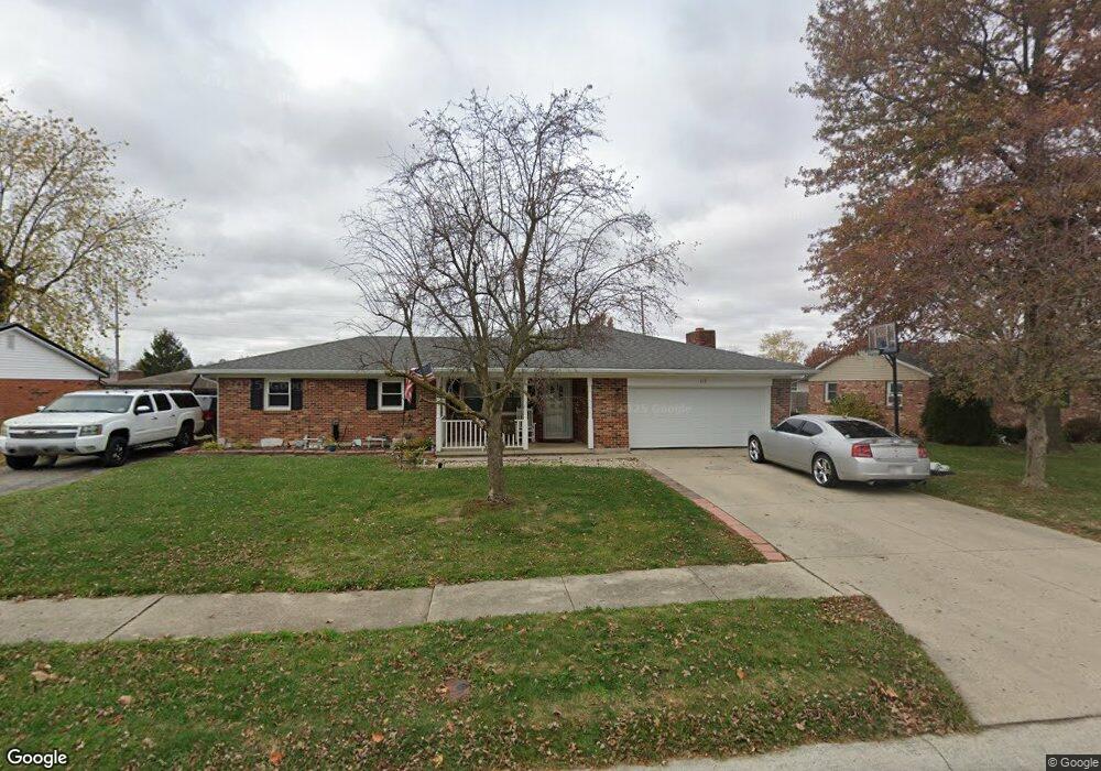
213 Lincoln Dr Celina, OH 45822
Estimated Value: $228,000 - $262,000
3
Beds
2
Baths
1,572
Sq Ft
$153/Sq Ft
Est. Value
About This Home
This home is located at 213 Lincoln Dr, Celina, OH 45822 and is currently estimated at $241,142, approximately $153 per square foot. 213 Lincoln Dr is a home located in Mercer County with nearby schools including Celina Middle School, Celina High School, and Immaculate Conception School.
Ownership History
Date
Name
Owned For
Owner Type
Purchase Details
Closed on
Sep 20, 2012
Sold by
Vorhees Mark A and Vinget Gaye L
Bought by
Secrest Jamie S
Current Estimated Value
Home Financials for this Owner
Home Financials are based on the most recent Mortgage that was taken out on this home.
Original Mortgage
$96,836
Outstanding Balance
$65,803
Interest Rate
3.57%
Mortgage Type
New Conventional
Estimated Equity
$175,339
Purchase Details
Closed on
Feb 21, 2008
Sold by
Detomaso Arthur and Detomaso Geraldine R
Bought by
Vorhees Mark A and Winget Gaye L
Home Financials for this Owner
Home Financials are based on the most recent Mortgage that was taken out on this home.
Original Mortgage
$75,200
Interest Rate
5.9%
Mortgage Type
Purchase Money Mortgage
Create a Home Valuation Report for This Property
The Home Valuation Report is an in-depth analysis detailing your home's value as well as a comparison with similar homes in the area
Home Values in the Area
Average Home Value in this Area
Purchase History
| Date | Buyer | Sale Price | Title Company |
|---|---|---|---|
| Secrest Jamie S | $132,880 | Attorney | |
| Vorhees Mark A | $94,000 | Attorney |
Source: Public Records
Mortgage History
| Date | Status | Borrower | Loan Amount |
|---|---|---|---|
| Open | Secrest Jamie S | $96,836 | |
| Previous Owner | Vorhees Mark A | $75,200 |
Source: Public Records
Tax History
| Year | Tax Paid | Tax Assessment Tax Assessment Total Assessment is a certain percentage of the fair market value that is determined by local assessors to be the total taxable value of land and additions on the property. | Land | Improvement |
|---|---|---|---|---|
| 2025 | $2,416 | $59,920 | $6,930 | $52,990 |
| 2024 | $2,424 | $59,920 | $6,930 | $52,990 |
| 2023 | $2,416 | $59,920 | $6,930 | $52,990 |
| 2022 | $1,926 | $41,720 | $6,650 | $35,070 |
| 2021 | $1,931 | $41,720 | $6,650 | $35,070 |
| 2020 | $1,625 | $41,720 | $6,650 | $35,070 |
| 2019 | $1,523 | $36,680 | $5,950 | $30,730 |
| 2018 | $1,584 | $36,680 | $5,950 | $30,730 |
| 2017 | $1,503 | $36,680 | $5,950 | $30,730 |
| 2016 | $1,422 | $33,330 | $5,570 | $27,760 |
| 2015 | $1,382 | $33,330 | $5,570 | $27,760 |
| 2014 | $1,385 | $33,330 | $5,570 | $27,760 |
| 2013 | $1,636 | $37,040 | $6,200 | $30,840 |
Source: Public Records
Map
Nearby Homes
- 1312 Michael Ave
- 1409 James Dr
- 611 N Sugar St
- 905 N Walnut St
- 115 Touvelle St
- 116 S Elm St
- 680 N Main St
- 609 N Cherry St
- 316 Dogwood Dr
- 308 Dogwood Dr
- 807 Sycamore St
- 426 Magnolia St
- 328 E Livingston St
- 502 S Sugar St
- 526 Willow St
- 1201 Lilac Dr
- 802 E Market St
- 6764 Silver Lakes Dr
- 1700 E Market St Unit 310
- 2504 Eaglebrooke Pkwy
Your Personal Tour Guide
Ask me questions while you tour the home.