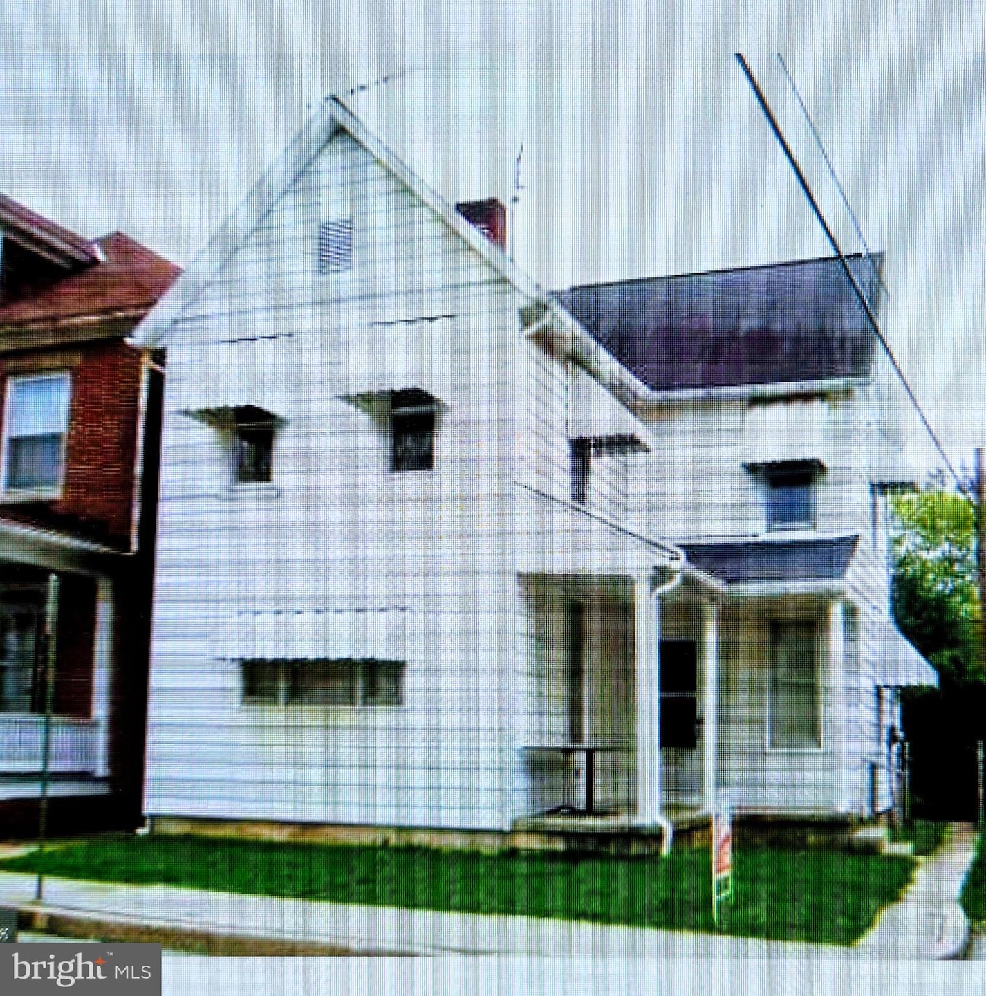
213 Locust St Hanover, PA 17331
Hanover Historic District NeighborhoodEstimated payment $1,217/month
Highlights
- Colonial Architecture
- Hanover Street Elementary School Rated A-
- Central Heating and Cooling System
About This Home
Excellent Investment Opportunity – Fully Leased Duplex with Bonus Income! Discover this well-maintained duplex in the heart of Hanover, PA, offering two spacious one-bedroom units and valuable additional income from a detached garage. Located within easy walking distance to downtown Hanover’s shops, dining, and amenities, this property is perfectly situated for long-term rental demand. Both units are fully leased, providing immediate cash flow for investors. Each apartment features comfortable living spaces, functional layouts, and reliable tenants who enjoy the convenience of in-town living. A standout feature is the detached garage, currently rented and generating extra monthly income—boosting your overall return. Whether you're expanding your portfolio or entering the investment market, this duplex delivers dependable performance and an unbeatable location.
Listing Agent
(717) 870-3608 bshafer@sitesrealtyinc.com Sites Realty, Inc. License #RS336366 Listed on: 11/21/2025
Property Details
Home Type
- Multi-Family
Est. Annual Taxes
- $3,510
Year Built
- Built in 1898
Lot Details
- 4,500 Sq Ft Lot
Parking
- Off-Street Parking
Home Design
- 1,512 Sq Ft Home
- Duplex
- Colonial Architecture
- Block Foundation
- Aluminum Siding
- Vinyl Siding
Utilities
- Central Heating and Cooling System
- Electric Water Heater
Listing and Financial Details
- Tax Lot 0125
- Assessor Parcel Number 67-000-04-0125-00-00000
Community Details
Overview
- 2 Units
- 2-Story Building
Building Details
- Operating Expense $4,418
Map
Home Values in the Area
Average Home Value in this Area
Tax History
| Year | Tax Paid | Tax Assessment Tax Assessment Total Assessment is a certain percentage of the fair market value that is determined by local assessors to be the total taxable value of land and additions on the property. | Land | Improvement |
|---|---|---|---|---|
| 2025 | $3,510 | $95,880 | $21,600 | $74,280 |
| 2024 | $3,483 | $95,880 | $21,600 | $74,280 |
| 2023 | $3,456 | $95,880 | $21,600 | $74,280 |
| 2022 | $3,414 | $95,880 | $21,600 | $74,280 |
| 2021 | $3,318 | $95,880 | $21,600 | $74,280 |
| 2020 | $3,318 | $95,880 | $21,600 | $74,280 |
| 2019 | $3,267 | $95,880 | $21,600 | $74,280 |
| 2018 | $3,206 | $95,880 | $21,600 | $74,280 |
| 2017 | $3,146 | $95,880 | $21,600 | $74,280 |
| 2016 | $0 | $95,880 | $21,600 | $74,280 |
| 2015 | -- | $95,880 | $21,600 | $74,280 |
| 2014 | -- | $95,880 | $21,600 | $74,280 |
Property History
| Date | Event | Price | List to Sale | Price per Sq Ft |
|---|---|---|---|---|
| 11/21/2025 11/21/25 | For Sale | $175,000 | -- | $116 / Sq Ft |
Purchase History
| Date | Type | Sale Price | Title Company |
|---|---|---|---|
| Deed | $124,900 | None Available |
Mortgage History
| Date | Status | Loan Amount | Loan Type |
|---|---|---|---|
| Open | $99,920 | Purchase Money Mortgage |
Source: Bright MLS
MLS Number: PAYK2093842
APN: 67-000-04-0125.00-00000
Disclaimer: Certain information contained herein is derived from information provided by parties other than Homes.com. All information provided is deemed reliable, but is not guaranteed to be accurate and should be independently verified.
![]() The data relating to real estate for sale on this website appears in part through the BRIGHT Internet Data Exchange program, a voluntary cooperative exchange of property listing data between licensed real estate brokerage firms, and is provided by BRIGHT through a licensing agreement.
The data relating to real estate for sale on this website appears in part through the BRIGHT Internet Data Exchange program, a voluntary cooperative exchange of property listing data between licensed real estate brokerage firms, and is provided by BRIGHT through a licensing agreement.
Listing information is from various brokers who participate in the Bright MLS IDX program and not all listings may be visible on the site.
The property information being provided on or through the website is for the personal, non-commercial use of consumers and such information may not be used for any purpose other than to identify prospective properties consumers may be interested in purchasing.
Some properties which appear for sale on the website may no longer be available because they are for instance, under contract, sold or are no longer being offered for sale.
Property information displayed is deemed reliable but is not guaranteed.
Copyright 2025 Bright MLS, Inc.
- 112 Baltimore St Unit 1
- 1 E Walnut St
- 214 Broadway
- 12 Pleasant St Unit First Floor
- 102 Carlisle St Unit 102B
- 432 S Franklin St
- 325 2nd Ave
- 425 Carlisle St Unit 425.5 A
- 833 York St
- 648 Broadway Unit E
- 648 Broadway Unit A
- 502 Charles Ave
- 74 Brookside Ave
- 693 E Walnut St
- 626 Eichelberger St
- 506 Penn St
- 215 Woodside Ave
- 180 Breezewood Dr
- 324 3rd St Unit 324-1
- 2 Clearview Ct
