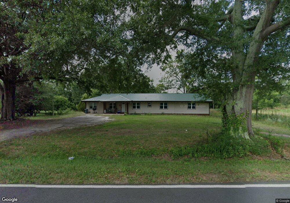
213 Manning Gin Rd Monroe, GA 30656
Estimated Value: $190,000 - $450,000
4
Beds
2
Baths
2,164
Sq Ft
$148/Sq Ft
Est. Value
About This Home
This home is located at 213 Manning Gin Rd, Monroe, GA 30656 and is currently estimated at $319,818, approximately $147 per square foot. 213 Manning Gin Rd is a home located in Barrow County with nearby schools including Bethlehem Elementary School, Haymon-Morris Middle School, and Apalachee High School.
Ownership History
Date
Name
Owned For
Owner Type
Purchase Details
Closed on
Jun 17, 2020
Sold by
Tousel Susan E
Bought by
Martinez Felipe De Jesus and Ramirez Mayra Nallely
Current Estimated Value
Purchase Details
Closed on
Apr 14, 1999
Sold by
Anthony Mary G
Bought by
Tousel Susan E
Home Financials for this Owner
Home Financials are based on the most recent Mortgage that was taken out on this home.
Original Mortgage
$106,250
Interest Rate
7.08%
Mortgage Type
FHA
Purchase Details
Closed on
Dec 16, 1998
Sold by
Anthony Robert L
Bought by
Anthony Mary G
Create a Home Valuation Report for This Property
The Home Valuation Report is an in-depth analysis detailing your home's value as well as a comparison with similar homes in the area
Home Values in the Area
Average Home Value in this Area
Purchase History
| Date | Buyer | Sale Price | Title Company |
|---|---|---|---|
| Martinez Felipe De Jesus | $110,000 | -- | |
| Tousel Susan E | $115,500 | -- | |
| Anthony Mary G | -- | -- |
Source: Public Records
Mortgage History
| Date | Status | Borrower | Loan Amount |
|---|---|---|---|
| Previous Owner | Tousel Susan E | $106,250 |
Source: Public Records
Tax History Compared to Growth
Tax History
| Year | Tax Paid | Tax Assessment Tax Assessment Total Assessment is a certain percentage of the fair market value that is determined by local assessors to be the total taxable value of land and additions on the property. | Land | Improvement |
|---|---|---|---|---|
| 2024 | $2,121 | $85,653 | $35,485 | $50,168 |
| 2023 | $2,109 | $85,653 | $35,485 | $50,168 |
| 2022 | $1,842 | $64,113 | $35,485 | $28,628 |
| 2021 | $1,666 | $54,757 | $28,388 | $26,369 |
| 2020 | $1,519 | $53,164 | $26,042 | $27,122 |
| 2019 | $1,545 | $53,164 | $26,042 | $27,122 |
| 2018 | $1,522 | $53,164 | $26,042 | $27,122 |
| 2017 | $1,423 | $48,880 | $26,042 | $22,838 |
| 2016 | $1,361 | $48,880 | $26,042 | $22,838 |
| 2015 | $1,367 | $48,880 | $26,042 | $22,838 |
| 2014 | $969 | $35,598 | $12,760 | $22,838 |
| 2013 | -- | $34,494 | $12,760 | $21,734 |
Source: Public Records
Map
Nearby Homes
- 164 Manning Gin Rd
- 303 Carly Ct
- 1050 Bethlehem Church Rd
- 966 David Ave
- 784 Manger Ave
- 0 Manger Ave E Unit 20154677
- 0 Manger Ave E Unit 20127001
- 0 McElhannon Rd SW Unit 10581793
- 724 Manger Ave
- 1235 Dale Dr
- 1408 Wyndham Way
- 898 Harrison Mill Rd
- 449 & 455 Carl-Bethlehem Rd
- 797 Ode Peppers Rd
- 3300 Jack Glass Rd
- 182 Nativity Cove
- 259 Dunagan Ct
- 378 Dunagan Ct
- 0 Harrison Mill Rd Unit 10522698
- 1224 Palmer Dr
- 221 Manning Gin Rd
- 201 Tia Ct Unit 18
- 201 Tia Ct
- 203 Tia Ct
- 1030 Tia Dr
- 1124 Yearwood Rd
- 230 Manning Gin Rd
- 205 Tia Ct
- 1032 Tia Dr
- 1032 Tia Dr Unit 1032
- 0 Tia Ct Unit 8728525
- 0 Tia Ct Unit 9005174
- 0 Tia Ct Unit 7021951
- 0 Tia Ct
- 1036 Tia Dr
- 233 Manning Gin Rd
- 1135 Yearwood Rd
- 0 Tia Dr Unit 7526979
- 0 Tia Dr Unit 7465182
- 0 Tia Dr Unit 7596045