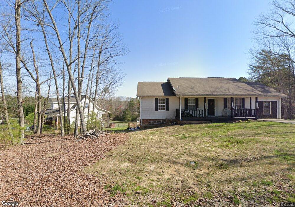
213 Millsap Rd La Fayette, GA 30728
Noble NeighborhoodEstimated Value: $261,283 - $328,000
3
Beds
2
Baths
1,650
Sq Ft
$179/Sq Ft
Est. Value
About This Home
This home is located at 213 Millsap Rd, La Fayette, GA 30728 and is currently estimated at $294,821, approximately $178 per square foot. 213 Millsap Rd is a home located in Walker County with nearby schools including Rock Spring Elementary School and Lafayette High School.
Ownership History
Date
Name
Owned For
Owner Type
Purchase Details
Closed on
Mar 31, 2011
Sold by
Cameron Patrick W
Bought by
Sosebee Nathaniel Scott
Current Estimated Value
Home Financials for this Owner
Home Financials are based on the most recent Mortgage that was taken out on this home.
Original Mortgage
$110,865
Outstanding Balance
$76,594
Interest Rate
4.83%
Mortgage Type
FHA
Estimated Equity
$218,227
Purchase Details
Closed on
May 16, 2001
Sold by
B&B Development Lc & Douglas F
Bought by
Cameron Patrick W
Purchase Details
Closed on
Sep 26, 2000
Sold by
Townsend Frances Dianne
Bought by
B&B Development Lc & Douglas F
Purchase Details
Closed on
Oct 14, 1986
Bought by
Townsend Frances Dianne
Create a Home Valuation Report for This Property
The Home Valuation Report is an in-depth analysis detailing your home's value as well as a comparison with similar homes in the area
Home Values in the Area
Average Home Value in this Area
Purchase History
| Date | Buyer | Sale Price | Title Company |
|---|---|---|---|
| Sosebee Nathaniel Scott | $113,750 | -- | |
| Cameron Patrick W | $12,500 | -- | |
| B&B Development Lc & Douglas F | $55,800 | -- | |
| Townsend Frances Dianne | -- | -- |
Source: Public Records
Mortgage History
| Date | Status | Borrower | Loan Amount |
|---|---|---|---|
| Open | Sosebee Nathaniel Scott | $110,865 |
Source: Public Records
Tax History Compared to Growth
Tax History
| Year | Tax Paid | Tax Assessment Tax Assessment Total Assessment is a certain percentage of the fair market value that is determined by local assessors to be the total taxable value of land and additions on the property. | Land | Improvement |
|---|---|---|---|---|
| 2024 | $2,052 | $89,781 | $8,000 | $81,781 |
| 2023 | $1,999 | $85,452 | $8,000 | $77,452 |
| 2022 | $1,894 | $74,486 | $8,000 | $66,486 |
| 2021 | $1,814 | $64,153 | $8,000 | $56,153 |
| 2020 | $1,576 | $52,914 | $8,000 | $44,914 |
| 2019 | $1,604 | $52,914 | $8,000 | $44,914 |
| 2018 | $1,400 | $52,914 | $8,000 | $44,914 |
| 2017 | $1,748 | $52,914 | $8,000 | $44,914 |
| 2016 | $1,425 | $52,914 | $8,000 | $44,914 |
| 2015 | $1,514 | $53,144 | $8,000 | $45,144 |
| 2014 | $1,406 | $53,144 | $8,000 | $45,144 |
| 2013 | -- | $53,144 | $8,000 | $45,144 |
Source: Public Records
Map
Nearby Homes
- 218 Golden Oaks Dr
- 1585 E Reed Rd
- 450 Arnold Ln
- 1186 E Reed Rd
- 1934 Round Pond Rd
- 0 Clyde Byrd Rd
- 57 McGaha Rd
- 63 Loughridge Ln
- 521 Wheeler Rd
- 5062 Georgia 95
- 894 896 Wheeler Unit 1 & 2
- 894 896 Wheeler
- 23 Oak Meadow Dr
- 58 Oak Run
- 4904 Ringgold Rd
- 106 Meadow Oak Dr
- 34 Winter Ln
- 0 Georgia 95
- 4544 N Highway 27
- 0 E Warren Rd Unit RTC2681365
- 213 Millsap Rd
- 233 Millsap Rd
- 195 Millsap Rd
- 176 Millsap Rd
- 157 Millsap Rd
- 177 Millsap Rd
- 170 Millsap Rd
- 163 Millsap Rd
- 101 Millsap Rd
- 101 Millsap Rd
- 292 Millsap Rd
- 118 Millsap Rd
- 502 Cordell Rd
- 502 Cordell Rd
- 494 Cordell Rd
- 21 Millsap Rd
- 6 Millsap Rd
- 6 Millsap Rd Unit TRACT
- 2 Millsap Rd
- 448 Cordell Rd