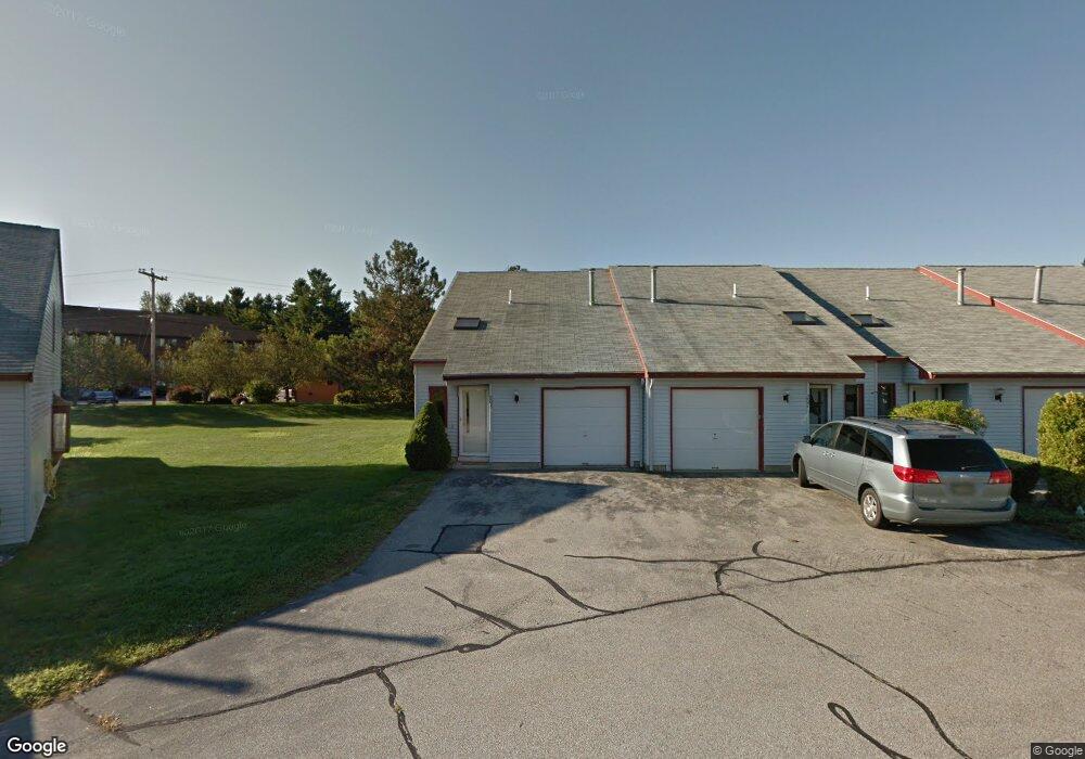
213 Millwright Dr Nashua, NH 03063
Northwest Nashua NeighborhoodEstimated Value: $249,000 - $340,000
2
Beds
1
Bath
1,072
Sq Ft
$281/Sq Ft
Est. Value
About This Home
This home is located at 213 Millwright Dr, Nashua, NH 03063 and is currently estimated at $300,758, approximately $280 per square foot. 213 Millwright Dr is a home located in Hillsborough County with nearby schools including Birch Hill Elementary School, Pennichuck Middle School, and Nashua High School North.
Ownership History
Date
Name
Owned For
Owner Type
Purchase Details
Closed on
Aug 9, 2020
Sold by
Whitestone Rlty Assoc
Bought by
Liu Litian and Wang Li
Current Estimated Value
Purchase Details
Closed on
Feb 12, 2019
Sold by
Botsko Edward S and Botsko Janice J
Bought by
Liu Litian and Wang Li
Home Financials for this Owner
Home Financials are based on the most recent Mortgage that was taken out on this home.
Original Mortgage
$76,500
Interest Rate
4.4%
Mortgage Type
Purchase Money Mortgage
Purchase Details
Closed on
Apr 15, 1988
Bought by
Botsko Edward S and Botsko Janice J
Create a Home Valuation Report for This Property
The Home Valuation Report is an in-depth analysis detailing your home's value as well as a comparison with similar homes in the area
Home Values in the Area
Average Home Value in this Area
Purchase History
| Date | Buyer | Sale Price | Title Company |
|---|---|---|---|
| Liu Litian | $47,000 | None Available | |
| Liu Litian | $102,000 | -- | |
| Botsko Edward S | $82,000 | -- |
Source: Public Records
Mortgage History
| Date | Status | Borrower | Loan Amount |
|---|---|---|---|
| Previous Owner | Liu Litian | $76,500 |
Source: Public Records
Tax History
| Year | Tax Paid | Tax Assessment Tax Assessment Total Assessment is a certain percentage of the fair market value that is determined by local assessors to be the total taxable value of land and additions on the property. | Land | Improvement |
|---|---|---|---|---|
| 2025 | $4,497 | $267,200 | $0 | $267,200 |
| 2024 | $4,248 | $267,200 | $0 | $267,200 |
| 2023 | $3,599 | $197,400 | $0 | $197,400 |
| 2022 | $3,567 | $197,400 | $0 | $197,400 |
| 2021 | $3,399 | $146,400 | $0 | $146,400 |
| 2020 | $2,505 | $110,800 | $0 | $110,800 |
| 2019 | $2,515 | $115,600 | $0 | $115,600 |
| 2018 | $2,452 | $115,600 | $0 | $115,600 |
| 2017 | $1,798 | $69,700 | $0 | $69,700 |
| 2016 | $1,747 | $69,700 | $0 | $69,700 |
| 2015 | $1,710 | $69,700 | $0 | $69,700 |
| 2014 | $1,676 | $69,700 | $0 | $69,700 |
Source: Public Records
Map
Nearby Homes
- 1133 Blackstone Dr Unit 33
- 3 Roedean Dr Unit UC101
- 5 Blackstone Dr Unit 7
- 4 Knights Bridge Dr Unit UI206
- 9 Blackstone Dr Unit U88
- 5 Dumaine Ave Unit A
- 7 Dumaine Ave Unit H
- 6 Duckford Cir Unit U19
- 35 Albury Stone Cir Unit U201
- 10 Westborn Dr
- 103 Jay Rd
- 47 Lamson Dr
- 11 Erik St
- 1 Cambridge Dr
- 4 Wasserman Heights
- 63 Cannongate III Unit 3
- 8 Heron Cove Dr
- 2 Westchester Dr
- 189 Coburn Woods
- 5 Ivy Ln Unit U131
- 213 Millwright Dr
- 214 Millwright Dr
- 214 Millwright Dr
- 214 Millwright Dr Unit 214
- 215 Millwright Dr
- 215 Millwright Dr
- 215 Millwright Dr Unit 215
- 212 Millwright Dr
- 212 Millwright Dr
- 216 Millwright Dr
- 216 Millwright Dr
- 216 Millwright Dr Unit 216
- 211 Millwright Dr
- 211 Millwright Dr
- 211 Millwright Dr Unit 211
- 217 Millwright Dr
- 217 Millwright Dr
- 210 Millwright Dr
- 210 Millwright Dr
- 19 Stonebridge Dr Unit 292
Your Personal Tour Guide
Ask me questions while you tour the home.