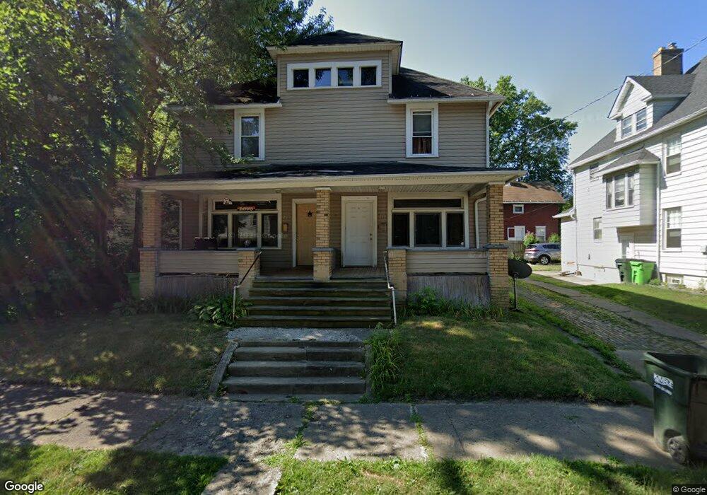
213 Milner St Alliance, OH 44601
Estimated Value: $69,000 - $123,000
6
Beds
2
Baths
2,560
Sq Ft
$37/Sq Ft
Est. Value
About This Home
This home is located at 213 Milner St, Alliance, OH 44601 and is currently estimated at $94,540, approximately $36 per square foot. 213 Milner St is a home located in Stark County with nearby schools including Alliance Elementary School at Rockhill, Alliance Intermediate School at Northside, and Alliance Middle School.
Ownership History
Date
Name
Owned For
Owner Type
Purchase Details
Closed on
May 20, 2008
Sold by
Caldwell Charles and Caldwell Tammy
Bought by
Superior Housing Llc
Current Estimated Value
Home Financials for this Owner
Home Financials are based on the most recent Mortgage that was taken out on this home.
Original Mortgage
$33,935
Outstanding Balance
$7,110
Interest Rate
5.87%
Mortgage Type
Purchase Money Mortgage
Estimated Equity
$87,430
Purchase Details
Closed on
Apr 30, 2007
Sold by
Homesales Inc
Bought by
Caldwell Charles
Purchase Details
Closed on
Feb 22, 2007
Sold by
Grubbs Ronnie L and Grubbs Grace D
Bought by
Homesales Inc and Homesales Inc Of Delaware
Purchase Details
Closed on
Oct 30, 1998
Sold by
Smith Lee D and Smith Theresa M
Bought by
Grubbs Ronnie L and Grubbs Grace D
Create a Home Valuation Report for This Property
The Home Valuation Report is an in-depth analysis detailing your home's value as well as a comparison with similar homes in the area
Home Values in the Area
Average Home Value in this Area
Purchase History
| Date | Buyer | Sale Price | Title Company |
|---|---|---|---|
| Superior Housing Llc | $30,000 | Attorney | |
| Caldwell Charles | $13,500 | Attorney | |
| Homesales Inc | $26,000 | None Available | |
| Grubbs Ronnie L | $25,000 | -- |
Source: Public Records
Mortgage History
| Date | Status | Borrower | Loan Amount |
|---|---|---|---|
| Open | Superior Housing Llc | $33,935 |
Source: Public Records
Tax History Compared to Growth
Tax History
| Year | Tax Paid | Tax Assessment Tax Assessment Total Assessment is a certain percentage of the fair market value that is determined by local assessors to be the total taxable value of land and additions on the property. | Land | Improvement |
|---|---|---|---|---|
| 2025 | -- | $25,170 | $2,700 | $22,470 |
| 2024 | -- | $25,170 | $2,700 | $22,470 |
| 2023 | $588 | $14,290 | $2,630 | $11,660 |
| 2022 | $296 | $14,290 | $2,630 | $11,660 |
| 2021 | $594 | $14,290 | $2,630 | $11,660 |
| 2020 | $614 | $13,800 | $2,280 | $11,520 |
| 2019 | $606 | $13,800 | $2,280 | $11,520 |
| 2018 | $608 | $13,800 | $2,280 | $11,520 |
| 2017 | $555 | $12,360 | $1,930 | $10,430 |
| 2016 | $559 | $12,360 | $1,930 | $10,430 |
| 2015 | $563 | $12,330 | $1,930 | $10,400 |
| 2014 | $606 | $12,640 | $1,960 | $10,680 |
| 2013 | $302 | $12,640 | $1,960 | $10,680 |
Source: Public Records
Map
Nearby Homes
- 1005 S Freedom Ave
- 1175 S Freedom Ave
- 807 S Union Ave
- 452 E Summit St
- 551 South St
- 1437 S Linden Ave
- 1044 S Liberty Ave
- 1475 Chatauqua Ct
- 203 Glamorgan St
- 140 W Summit St
- 814 Milner St
- 432 S Linden Ave
- 404 S Linden Ave
- 427 S Union Ave
- 729 Waugh St
- 1395 S Webb Ave
- V/L S Fredeom Ave
- 831 Wade Ave
- 442 S Liberty Ave
- 356 E Broadway St