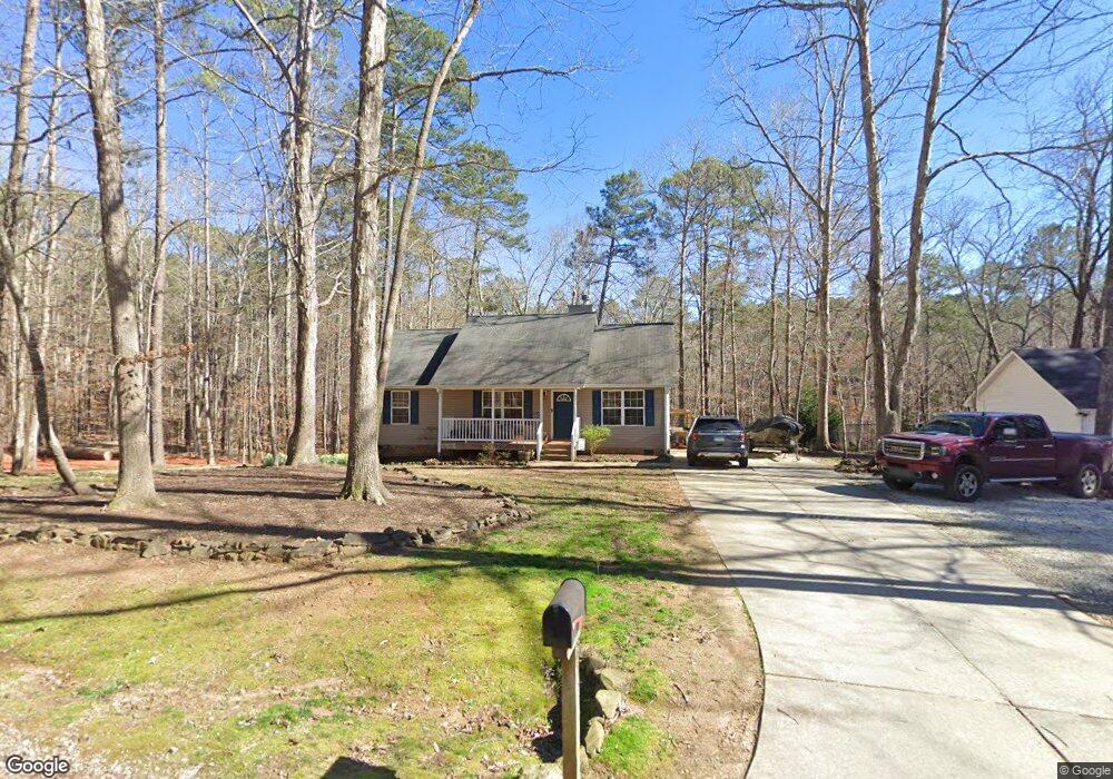
213 Mockingbird Dr Monticello, GA 31064
Jasper County NeighborhoodEstimated Value: $229,242 - $273,000
--
Bed
2
Baths
1,188
Sq Ft
$215/Sq Ft
Est. Value
About This Home
This home is located at 213 Mockingbird Dr, Monticello, GA 31064 and is currently estimated at $255,311, approximately $214 per square foot. 213 Mockingbird Dr is a home located in Jasper County with nearby schools including Jasper County Primary School, Washington Park Elementary School, and Jasper County Middle School.
Ownership History
Date
Name
Owned For
Owner Type
Purchase Details
Closed on
May 14, 2004
Sold by
Tradebank International Inc
Bought by
Starfirst Homes Inc
Current Estimated Value
Purchase Details
Closed on
Mar 28, 2004
Sold by
Zekowski Robert J
Bought by
Trade Bank International Inc
Purchase Details
Closed on
Aug 31, 1994
Bought by
Muhammad Abdul R
Purchase Details
Closed on
Mar 1, 1993
Bought by
Zekowski Robert J
Purchase Details
Closed on
Dec 1, 1992
Bought by
Jasper County
Create a Home Valuation Report for This Property
The Home Valuation Report is an in-depth analysis detailing your home's value as well as a comparison with similar homes in the area
Home Values in the Area
Average Home Value in this Area
Purchase History
| Date | Buyer | Sale Price | Title Company |
|---|---|---|---|
| Starfirst Homes Inc | $8,000 | -- | |
| Trade Bank International Inc | $10,000 | -- | |
| Muhammad Abdul R | $5,900 | -- | |
| Zekowski Robert J | -- | -- | |
| Jasper County | $600 | -- |
Source: Public Records
Tax History Compared to Growth
Tax History
| Year | Tax Paid | Tax Assessment Tax Assessment Total Assessment is a certain percentage of the fair market value that is determined by local assessors to be the total taxable value of land and additions on the property. | Land | Improvement |
|---|---|---|---|---|
| 2024 | $2,329 | $83,720 | $3,600 | $80,120 |
| 2023 | $2,109 | $75,080 | $2,600 | $72,480 |
| 2022 | $1,954 | $63,840 | $2,600 | $61,240 |
| 2021 | $1,796 | $52,320 | $1,040 | $51,280 |
| 2020 | $1,753 | $48,800 | $1,040 | $47,760 |
| 2019 | $1,751 | $46,720 | $800 | $45,920 |
| 2018 | $1,627 | $42,480 | $800 | $41,680 |
| 2017 | $1,532 | $38,920 | $800 | $38,120 |
| 2016 | $1,399 | $34,680 | $800 | $33,880 |
| 2015 | $1,268 | $29,360 | $400 | $28,960 |
| 2014 | $1,015 | $22,600 | $400 | $22,200 |
Source: Public Records
Map
Nearby Homes
- 76 Killdeer Ln
- 281 Mockingbird Dr
- 94 Bunting Ct
- 0 Waxwing Dr Unit 10518396
- 114 Heron Ct
- 128 Turtle Cove Trailway
- 128 Turtle Cove
- 118 Turtle Cove Throughway
- 238 W Mourning Dove
- 111 Turtle Cove Throughway
- 56 Starling Dr
- 15 Egret Ct
- 235 Waxwing Dr
- 350 Hummingbird Dr
- 389 Waxwing Dr
- 124 Flamingo Dr
- 0 Robin Ct Unit 10527408
- 55 Swan Ct
- 575 Starling Dr
- 0 Nuthatch W Unit 10594690
- 219 Mockingbird Dr
- 200 Mockingbird Dr
- 186 Mockingbird Dr
- 268 Mockingbird Dr
- 76 Killdeer Ln Unit 34
- 129 Mockingbird Dr
- 00 Killdeer Ln
- 171 Oriole Cir
- 0 Killdeer Ln Unit 10337400
- 0 Killdeer Ln Unit 28 9030927
- 0 Killdeer Ln Unit 8554203
- 0 Killdeer Ln Unit Lot 34 8868160
- 0 Killdeer Ln Unit Lot 34 8670306
- 0 Killdeer Ln
- 50 Bunting Ct
- 02 Mockingbird Dr
- 55 Killdeer Ln
- 0 Mockingbird Dr Unit 1 3097973
- 0 Mockingbird Dr Unit 7436411
- 0 Mockingbird Dr Unit 41 7510986