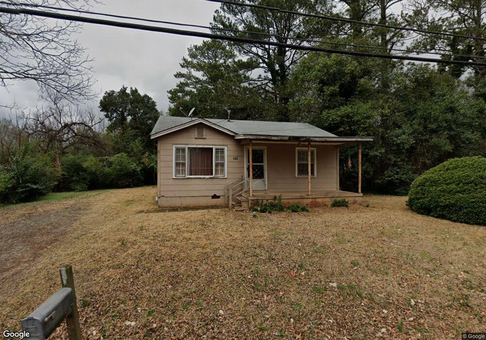
213 N 17th St Griffin, GA 30223
Spalding County NeighborhoodEstimated Value: $77,902 - $97,000
2
Beds
1
Bath
796
Sq Ft
$110/Sq Ft
Est. Value
About This Home
This home is located at 213 N 17th St, Griffin, GA 30223 and is currently estimated at $87,726, approximately $110 per square foot. 213 N 17th St is a home located in Spalding County with nearby schools including Orrs Elementary School, Carver Road Middle School, and Griffin High School.
Ownership History
Date
Name
Owned For
Owner Type
Purchase Details
Closed on
Mar 3, 2003
Sold by
Milner Tessica D
Bought by
Thompson Carla
Current Estimated Value
Purchase Details
Closed on
Jan 31, 1985
Sold by
Ford Gene C
Bought by
Reid Ronald and Donna Faye
Purchase Details
Closed on
Jan 29, 1982
Sold by
The Bank Of Griffin
Bought by
Sanders Morrow C and Sanders James E
Purchase Details
Closed on
Dec 1, 1981
Sold by
Fouts Charles Larry and Donna Lee
Bought by
The Bank Of Griffin
Purchase Details
Closed on
Jul 22, 1976
Sold by
Handy Evelyne S
Bought by
Fouts Charles Larry and Donna Lee
Purchase Details
Closed on
Jul 22, 1972
Sold by
Martin Martha W
Bought by
Handy Evelyne S
Create a Home Valuation Report for This Property
The Home Valuation Report is an in-depth analysis detailing your home's value as well as a comparison with similar homes in the area
Home Values in the Area
Average Home Value in this Area
Purchase History
| Date | Buyer | Sale Price | Title Company |
|---|---|---|---|
| Thompson Carla | -- | -- | |
| Thompson Carla | -- | -- | |
| Reid Ronald | $20,000 | -- | |
| Sanders Morrow C | $12,800 | -- | |
| The Bank Of Griffin | $17,000 | -- | |
| Fouts Charles Larry | $10,700 | -- | |
| Handy Evelyne S | $5,500 | -- |
Source: Public Records
Tax History Compared to Growth
Tax History
| Year | Tax Paid | Tax Assessment Tax Assessment Total Assessment is a certain percentage of the fair market value that is determined by local assessors to be the total taxable value of land and additions on the property. | Land | Improvement |
|---|---|---|---|---|
| 2024 | $326 | $8,529 | $2,240 | $6,289 |
| 2023 | $326 | $8,529 | $2,240 | $6,289 |
| 2022 | $275 | $6,881 | $1,400 | $5,481 |
| 2021 | $254 | $6,354 | $1,400 | $4,954 |
| 2020 | $254 | $6,354 | $1,400 | $4,954 |
| 2019 | $259 | $6,354 | $1,400 | $4,954 |
| 2018 | $246 | $5,832 | $1,400 | $4,432 |
| 2017 | $241 | $5,832 | $1,400 | $4,432 |
| 2016 | $245 | $5,832 | $1,400 | $4,432 |
| 2015 | $249 | $5,832 | $1,400 | $4,432 |
| 2014 | $256 | $5,832 | $1,400 | $4,432 |
Source: Public Records
Map
Nearby Homes
- 1106 Wright St
- 1126 Wright St
- 1025 W Broad St
- 1017 W Broad St
- 306 Louise Ln Unit A
- 1102 Thompson St
- 930 W Broad St
- 1206 Hillwood Ave
- 354 N 17th St
- 1223 W Broad St
- 124 Ohoopee Dr
- 417 N 16th St
- 221 N 14th St
- 318 N 15th St
- 1024 Lake Ave
- 203 Hillside Cir
- 822 W Solomon St
- 332 N 14th St
- 108 N 14th St
- 737 W Solomon St
- 1107 W Broad St
- 1101 W Broad St
- 214 N 17th St
- 1102 Wright St
- 1109 W Broad St
- 1033 W Broad St
- 1110 Wright St Unit 17
- 1110 Wright St
- 218 N 17th St
- 1114 Wright St
- 1111 W Broad St
- 1118 Wright St
- 1113 W Broad St
- 1030 Wright St
- 1104 W Broad St
- 1106 W Broad St
- 1122 Wright St
- 1038 W Broad St
- 1024 Wright St
- 1115 W Broad St