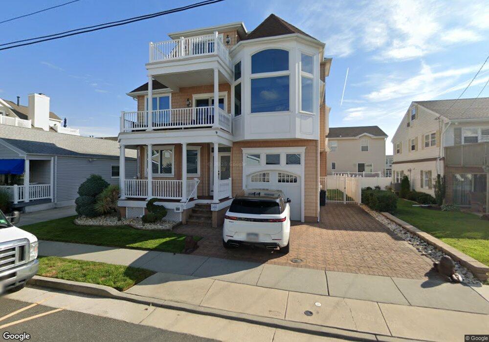
213 N 36th Ave Longport, NJ 08403
Estimated Value: $1,384,000 - $3,486,000
6
Beds
5
Baths
3,118
Sq Ft
$752/Sq Ft
Est. Value
About This Home
This home is located at 213 N 36th Ave, Longport, NJ 08403 and is currently estimated at $2,345,313, approximately $752 per square foot. 213 N 36th Ave is a home located in Atlantic County with nearby schools including Blessed Sacrament Regional School and St. James Elementary School.
Ownership History
Date
Name
Owned For
Owner Type
Purchase Details
Closed on
Aug 18, 2006
Sold by
Lynn Raquel
Bought by
Lynn Joseph and Lynn Raquel
Current Estimated Value
Purchase Details
Closed on
Aug 5, 2005
Sold by
Lynn Joseph and Lynn Raquel
Bought by
Lynn Raquel
Purchase Details
Closed on
Sep 17, 2004
Sold by
Goldberg Harold
Bought by
Lynn Joseph and Lynn Racquel
Purchase Details
Closed on
Nov 1, 1989
Sold by
Goldberg Harold and Goldberg Evelyn
Bought by
Goldberg Harold and Goldberg Evelyn
Create a Home Valuation Report for This Property
The Home Valuation Report is an in-depth analysis detailing your home's value as well as a comparison with similar homes in the area
Home Values in the Area
Average Home Value in this Area
Purchase History
| Date | Buyer | Sale Price | Title Company |
|---|---|---|---|
| Lynn Joseph | -- | -- | |
| Lynn Raquel | -- | The Title Company Of Jersey | |
| Lynn Joseph | $475,000 | -- | |
| Lynn Joseph | $475,000 | -- | |
| Lynn Joseph | $475,000 | -- | |
| Goldberg Harold | -- | -- |
Source: Public Records
Tax History Compared to Growth
Tax History
| Year | Tax Paid | Tax Assessment Tax Assessment Total Assessment is a certain percentage of the fair market value that is determined by local assessors to be the total taxable value of land and additions on the property. | Land | Improvement |
|---|---|---|---|---|
| 2025 | $10,975 | $978,200 | $403,800 | $574,400 |
| 2024 | $10,975 | $978,200 | $403,800 | $574,400 |
| 2023 | $9,909 | $978,200 | $403,800 | $574,400 |
| 2022 | $9,909 | $978,200 | $403,800 | $574,400 |
| 2021 | $9,518 | $978,200 | $403,800 | $574,400 |
| 2020 | $9,645 | $978,200 | $403,800 | $574,400 |
| 2019 | $9,625 | $978,200 | $403,800 | $574,400 |
| 2018 | $9,625 | $978,200 | $403,800 | $574,400 |
| 2017 | $9,430 | $978,200 | $403,800 | $574,400 |
| 2016 | $9,058 | $978,200 | $403,800 | $574,400 |
| 2015 | $8,872 | $978,200 | $403,800 | $574,400 |
| 2014 | $8,784 | $978,200 | $403,800 | $574,400 |
Source: Public Records
Map
Nearby Homes
- 206 N Madison Ave
- 9600 Amherst Ave Unit 7
- 100 N Monroe #2 Ave
- 107 N Monroe Ave
- 119 N Madison #B Ave Unit B
- 119 N Madison Ave Unit A
- 212 N 33rd Ave
- 111 N Madison Ave Unit 2
- 22 N Coolidge Ave
- 9411 Monmouth Ave Unit 9
- 9411 Monmouth Ave
- 9801 Ventnor Ave Unit B-1
- 9704 Ventnor Ave Unit D
- 201 N Washington Ave Unit 1
- 201 N Washington Ave Unit 3
- 201 N Washington Ave Unit 5
- 201 N Washington Ave Unit 2
- 201 N Washington Ave Unit 6
- 201 N Washington Ave Unit 4
- 7 S Monroe Ave
- 217 N 36th Ave
- 209 N 36th Ave
- 212 N Coolidge Ave
- 214 N Coolidge Ave
- 210 N Coolidge Ave
- 216 N Coolidge Ave
- 208 N Coolidge Ave
- 205 N 36th Ave
- 206 N Coolidge Ave
- 218 N Coolidge Ave
- 212 N 36th Ave
- 216 N 36th Ave
- 208 N 36th Ave
- 204 N Coolidge Ave
- 220 N Coolidge Ave
- 229 N 36th Ave
- 227 N 36th Ave Unit AB
- 225 N 36th Ave
- 223 N 36th Ave
- 221 N 36th Ave Unit BB