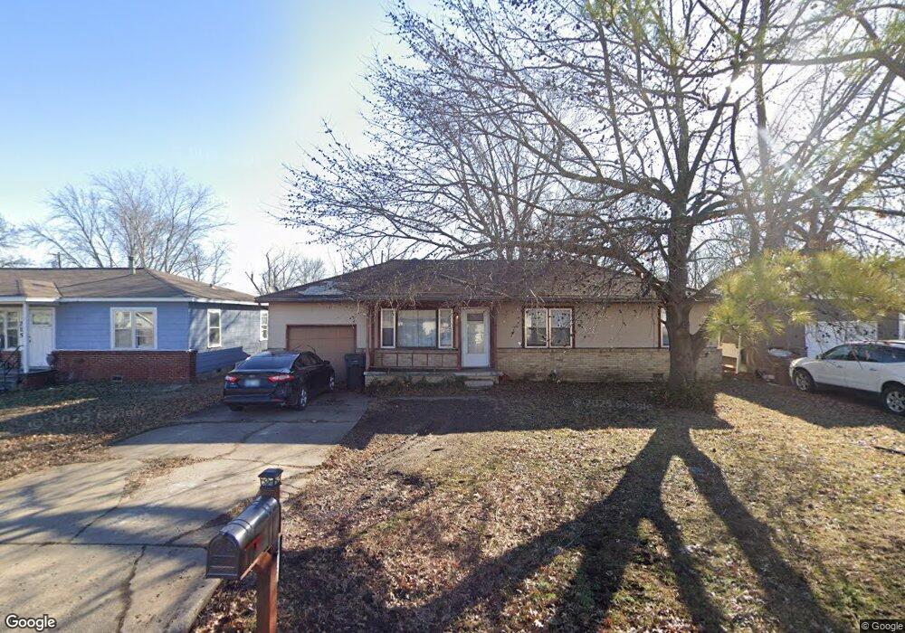
213 N Elgin Ave Sperry, OK 74073
Estimated Value: $117,000 - $173,000
--
Bed
1
Bath
1,040
Sq Ft
$137/Sq Ft
Est. Value
About This Home
This home is located at 213 N Elgin Ave, Sperry, OK 74073 and is currently estimated at $142,534, approximately $137 per square foot. 213 N Elgin Ave is a home located in Tulsa County with nearby schools including Sperry Elementary School, Sperry Middle School, and Sperry High School.
Ownership History
Date
Name
Owned For
Owner Type
Purchase Details
Closed on
Jan 24, 2017
Bought by
Pressnall Darrel M
Current Estimated Value
Home Financials for this Owner
Home Financials are based on the most recent Mortgage that was taken out on this home.
Original Mortgage
$60,000
Outstanding Balance
$49,524
Interest Rate
4.09%
Estimated Equity
$93,010
Purchase Details
Closed on
Nov 1, 1985
Create a Home Valuation Report for This Property
The Home Valuation Report is an in-depth analysis detailing your home's value as well as a comparison with similar homes in the area
Home Values in the Area
Average Home Value in this Area
Purchase History
| Date | Buyer | Sale Price | Title Company |
|---|---|---|---|
| Pressnall Darrel M | -- | -- | |
| -- | $25,000 | -- |
Source: Public Records
Mortgage History
| Date | Status | Borrower | Loan Amount |
|---|---|---|---|
| Open | Pressnall Darrel M | $60,000 | |
| Closed | Pressnall Darrel M | -- |
Source: Public Records
Tax History Compared to Growth
Tax History
| Year | Tax Paid | Tax Assessment Tax Assessment Total Assessment is a certain percentage of the fair market value that is determined by local assessors to be the total taxable value of land and additions on the property. | Land | Improvement |
|---|---|---|---|---|
| 2024 | $699 | $6,512 | $543 | $5,969 |
| 2023 | $699 | $7,293 | $689 | $6,604 |
| 2022 | $681 | $6,081 | $1,031 | $5,050 |
| 2021 | $678 | $6,081 | $1,031 | $5,050 |
| 2020 | $678 | $6,081 | $1,031 | $5,050 |
| 2019 | $683 | $6,081 | $1,031 | $5,050 |
| 2018 | $683 | $6,081 | $1,031 | $5,050 |
| 2017 | $614 | $5,645 | $1,201 | $4,444 |
| 2016 | $588 | $5,429 | $1,155 | $4,274 |
| 2015 | $557 | $5,170 | $1,100 | $4,070 |
| 2014 | $551 | $5,170 | $1,100 | $4,070 |
Source: Public Records
Map
Nearby Homes
- 109 N Coal St
- 10201 N Cincinnati Ave
- 9545 S Cincinnati St
- 202 W Ada St
- 308 S Cincinnati Ave
- 299 W Cherry
- 0 Sunset Unit 2544339
- 0 Sunset Unit 2544356
- 4787 E 106th St N
- 9610 N Peoria Ave
- 9839 N Peoria Ave
- 2012 W 88th St N
- 9084 N Osage Dr
- 8588 N Cincinnati Ave
- 1819 W Oak Knoll
- 0003 E 84th St N
- 9839 N Lewis Ave
- 9026 Crestwood Dr
- 10739 N 25th West Ave
- 4812 E 76th
- 215 N Elgin Ave
- 211 N Elgin Ave
- 209 N Elgin Ave
- 217 N Elgin Ave
- 214 N Frankfort Ave
- 212 N Frankfort Ave
- 216 N Frankfort Ave
- 207 N Elgin Ave
- 210 N Frankfort Ave
- 218 N Frankfort Ave
- 219 N Elgin Ave
- 214 N Elgin Ave
- 216 N Elgin Ave
- 212 N Elgin Ave
- 408 E Blair St
- 210 N Elgin Ave
- 218 N Elgin Ave
- 205 N Elgin Ave
- 9926 N Elgin Ave
- 9208 N Elgin Ave