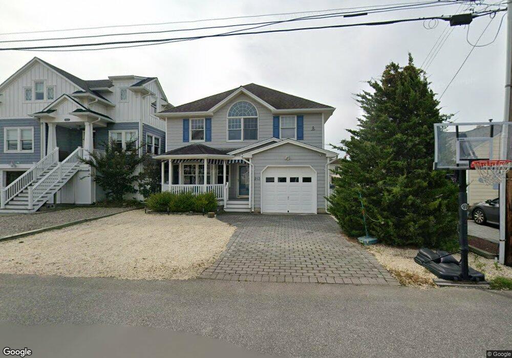
213 Norman Ct Lavallette, NJ 08735
Dover Beaches North NeighborhoodEstimated Value: $2,020,000 - $2,235,000
--
Bed
3
Baths
2,632
Sq Ft
$806/Sq Ft
Est. Value
About This Home
This home is located at 213 Norman Ct, Lavallette, NJ 08735 and is currently estimated at $2,122,160, approximately $806 per square foot. 213 Norman Ct is a home.
Ownership History
Date
Name
Owned For
Owner Type
Purchase Details
Closed on
Jun 4, 2019
Sold by
Pauly David E and Pauly Jeanne B
Bought by
L Apero Llc
Current Estimated Value
Home Financials for this Owner
Home Financials are based on the most recent Mortgage that was taken out on this home.
Original Mortgage
$748,000
Outstanding Balance
$657,675
Interest Rate
4.1%
Mortgage Type
New Conventional
Estimated Equity
$1,464,485
Purchase Details
Closed on
Dec 13, 2013
Sold by
Pauly Jeanne B
Bought by
Pauly David E and Pauly Jeanne B
Home Financials for this Owner
Home Financials are based on the most recent Mortgage that was taken out on this home.
Original Mortgage
$938,250
Interest Rate
2.92%
Mortgage Type
Reverse Mortgage Home Equity Conversion Mortgage
Create a Home Valuation Report for This Property
The Home Valuation Report is an in-depth analysis detailing your home's value as well as a comparison with similar homes in the area
Home Values in the Area
Average Home Value in this Area
Purchase History
| Date | Buyer | Sale Price | Title Company |
|---|---|---|---|
| L Apero Llc | $935,000 | Amtrust Title Insurance Co | |
| Pauly David E | -- | Stewart Title |
Source: Public Records
Mortgage History
| Date | Status | Borrower | Loan Amount |
|---|---|---|---|
| Open | L Apero Llc | $748,000 | |
| Previous Owner | Pauly David E | $938,250 |
Source: Public Records
Tax History Compared to Growth
Tax History
| Year | Tax Paid | Tax Assessment Tax Assessment Total Assessment is a certain percentage of the fair market value that is determined by local assessors to be the total taxable value of land and additions on the property. | Land | Improvement |
|---|---|---|---|---|
| 2025 | $23,866 | $1,310,600 | $555,000 | $755,600 |
| 2024 | $22,686 | $1,310,600 | $555,000 | $755,600 |
| 2023 | $21,874 | $1,310,600 | $555,000 | $755,600 |
| 2022 | $21,874 | $1,310,600 | $555,000 | $755,600 |
| 2021 | $18,154 | $724,700 | $374,800 | $349,900 |
| 2020 | $18,074 | $724,700 | $374,800 | $349,900 |
| 2019 | $17,291 | $724,700 | $374,800 | $349,900 |
| 2018 | $17,059 | $724,700 | $374,800 | $349,900 |
| 2017 | $16,915 | $724,700 | $374,800 | $349,900 |
| 2016 | $16,472 | $724,700 | $374,800 | $349,900 |
| 2015 | $15,849 | $724,700 | $374,800 | $349,900 |
| 2014 | $15,088 | $724,700 | $374,800 | $349,900 |
Source: Public Records
Map
Nearby Homes
- 254 Harbor Ct
- 545 Route 35
- 417 Delray Dr
- 515 New Jersey 35
- 26 N Surf Rd
- 257 Strickland Blvd
- 34 S Surf Rd
- 465 Boca Raton Dr
- 348 Venice Dr
- 366 Fort Meyers Ct
- 37 E Flamingo Way
- 3420 Seaview Rd
- 108 W Sandpiper Way
- 12 Shell Rd
- 109 W Sandpiper Way
- 102 W Pompano Way
- 438 Highway 35 N Unit 1304
- 3311 Seaview Rd
- 366 Highway 35 N
- 236 Gull Ln
- 211 Norman Ct
- 215 Norman Ct
- 217 Norman Ct
- 209 Norman Ct
- 505 Normandy Dr Unit SUMMER RENTAL
- 3629 N Route 35 Unit 2
- 34 1st Ave Unit A
- 34 1st Ave Unit B
- 416 Arrow Ct
- 200 4th Ave
- 114 7th Ave
- 210 Hayes Ct
- 216 Norman Ct
- 3629 N Route 35 Unit 6
- 505 Normandy Dr
- 113 Peterson Ln
- 226 4th Ave
- 487 Ellison Dr
- 29 3rd Ave
- 202 4th Ave