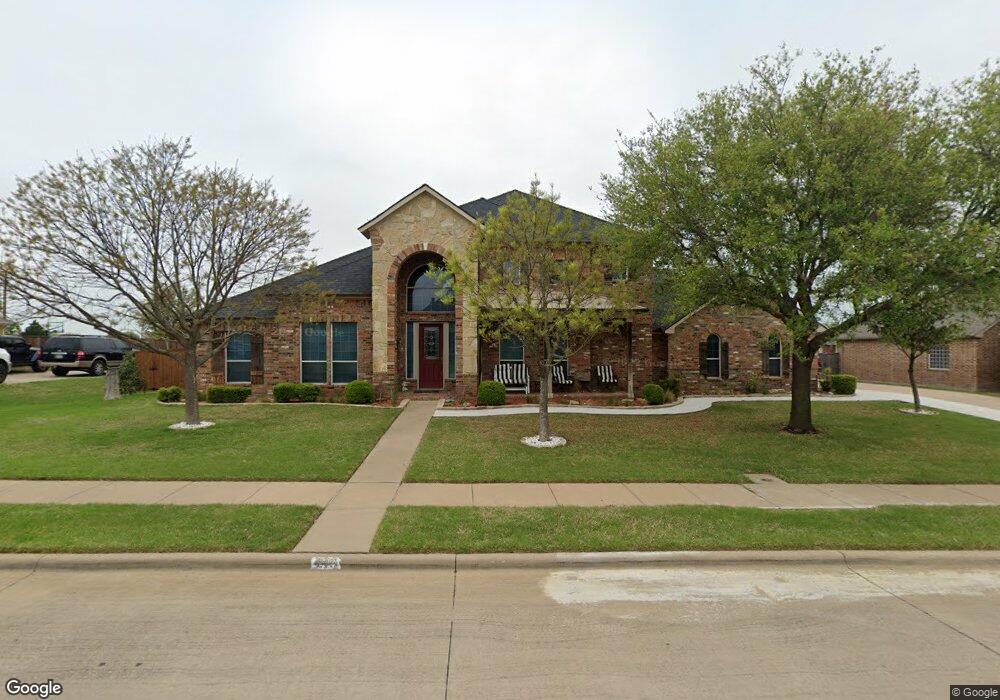
213 Panther Peak Dr Midlothian, TX 76065
Estimated Value: $497,000 - $501,259
4
Beds
3
Baths
3,045
Sq Ft
$164/Sq Ft
Est. Value
About This Home
This home is located at 213 Panther Peak Dr, Midlothian, TX 76065 and is currently estimated at $499,130, approximately $163 per square foot. 213 Panther Peak Dr is a home located in Ellis County with nearby schools including Mount Peak Elementary School and Frank Seale Middle School.
Ownership History
Date
Name
Owned For
Owner Type
Purchase Details
Closed on
Oct 19, 2021
Sold by
Davidson Dale B
Bought by
Davidson Dale B and Dale B Davidson Revocable Trus
Current Estimated Value
Purchase Details
Closed on
Jul 12, 2006
Sold by
Legendary Homes Lp
Bought by
Davidson Dale B and Davidson Joyce
Home Financials for this Owner
Home Financials are based on the most recent Mortgage that was taken out on this home.
Original Mortgage
$185,050
Outstanding Balance
$109,981
Interest Rate
6.67%
Mortgage Type
Purchase Money Mortgage
Estimated Equity
$389,149
Create a Home Valuation Report for This Property
The Home Valuation Report is an in-depth analysis detailing your home's value as well as a comparison with similar homes in the area
Home Values in the Area
Average Home Value in this Area
Purchase History
| Date | Buyer | Sale Price | Title Company |
|---|---|---|---|
| Davidson Dale B | -- | None Available | |
| Davidson Dale B | -- | None Available |
Source: Public Records
Mortgage History
| Date | Status | Borrower | Loan Amount |
|---|---|---|---|
| Open | Davidson Dale B | $185,050 |
Source: Public Records
Tax History Compared to Growth
Tax History
| Year | Tax Paid | Tax Assessment Tax Assessment Total Assessment is a certain percentage of the fair market value that is determined by local assessors to be the total taxable value of land and additions on the property. | Land | Improvement |
|---|---|---|---|---|
| 2025 | $2,638 | $491,030 | -- | -- |
| 2024 | $2,638 | $446,391 | -- | -- |
| 2023 | $2,638 | $405,810 | $0 | $0 |
| 2022 | $8,265 | $368,918 | $0 | $0 |
| 2021 | $7,936 | $335,380 | $52,500 | $282,880 |
| 2020 | $8,331 | $331,180 | $50,000 | $281,180 |
| 2019 | $8,321 | $317,760 | $0 | $0 |
| 2018 | $8,179 | $309,630 | $35,000 | $274,630 |
| 2017 | $8,149 | $306,150 | $35,000 | $271,150 |
| 2016 | $7,595 | $285,310 | $35,000 | $250,310 |
| 2015 | $4,665 | $261,720 | $35,000 | $226,720 |
| 2014 | $4,665 | $247,280 | $0 | $0 |
Source: Public Records
Map
Nearby Homes
- 414 Mountain Peak Bend
- 437 Rusty Run Dr
- 4633 Rawhide Trail
- 418 Hillstone Dr
- 4637 Saddlehorn Dr
- 806 Monza Dr
- 805 Monza Dr
- 4213 Biscayne Dr
- 4414 Biscayne Dr
- 4410 Biscayne Dr
- Bellflower Plan at Ridgepoint
- Carolina IV Plan at Ridgepoint
- Seaberry II Plan at Ridgepoint
- Primrose IV Plan at Ridgepoint
- Magnolia III Plan at Ridgepoint
- Carolina II Plan at Ridgepoint
- Spring Cress II Plan at Ridgepoint
- Carolina III Plan at Ridgepoint
- Dewberry Plan at Ridgepoint
- Primrose II Plan at Ridgepoint
- 214 Panther Peak Dr
- 209 Panther Peak Dr
- 210 Panther Peak Dr
- 218 Panther Peak Dr
- 221 Panther Peak Dr
- 222 Panther Peak Dr
- 206 Panther Peak Dr
- 209 Mountain Peak Bend
- 213 Mountain Peak Bend
- 201 Panther Peak Dr
- 205 Mountain Peak Bend
- 217 Mountain Peak Bend
- 225 Panther Peak Dr
- 226 Panther Peak Dr
- 202 Panther Peak Dr
- 201 Mountain Peak Bend
- 4440 Fm 663
- 221 Mountain Peak Bend
- 401 Panther Peak Dr
- 4621 Cedar Run Dr