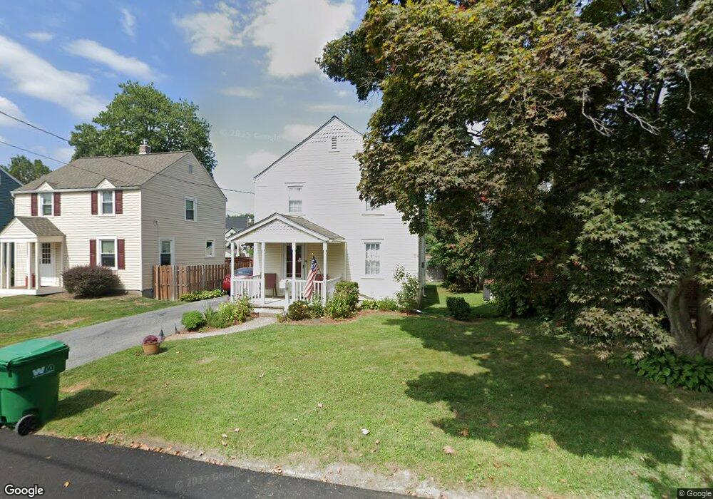
213 Pine Rd Wallingford, PA 19086
Estimated Value: $405,867 - $472,000
3
Beds
2
Baths
1,854
Sq Ft
$238/Sq Ft
Est. Value
About This Home
This home is located at 213 Pine Rd, Wallingford, PA 19086 and is currently estimated at $440,467, approximately $237 per square foot. 213 Pine Rd is a home located in Delaware County with nearby schools including Nether Providence El School, Strath Haven Middle School, and Strath Haven High School.
Ownership History
Date
Name
Owned For
Owner Type
Purchase Details
Closed on
Sep 30, 2020
Sold by
Armstang Markinnie E and Johening Marianne E
Bought by
Johening Michael and Johening Marianne E
Current Estimated Value
Purchase Details
Closed on
Aug 17, 2006
Sold by
Armstrong Noel and Armstrong Marianne E
Bought by
Armstrong Marianne E
Home Financials for this Owner
Home Financials are based on the most recent Mortgage that was taken out on this home.
Original Mortgage
$150,000
Interest Rate
6.47%
Mortgage Type
Stand Alone Refi Refinance Of Original Loan
Create a Home Valuation Report for This Property
The Home Valuation Report is an in-depth analysis detailing your home's value as well as a comparison with similar homes in the area
Home Values in the Area
Average Home Value in this Area
Purchase History
| Date | Buyer | Sale Price | Title Company |
|---|---|---|---|
| Johening Michael | -- | None Available | |
| Armstrong Marianne E | -- | None Available |
Source: Public Records
Mortgage History
| Date | Status | Borrower | Loan Amount |
|---|---|---|---|
| Closed | Armstrong Marianne E | $150,000 |
Source: Public Records
Tax History
| Year | Tax Paid | Tax Assessment Tax Assessment Total Assessment is a certain percentage of the fair market value that is determined by local assessors to be the total taxable value of land and additions on the property. | Land | Improvement |
|---|---|---|---|---|
| 2025 | $8,555 | $239,960 | $53,030 | $186,930 |
| 2024 | $8,555 | $239,960 | $53,030 | $186,930 |
| 2023 | $8,220 | $239,960 | $53,030 | $186,930 |
| 2022 | $8,046 | $239,960 | $53,030 | $186,930 |
| 2021 | $13,071 | $239,960 | $53,030 | $186,930 |
| 2020 | $6,403 | $110,490 | $34,050 | $76,440 |
| 2019 | $6,226 | $110,490 | $34,050 | $76,440 |
| 2018 | $6,105 | $110,490 | $0 | $0 |
| 2017 | $5,937 | $110,490 | $0 | $0 |
| 2016 | $606 | $110,490 | $0 | $0 |
| 2015 | $606 | $110,490 | $0 | $0 |
| 2014 | $606 | $110,490 | $0 | $0 |
Source: Public Records
Map
Nearby Homes
- 214-216 Beech Rd
- 203 Chestnut Pkwy
- 512 Media Pkwy
- 209 Willow Rd
- 6 Cedar Rd
- 403 Trenton Ct
- 17 Ridley Dr
- 787 Pennsylvania Ave
- 703 Dover Ct
- 357 Saybrook Ln Unit 158
- 404 Nashville Ct
- 856 Putnam Blvd Unit B
- 856A Putnam Blvd Unit 67A
- 709 Pennsylvania Ave
- 844A Putnam Blvd Unit 61A
- 820B Putnam Blvd Unit 49B
- 157 Meadowbrook Ln
- 832B Putnam Blvd Unit 55B
- 102 Harvey Rd Unit 1BMP
- 102 Harvey Rd Unit 1AP
Your Personal Tour Guide
Ask me questions while you tour the home.