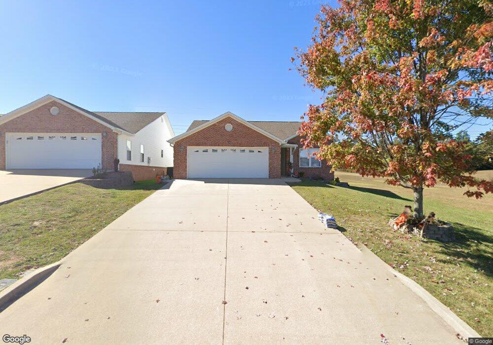
213 Redhead Ln Poplar Bluff, MO 63901
Estimated Value: $227,774 - $293,000
2
Beds
--
Bath
1,663
Sq Ft
$158/Sq Ft
Est. Value
About This Home
This home is located at 213 Redhead Ln, Poplar Bluff, MO 63901 and is currently estimated at $262,944, approximately $158 per square foot. 213 Redhead Ln is a home located in Butler County with nearby schools including Oak Grove Elementary School, Poplar Bluff Fifth & Sixth Grade Center, and Poplar Bluff Junior High School.
Ownership History
Date
Name
Owned For
Owner Type
Purchase Details
Closed on
Mar 16, 2021
Sold by
Malson Jerry Wayne and Malson Carolyn Ann
Bought by
Malson Jerry Wayne and Malson Carolyn Ann
Current Estimated Value
Purchase Details
Closed on
Jun 29, 2011
Sold by
Fannie Mae
Bought by
Malson Jerry Wayne and Malson Carolyn Ann
Purchase Details
Closed on
Jun 8, 2011
Sold by
Gmac Mortgage Llc
Bought by
Federal National Mortgage Association
Purchase Details
Closed on
Aug 14, 2006
Sold by
Bjt Investments Llc
Bought by
Vancleve Civkey Van
Create a Home Valuation Report for This Property
The Home Valuation Report is an in-depth analysis detailing your home's value as well as a comparison with similar homes in the area
Home Values in the Area
Average Home Value in this Area
Purchase History
| Date | Buyer | Sale Price | Title Company |
|---|---|---|---|
| Malson Jerry Wayne | -- | None Available | |
| Malson Jerry Wayne | -- | -- | |
| Federal National Mortgage Association | -- | -- | |
| Vancleve Civkey Van | -- | -- |
Source: Public Records
Tax History
| Year | Tax Paid | Tax Assessment Tax Assessment Total Assessment is a certain percentage of the fair market value that is determined by local assessors to be the total taxable value of land and additions on the property. | Land | Improvement |
|---|---|---|---|---|
| 2025 | $1,441 | $33,130 | $0 | $0 |
| 2024 | $14 | $30,680 | $0 | $0 |
| 2023 | $1,366 | $30,680 | $0 | $0 |
| 2022 | $1,320 | $29,700 | $0 | $0 |
| 2021 | $1,321 | $29,700 | $0 | $0 |
| 2020 | $1,341 | $29,700 | $0 | $0 |
| 2019 | $1,340 | $29,700 | $0 | $0 |
| 2018 | $1,340 | $29,700 | $0 | $0 |
| 2017 | -- | $29,700 | $0 | $0 |
| 2016 | -- | $29,700 | $0 | $0 |
| 2015 | -- | $29,700 | $0 | $0 |
| 2014 | -- | $27,740 | $0 | $0 |
| 2012 | $1,057 | $27,740 | $0 | $0 |
Source: Public Records
Map
Nearby Homes
- 00 Mallard Trail
- 0 Mallard Trail Unit MIS26014074
- 319 Pintail Ln
- 16 Boulder Trail
- 0 Boulder Trail
- 6708 Brown Ln
- 2184 J Bird Dr
- 500 County Road 523
- 3841 County Road 441
- 205 Batson Lake Ln
- 192 Bruce
- 414 County Road 4414
- 0 W Hwy Unit MIS25082730
- 3401 Normandy Rd
- 306 Timberwolf Dr
- 2911 Oak Grove Rd
- 353 Meadow View Dr
- 224 Timber Way Dr
- 66 County Road 445
- 224 Timber Ay Dr
- 209 Redhead Ln
- 207 Redhead Ln
- 248 Redhead Ln
- 242 Redhead Ln
- 258 Redhead Ln
- 268 Redhead Ln
- 0 Mallard Trail Unit MIS25057052
- 0 Mallard Trail Unit 21063697
- 0 Mallard Trail Unit 21002567
- 0 Mallard Trail
- 2 Mallard Trail
- 0 Lot 33 Mallard Pointe
- 0 Lots 8-13 Mallard Pointe Sub
- 132 Mallard Trail
- 125 Mallard Trail
- 121 Mallard Trail
- 126 Mallard Trail
- 122 Mallard Trail
- 138 Mallard Trail
- 130 Mallard Trail
Your Personal Tour Guide
Ask me questions while you tour the home.