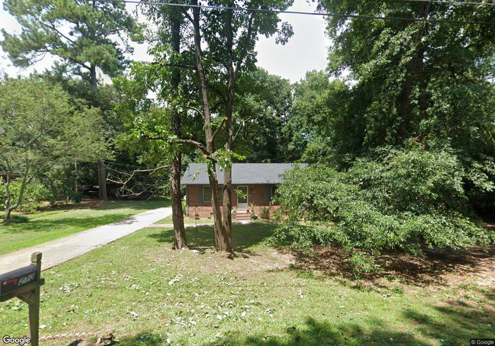
213 Ricefield Rd Hartwell, GA 30643
Estimated Value: $158,000 - $174,000
3
Beds
1
Bath
1,125
Sq Ft
$151/Sq Ft
Est. Value
About This Home
This home is located at 213 Ricefield Rd, Hartwell, GA 30643 and is currently estimated at $169,393, approximately $150 per square foot. 213 Ricefield Rd is a home located in Hart County with nearby schools including Hart County High School and Barnes Academy.
Ownership History
Date
Name
Owned For
Owner Type
Purchase Details
Closed on
Feb 23, 2016
Sold by
Durrett Tracie G
Bought by
Double Rrb Llc
Current Estimated Value
Purchase Details
Closed on
Jun 20, 2014
Sold by
Durrett Willie Daren
Bought by
Durrett Tracie G
Purchase Details
Closed on
Mar 11, 2005
Sold by
Jp Morgan Chase Bank
Bought by
Durrett Willie Darin and Durrett Tracie G
Purchase Details
Closed on
May 1, 2004
Purchase Details
Closed on
Jan 1, 2001
Purchase Details
Closed on
May 1, 2000
Purchase Details
Closed on
Nov 1, 1986
Create a Home Valuation Report for This Property
The Home Valuation Report is an in-depth analysis detailing your home's value as well as a comparison with similar homes in the area
Home Values in the Area
Average Home Value in this Area
Purchase History
| Date | Buyer | Sale Price | Title Company |
|---|---|---|---|
| Double Rrb Llc | $27,000 | -- | |
| Durrett Tracie G | -- | -- | |
| Durrett Willie Darin | $29,900 | -- | |
| -- | -- | -- | |
| -- | $53,000 | -- | |
| -- | $37,800 | -- | |
| -- | -- | -- |
Source: Public Records
Tax History Compared to Growth
Tax History
| Year | Tax Paid | Tax Assessment Tax Assessment Total Assessment is a certain percentage of the fair market value that is determined by local assessors to be the total taxable value of land and additions on the property. | Land | Improvement |
|---|---|---|---|---|
| 2024 | $856 | $36,677 | $3,200 | $33,477 |
| 2023 | $794 | $31,923 | $3,200 | $28,723 |
| 2022 | $450 | $27,043 | $1,200 | $25,843 |
| 2021 | $461 | $24,828 | $1,200 | $23,628 |
| 2020 | $451 | $23,286 | $1,200 | $22,086 |
| 2019 | $440 | $22,521 | $1,200 | $21,321 |
| 2018 | $458 | $23,148 | $1,200 | $21,948 |
| 2017 | $215 | $22,900 | $1,200 | $21,700 |
| 2016 | $314 | $17,306 | $1,200 | $16,106 |
| 2015 | $418 | $16,984 | $700 | $16,284 |
| 2014 | $409 | $22,569 | $700 | $21,869 |
| 2013 | -- | $23,221 | $700 | $22,521 |
Source: Public Records
Map
Nearby Homes
- 65 Faye Kight Cir
- 20 Clipper Cir
- 0 Teasley St Unit 7659667
- 0 Teasley St Unit 10616853
- 2 The Oaks Dr
- 194 Winding Way
- 486 Winding Way
- 181 Cherry Cir
- 1233 N Forest Ave Unit 5 HOMES
- 0 Winding Way Unit LOT G 10599992
- 218 Savannah St
- 113 Maple St Unit 3 HOMES
- 371 Ridge Rd
- 123 Fairview Station
- 318 Chandler St
- 83 Crestwood Dr
- 226 Idlewood Acres
- 71 Crestwood Dr
- 0 Idlewood Acres Unit 10532759
- 0 Idlewood Acres Unit 7588153
- 0 Ricefield Rd Unit 8688569
- 0 Ricefield Rd Unit 7399509
- 0 Ricefield Rd
- 195 Ricefield Rd
- 597 Rome St
- 65 Faye Kight Cir Unit STE C210
- 615 Rome St
- 541 Rome St
- 75 Faye Kight Cir
- 175 Ricefield Rd
- 21 Faye Kight Cir
- 81 Faye Kight Cir
- 140 Ricefield Rd
- 84 Faye Kight Cir
- 685 Rome St
- 521 Rome St
- 40 Faye Kight Cir
- 161 Ricefield Rd
- 52 Ricefield Rd
- 110 Ricefield Rd