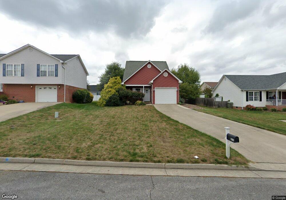
213 Rutledge Dr Waynesboro, VA 22980
Estimated Value: $318,978 - $338,000
3
Beds
2
Baths
1,433
Sq Ft
$229/Sq Ft
Est. Value
About This Home
This home is located at 213 Rutledge Dr, Waynesboro, VA 22980 and is currently estimated at $327,745, approximately $228 per square foot. 213 Rutledge Dr is a home located in Waynesboro City with nearby schools including William Perry Elementary School, Kate Collins Middle School, and Waynesboro High School.
Ownership History
Date
Name
Owned For
Owner Type
Purchase Details
Closed on
Apr 6, 2006
Sold by
Parrish Steven M
Bought by
Jahn Linda A
Current Estimated Value
Home Financials for this Owner
Home Financials are based on the most recent Mortgage that was taken out on this home.
Original Mortgage
$164,800
Outstanding Balance
$92,042
Interest Rate
6.26%
Mortgage Type
New Conventional
Estimated Equity
$235,703
Create a Home Valuation Report for This Property
The Home Valuation Report is an in-depth analysis detailing your home's value as well as a comparison with similar homes in the area
Purchase History
| Date | Buyer | Sale Price | Title Company |
|---|---|---|---|
| Jahn Linda A | $206,000 | -- |
Source: Public Records
Mortgage History
| Date | Status | Borrower | Loan Amount |
|---|---|---|---|
| Open | Jahn Linda A | $164,800 |
Source: Public Records
Tax History
| Year | Tax Paid | Tax Assessment Tax Assessment Total Assessment is a certain percentage of the fair market value that is determined by local assessors to be the total taxable value of land and additions on the property. | Land | Improvement |
|---|---|---|---|---|
| 2025 | $2,440 | $297,600 | $58,500 | $239,100 |
| 2024 | $2,077 | $269,700 | $55,000 | $214,700 |
| 2023 | $2,077 | $269,700 | $55,000 | $214,700 |
| 2022 | $1,969 | $218,800 | $45,000 | $173,800 |
| 2021 | $1,969 | $218,800 | $45,000 | $173,800 |
| 2020 | $1,678 | $186,400 | $45,000 | $141,400 |
| 2019 | $1,678 | $186,400 | $45,000 | $141,400 |
| 2018 | $1,486 | $165,100 | $45,000 | $120,100 |
| 2017 | $1,436 | $165,100 | $45,000 | $120,100 |
| 2016 | $1,210 | $151,300 | $41,000 | $110,300 |
| 2015 | $1,210 | $151,300 | $41,000 | $110,300 |
| 2014 | -- | $149,900 | $41,000 | $108,900 |
| 2013 | -- | $0 | $0 | $0 |
Source: Public Records
Map
Nearby Homes
- 212 Inglecress Rd
- 200 Bedford Rd
- 2039 Hampton Dr
- 177 Tomasville Dr
- 6 White Birch Rd
- 3 White Birch Rd
- 2015 Hampton Dr
- 9 White Birch Rd
- 153 Tomasville Dr
- 105 White Birch Rd
- 305 Overview St
- 300 Alphin Ave
- 241 Camden Dr
- 261 Camden Dr
- 233 Camden Dr
- 237 Camden Dr
- 1066 Pendleton Dr
- 100 Buckingham Place
- 12 White Birch Rd
- 105 Compass Dr
- 209 Rutledge Dr
- 217 Rutledge Dr
- 216 Mayfield Ln
- 205 Rutledge Dr
- 208 Mayfield Ln
- 221 Rutledge Dr
- 204 Mayfield Ln
- 208 Rutledge Dr
- 212 Rutledge Dr
- 201 Rutledge Dr
- 220 Mayfield Ln
- 224 Rutledge Dr
- 204 Rutledge Dr
- 200 Mayfield Ln
- 216 Rutledge Dr
- 200 Rutledge Dr
- 220 Rutledge Dr
- 225 Mayfield Ln
- 213 Mayfield Ln
- 213 Chantilly Dr
Your Personal Tour Guide
Ask me questions while you tour the home.