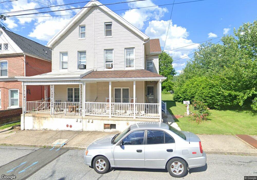
213 S 4th St Emmaus, PA 18049
Estimated Value: $216,000 - $300,000
3
Beds
2
Baths
1,606
Sq Ft
$163/Sq Ft
Est. Value
About This Home
This home is located at 213 S 4th St, Emmaus, PA 18049 and is currently estimated at $261,144, approximately $162 per square foot. 213 S 4th St is a home located in Lehigh County with nearby schools including Lincoln Elementary School, Lower Macungie Middle School, and Emmaus High School.
Ownership History
Date
Name
Owned For
Owner Type
Purchase Details
Closed on
Dec 27, 1993
Sold by
Barron Gene and Barron Patricia A
Bought by
Barron Gene
Current Estimated Value
Purchase Details
Closed on
Jan 18, 1991
Sold by
Barron Gene
Bought by
Barron Gene and Barron Patricia A
Purchase Details
Closed on
Jul 1, 1987
Sold by
Lorah Dean H and Lorah Valerie H
Bought by
Barron Gene
Purchase Details
Closed on
Dec 20, 1979
Bought by
Lorah Dean H and Lorah Valerie H
Create a Home Valuation Report for This Property
The Home Valuation Report is an in-depth analysis detailing your home's value as well as a comparison with similar homes in the area
Home Values in the Area
Average Home Value in this Area
Purchase History
| Date | Buyer | Sale Price | Title Company |
|---|---|---|---|
| Barron Gene | -- | -- | |
| Barron Gene | -- | -- | |
| Barron Gene | $57,900 | -- | |
| Lorah Dean H | $35,500 | -- |
Source: Public Records
Tax History Compared to Growth
Tax History
| Year | Tax Paid | Tax Assessment Tax Assessment Total Assessment is a certain percentage of the fair market value that is determined by local assessors to be the total taxable value of land and additions on the property. | Land | Improvement |
|---|---|---|---|---|
| 2025 | $4,361 | $123,800 | $15,500 | $108,300 |
| 2024 | $3,994 | $123,800 | $15,500 | $108,300 |
| 2023 | $3,917 | $123,800 | $15,500 | $108,300 |
| 2022 | $3,788 | $123,800 | $108,300 | $15,500 |
| 2021 | $3,693 | $123,800 | $15,500 | $108,300 |
| 2020 | $3,661 | $123,800 | $15,500 | $108,300 |
| 2019 | $3,563 | $123,800 | $15,500 | $108,300 |
| 2018 | $3,429 | $123,800 | $15,500 | $108,300 |
| 2017 | $3,323 | $123,800 | $15,500 | $108,300 |
| 2016 | -- | $123,800 | $15,500 | $108,300 |
| 2015 | -- | $123,800 | $15,500 | $108,300 |
| 2014 | -- | $123,800 | $15,500 | $108,300 |
Source: Public Records
Map
Nearby Homes
- 331 Minor St
- 521 Wood St
- 569 Chestnut St Unit 571
- 41 S 2nd St
- 610 Wood St
- 659 Broad St
- 106 Garden Ct
- 543 Long St
- 104 Garden Ct
- 120 N 2nd St
- 118 N 2nd St
- 657 Walnut St
- 4360 Hillary Dr
- 101 E George St
- 339 Delong Ave Unit 343
- 97 Chestnut Hill Rd
- 137 E Harrison St
- 943 N 6th St
- 507 Iroquois St
- 3430 Gentlewind Way Unit IC 109