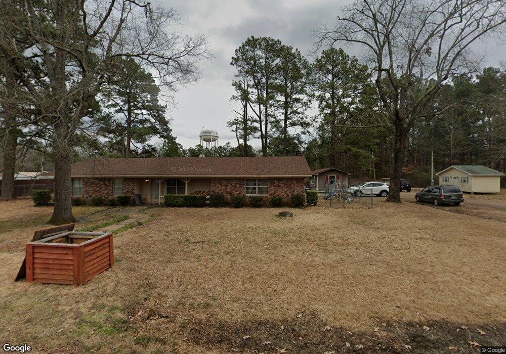
213 S 9th St Gurdon, AR 71743
Estimated Value: $109,491 - $174,000
--
Bed
2
Baths
2,024
Sq Ft
$68/Sq Ft
Est. Value
About This Home
This home is located at 213 S 9th St, Gurdon, AR 71743 and is currently estimated at $138,123, approximately $68 per square foot. 213 S 9th St is a home located in Clark County with nearby schools including Gurdon Primary School, Cabe Middle School, and Gurdon High School.
Ownership History
Date
Name
Owned For
Owner Type
Purchase Details
Closed on
Jun 16, 2022
Sold by
Bauer Investments Llc
Bought by
Efird Jef and Efird Jennifer
Current Estimated Value
Purchase Details
Closed on
Dec 13, 2018
Sold by
Lynn Bauer Kathy
Bought by
Bauer Investments Llc
Purchase Details
Closed on
Feb 24, 2011
Sold by
Baker Smith Steve and Baker Smith Valerie
Bought by
Francis James Bauer Revocable Trust
Purchase Details
Closed on
Jul 29, 2003
Bought by
Baker Jimmy D
Purchase Details
Closed on
Aug 1, 1989
Bought by
Plyler Gary and Plyler Wendy
Create a Home Valuation Report for This Property
The Home Valuation Report is an in-depth analysis detailing your home's value as well as a comparison with similar homes in the area
Home Values in the Area
Average Home Value in this Area
Purchase History
| Date | Buyer | Sale Price | Title Company |
|---|---|---|---|
| Efird Jef | $120,000 | New Title Company Name | |
| Bauer Investments Llc | -- | White & Marks Pllc | |
| Francis James Bauer Revocable Trust | -- | -- | |
| Baker Jimmy D | $82,000 | -- | |
| Plyler Gary | -- | -- |
Source: Public Records
Tax History Compared to Growth
Tax History
| Year | Tax Paid | Tax Assessment Tax Assessment Total Assessment is a certain percentage of the fair market value that is determined by local assessors to be the total taxable value of land and additions on the property. | Land | Improvement |
|---|---|---|---|---|
| 2025 | $549 | $30,320 | $1,410 | $28,910 |
| 2024 | $594 | $19,720 | $1,280 | $18,440 |
| 2023 | $956 | $19,720 | $1,280 | $18,440 |
| 2022 | $956 | $19,720 | $1,280 | $18,440 |
| 2021 | $956 | $19,720 | $1,280 | $18,440 |
| 2020 | $956 | $19,720 | $1,280 | $18,440 |
| 2019 | $911 | $18,790 | $1,280 | $17,510 |
| 2018 | $902 | $18,790 | $1,280 | $17,510 |
| 2017 | $902 | $18,790 | $1,280 | $17,510 |
| 2016 | $902 | $18,790 | $1,280 | $17,510 |
| 2015 | $902 | $18,790 | $1,280 | $17,510 |
| 2014 | $1,055 | $21,970 | $1,280 | $20,690 |
Source: Public Records
Map
Nearby Homes
- 110 S 10th St
- 326 Arkansas 53
- 0000 Arkansas 53
- 109 N 7th St
- 103 Stonegate Ct
- TBD Kansas Rd
- 000 Kansas Rd
- 705 N 9th St
- 51 South St
- 313 W Miller St
- 7104 Highway 67 S
- 1795 Bowen Hill Rd
- 1414 Arkansas 53
- TBD Hwy 67 S
- TBD Hwy 67
- 58 Dodgen Rd
- County Road 12
- 845 Stevenson Rd
- 602 Stevenson Rd
- 196 Stevenson Rd