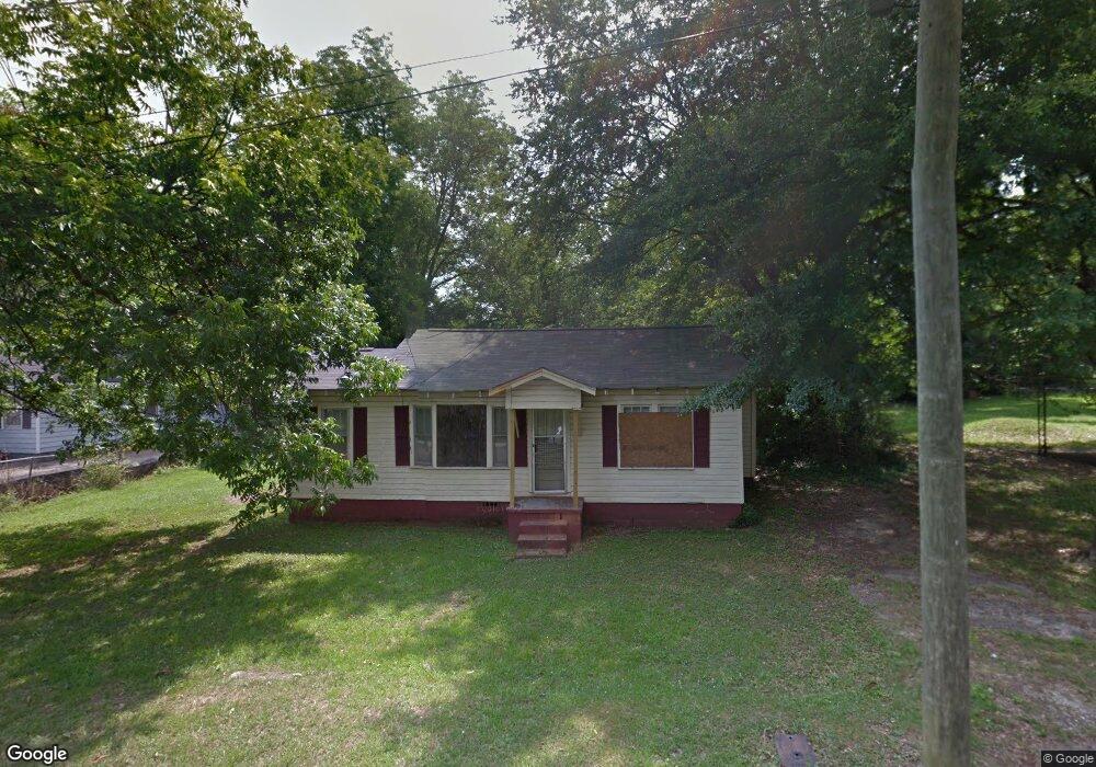
213 S Dawson St Lagrange, GA 30241
Estimated Value: $113,000 - $139,000
2
Beds
1
Bath
895
Sq Ft
$142/Sq Ft
Est. Value
About This Home
This home is located at 213 S Dawson St, Lagrange, GA 30241 and is currently estimated at $127,237, approximately $142 per square foot. 213 S Dawson St is a home located in Troup County with nearby schools including Hollis Hand Elementary School, Franklin Forest Elementary School, and Ethel W. Kight Elementary School.
Ownership History
Date
Name
Owned For
Owner Type
Purchase Details
Closed on
Jul 16, 2021
Sold by
Tucker Robert
Bought by
Abner Lakreasha
Current Estimated Value
Home Financials for this Owner
Home Financials are based on the most recent Mortgage that was taken out on this home.
Original Mortgage
$93,279
Outstanding Balance
$84,675
Interest Rate
2.93%
Mortgage Type
FHA
Estimated Equity
$42,562
Purchase Details
Closed on
Dec 28, 2018
Sold by
Davenport Donald Phillip
Bought by
Tucker Robert
Purchase Details
Closed on
Jun 8, 1998
Sold by
Deven Dewey and Deven Davenport
Bought by
Davenport Donald Phillip
Purchase Details
Closed on
Feb 19, 1997
Sold by
Emma Davenport
Bought by
Deven Dewey and Deven Davenport
Purchase Details
Closed on
Jan 1, 1974
Bought by
Emma Davenport
Purchase Details
Closed on
Jan 1, 1967
Create a Home Valuation Report for This Property
The Home Valuation Report is an in-depth analysis detailing your home's value as well as a comparison with similar homes in the area
Home Values in the Area
Average Home Value in this Area
Purchase History
| Date | Buyer | Sale Price | Title Company |
|---|---|---|---|
| Abner Lakreasha | $95,000 | -- | |
| Tucker Robert | $27,000 | -- | |
| Davenport Donald Phillip | $5,000 | -- | |
| Deven Dewey | -- | -- | |
| Emma Davenport | $5,800 | -- | |
| -- | -- | -- |
Source: Public Records
Mortgage History
| Date | Status | Borrower | Loan Amount |
|---|---|---|---|
| Open | Abner Lakreasha | $93,279 |
Source: Public Records
Tax History Compared to Growth
Tax History
| Year | Tax Paid | Tax Assessment Tax Assessment Total Assessment is a certain percentage of the fair market value that is determined by local assessors to be the total taxable value of land and additions on the property. | Land | Improvement |
|---|---|---|---|---|
| 2024 | $1,128 | $43,360 | $4,880 | $38,480 |
| 2023 | $1,023 | $39,480 | $4,880 | $34,600 |
| 2022 | $985 | $37,280 | $4,880 | $32,400 |
| 2021 | $764 | $25,320 | $2,760 | $22,560 |
| 2020 | $226 | $7,480 | $2,760 | $4,720 |
| 2019 | $208 | $6,880 | $2,760 | $4,120 |
| 2018 | $208 | $6,908 | $2,788 | $4,120 |
| 2017 | $208 | $6,908 | $2,788 | $4,120 |
| 2016 | $225 | $7,452 | $2,788 | $4,664 |
| 2015 | $224 | $7,430 | $2,766 | $4,664 |
| 2014 | $217 | $7,184 | $2,766 | $4,419 |
| 2013 | -- | $7,520 | $2,766 | $4,754 |
Source: Public Records
Map
Nearby Homes
- 910 N 916 1000 1002 N Oak & 1011 1019 1021 Johnson St
- 803 1/2 Hines St
- 0 Locust St
- 801 Hines St
- 208 Render St
- 519 Greenville St
- 105 Dix St
- 101 McGee St
- LOT 58 Belk St
- 119 Belk St
- LOT 65 Belk St
- LOT 66 Belk St
- 0 Burr St
- 306 Burr St
- 203 Revis St
- 205 Revis St
- 117 Belk St
- 621 Arthur St
- 203 Fannin St
- 205 Fannin St
- 211 S Dawson St
- 217 S Dawson St
- 209 S Dawson St
- 313 Ware St
- 110 Johnson St
- 405 Ware St
- 108 Johnson St
- 0 Ware St Unit 8697541
- 0 Ware St Unit 8408300
- 0 Ware St Unit 8357565
- 0 Ware St
- 404 Ware St
- 311 Ware St
- 106 Johnson St
- 400 Ware St
- 104 Johnson St
- 314 Ware St
- 202 Johnson St
- 107 Johnson St
- 310 Ware St