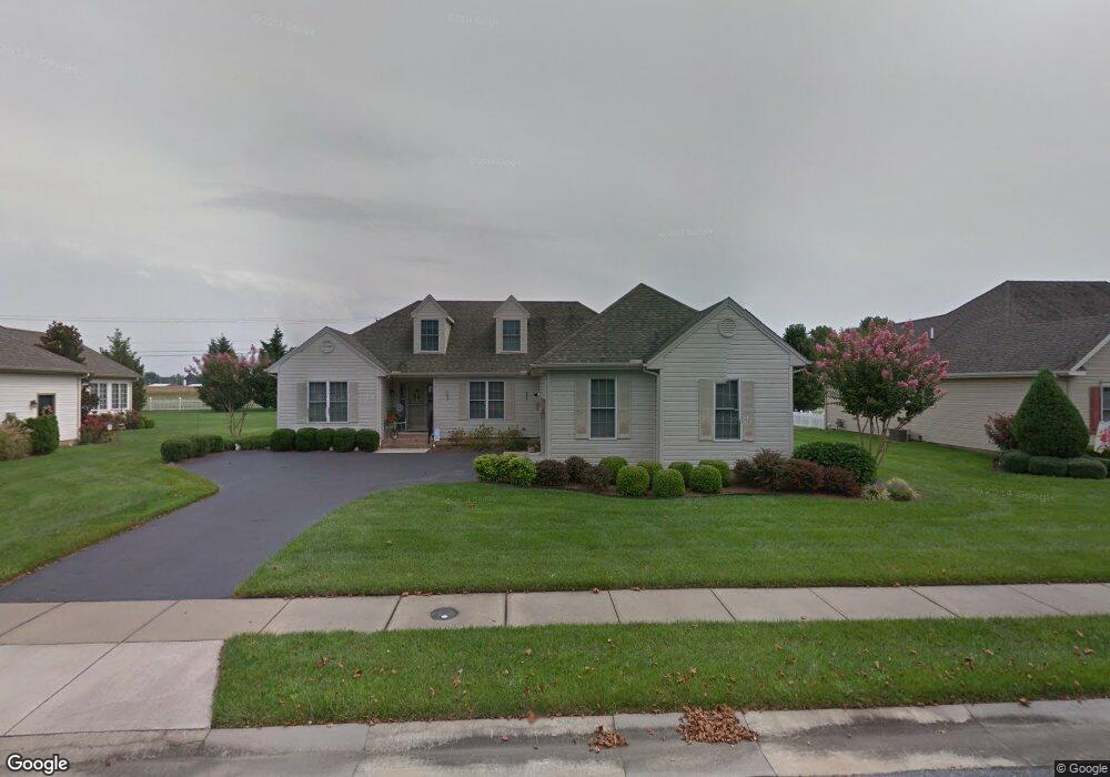
213 Sandy Bottom Ct Salisbury, MD 21804
South Salisbury NeighborhoodEstimated Value: $379,568 - $407,000
4
Beds
2
Baths
2,107
Sq Ft
$187/Sq Ft
Est. Value
About This Home
This home is located at 213 Sandy Bottom Ct, Salisbury, MD 21804 and is currently estimated at $393,142, approximately $186 per square foot. 213 Sandy Bottom Ct is a home located in Wicomico County with nearby schools including Fruitland Primary School, Fruitland Intermediate School, and Bennett Middle School.
Ownership History
Date
Name
Owned For
Owner Type
Purchase Details
Closed on
Apr 17, 2025
Sold by
Heath John R and Heath Linda J
Bought by
Becker Laura J and Cashman Kristin C
Current Estimated Value
Purchase Details
Closed on
Jul 16, 2009
Sold by
Eaton William D and Eaton Margaret M
Bought by
Heath John R and Heath Linda J
Home Financials for this Owner
Home Financials are based on the most recent Mortgage that was taken out on this home.
Original Mortgage
$177,000
Interest Rate
5.43%
Purchase Details
Closed on
Apr 13, 2007
Sold by
Eaton William D and Eaton Margaret M
Bought by
Eaton William D and Eaton Margaret M
Purchase Details
Closed on
Mar 26, 2007
Sold by
Eaton William D and Eaton Margaret M
Bought by
Eaton William D and Eaton Margaret M
Purchase Details
Closed on
May 25, 2004
Sold by
Thomas H Ruark Inc
Bought by
Eaton William D and Eaton Margaret M
Create a Home Valuation Report for This Property
The Home Valuation Report is an in-depth analysis detailing your home's value as well as a comparison with similar homes in the area
Home Values in the Area
Average Home Value in this Area
Purchase History
| Date | Buyer | Sale Price | Title Company |
|---|---|---|---|
| Becker Laura J | -- | None Listed On Document | |
| Becker Laura J | -- | None Listed On Document | |
| Heath John R | $277,000 | -- | |
| Eaton William D | -- | -- | |
| Eaton William D | -- | -- | |
| Eaton William D | $221,685 | -- |
Source: Public Records
Mortgage History
| Date | Status | Borrower | Loan Amount |
|---|---|---|---|
| Previous Owner | Heath John R | $177,000 | |
| Closed | Eaton William D | -- |
Source: Public Records
Tax History
| Year | Tax Paid | Tax Assessment Tax Assessment Total Assessment is a certain percentage of the fair market value that is determined by local assessors to be the total taxable value of land and additions on the property. | Land | Improvement |
|---|---|---|---|---|
| 2025 | $2,510 | $281,500 | $0 | $0 |
| 2024 | $2,500 | $260,700 | $35,000 | $225,700 |
| 2023 | $2,515 | $254,367 | $0 | $0 |
| 2022 | $2,527 | $248,033 | $0 | $0 |
| 2021 | $2,423 | $241,700 | $35,000 | $206,700 |
| 2020 | $2,423 | $234,967 | $0 | $0 |
| 2019 | $2,355 | $228,233 | $0 | $0 |
| 2018 | $4,096 | $221,500 | $35,000 | $186,500 |
| 2017 | $3,986 | $209,267 | $0 | $0 |
| 2016 | -- | $197,033 | $0 | $0 |
| 2015 | $3,914 | $184,800 | $0 | $0 |
| 2014 | $3,914 | $184,800 | $0 | $0 |
Source: Public Records
Map
Nearby Homes
- 212 Spring Crest Dr
- 131 Lakeview Dr
- 112 Johnson Dr
- 415 Creekside Trail
- 138 Coulbourn Dr
- 119 Lakewood Dr
- 225 Canal Park Dr Unit 15
- 227 Canal Park Dr Unit 206
- 227 Canal Park Dr Unit 205
- 227 Canal Park Dr Unit 307
- 229 Canal Park Dr Unit 407
- 1506 Rose Dr
- 1515 Windham Ct
- 228 Canal Park Dr Unit G7
- 4835 Goose Creek Dr
- 1405 Bantry Ln
- 232 Morris Dr
- 1515 Magnolia Dr
- 1817 W Clear Lake Dr
- 304 Elizabeth St
- 215 Sandy Bottom Ct
- 211 Sandy Bottom Ct
- 217 Sandy Bottom Ct
- 209 Sandy Bottom Ct
- 210 Sandy Bottom Ct
- 208 Sandy Bottom Ct
- 212 Sandy Bottom Ct
- 219 Sandy Bottom Ct
- 207 Sandy Bottom Ct
- 206 Sandy Bottom Ct
- 214 Sandy Bottom Ct
- 221 Sandy Bottom Ct
- 1733 S Division St
- 216 Sandy Bottom Ct
- 1735 S Division St
- 1735 S Division St Unit Lot 2
- 204 Sandy Bottom Ct
- 205 Sandy Bottom Ct
- 208 Creekside Dr
- 206 Creekside Dr
Your Personal Tour Guide
Ask me questions while you tour the home.