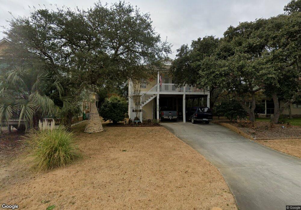
213 Sherrill Ave Oak Island, NC 28465
Estimated Value: $801,975 - $905,000
4
Beds
3
Baths
1,666
Sq Ft
$513/Sq Ft
Est. Value
About This Home
This home is located at 213 Sherrill Ave, Oak Island, NC 28465 and is currently estimated at $855,244, approximately $513 per square foot. 213 Sherrill Ave is a home located in Brunswick County with nearby schools including Southport Elementary School, South Brunswick Middle School, and South Brunswick High School.
Ownership History
Date
Name
Owned For
Owner Type
Purchase Details
Closed on
May 22, 2018
Sold by
Tolle Paul R and Tolle Pamela E
Bought by
Miller David G and Miller Lynda E
Current Estimated Value
Home Financials for this Owner
Home Financials are based on the most recent Mortgage that was taken out on this home.
Original Mortgage
$296,000
Outstanding Balance
$175,376
Interest Rate
4.4%
Mortgage Type
New Conventional
Estimated Equity
$679,868
Purchase Details
Closed on
Nov 1, 1998
Bought by
Tolle Paul R Et Pamela
Create a Home Valuation Report for This Property
The Home Valuation Report is an in-depth analysis detailing your home's value as well as a comparison with similar homes in the area
Home Values in the Area
Average Home Value in this Area
Purchase History
| Date | Buyer | Sale Price | Title Company |
|---|---|---|---|
| Miller David G | $370,000 | None Available | |
| Tolle Paul R Et Pamela | $46,500 | -- |
Source: Public Records
Mortgage History
| Date | Status | Borrower | Loan Amount |
|---|---|---|---|
| Open | Miller David G | $296,000 |
Source: Public Records
Tax History Compared to Growth
Tax History
| Year | Tax Paid | Tax Assessment Tax Assessment Total Assessment is a certain percentage of the fair market value that is determined by local assessors to be the total taxable value of land and additions on the property. | Land | Improvement |
|---|---|---|---|---|
| 2025 | $2,840 | $691,160 | $255,000 | $436,160 |
| 2024 | $2,840 | $691,160 | $255,000 | $436,160 |
| 2023 | $2,057 | $691,160 | $255,000 | $436,160 |
| 2022 | $2,057 | $357,530 | $153,000 | $204,530 |
| 2021 | $2,027 | $357,530 | $153,000 | $204,530 |
| 2020 | $2,002 | $357,530 | $153,000 | $204,530 |
| 2019 | $1,900 | $154,120 | $153,000 | $1,120 |
| 2018 | $1,692 | $298,560 | $135,000 | $163,560 |
| 2017 | $1,692 | $135,000 | $135,000 | $0 |
| 2016 | $1,667 | $135,000 | $135,000 | $0 |
| 2015 | $1,667 | $298,560 | $135,000 | $163,560 |
| 2014 | $1,591 | $309,100 | $175,000 | $134,100 |
Source: Public Records
Map
Nearby Homes
- 202 Sherrill St
- 202 SE 79th St
- 109 SE 79th St
- 309 Womble St
- 700 Ocean Dr Unit 110
- 700 Ocean Dr Unit 117
- 209 SE 77th St Unit 2
- 7705 E Oak Island Dr
- 314 Keziah St
- 407 Womble St
- 409 Womble St
- 300 Trott St
- 420 NE 79th St
- 412 Womble St
- 411 Keziah St
- 114 SE 75th St
- 414 Keziah St
- 121 NE 78th St
- 424 Keziah St
- 103 SE 74th St
- 213 Sherrill St
- 211 Sherrill Ave
- 215 Sherrill Ave
- 209 Sherrill St
- 209 Sherrill Ave
- 212 Crowell Ave
- 210 Crowell St
- 210 Crowell St Unit 1
- 214 Crowell Ave
- 214 Crowell St
- 208 Crowell Ave
- 207 Sherrill Ave
- 214 Sherrill Ave
- 212 Sherrill Ave
- 216 Sherrill Ave
- 210 Sherrill Ave
- 205 Sherrill Ave
- 1020 Live Oak Dr
- 208 Sherrill Ave
- 204 Crowell Ave