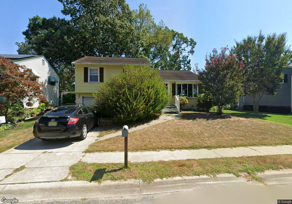
213 Sivia St Cape May, NJ 08204
Estimated Value: $500,112 - $557,000
4
Beds
2
Baths
1,400
Sq Ft
$378/Sq Ft
Est. Value
About This Home
This home is located at 213 Sivia St, Cape May, NJ 08204 and is currently estimated at $529,528, approximately $378 per square foot. 213 Sivia St is a home located in Cape May County with nearby schools including David C. Douglass Veterans Memorial School, Carl T. Mitnick School, and Maud Abrams School.
Ownership History
Date
Name
Owned For
Owner Type
Purchase Details
Closed on
Nov 1, 2011
Sold by
Dalton Michael W
Bought by
Fierro Michael J
Current Estimated Value
Home Financials for this Owner
Home Financials are based on the most recent Mortgage that was taken out on this home.
Original Mortgage
$175,437
Outstanding Balance
$118,761
Interest Rate
3.87%
Mortgage Type
FHA
Estimated Equity
$410,767
Purchase Details
Closed on
Nov 19, 2007
Sold by
Dalton Michael W
Bought by
Dalton Michael W
Purchase Details
Closed on
Aug 3, 1995
Sold by
Dalton Michael
Bought by
Dalton Kathleen O Donnell
Create a Home Valuation Report for This Property
The Home Valuation Report is an in-depth analysis detailing your home's value as well as a comparison with similar homes in the area
Home Values in the Area
Average Home Value in this Area
Purchase History
| Date | Buyer | Sale Price | Title Company |
|---|---|---|---|
| Fierro Michael J | $180,000 | The Title Company Of Jersey | |
| Dalton Michael W | -- | None Available | |
| Dalton Kathleen O Donnell | $42,250 | -- |
Source: Public Records
Mortgage History
| Date | Status | Borrower | Loan Amount |
|---|---|---|---|
| Open | Fierro Michael J | $175,437 |
Source: Public Records
Tax History Compared to Growth
Tax History
| Year | Tax Paid | Tax Assessment Tax Assessment Total Assessment is a certain percentage of the fair market value that is determined by local assessors to be the total taxable value of land and additions on the property. | Land | Improvement |
|---|---|---|---|---|
| 2025 | $3,746 | $184,700 | $88,000 | $96,700 |
| 2024 | $3,746 | $184,700 | $88,000 | $96,700 |
| 2023 | $3,692 | $184,700 | $88,000 | $96,700 |
| 2022 | $3,579 | $184,700 | $88,000 | $96,700 |
| 2021 | $3,472 | $184,700 | $88,000 | $96,700 |
| 2020 | $3,417 | $184,700 | $88,000 | $96,700 |
| 2019 | $3,332 | $184,700 | $88,000 | $96,700 |
| 2018 | $3,253 | $184,700 | $88,000 | $96,700 |
| 2017 | $3,256 | $184,700 | $88,000 | $96,700 |
| 2016 | $3,206 | $184,700 | $88,000 | $96,700 |
| 2015 | $3,103 | $184,700 | $88,000 | $96,700 |
| 2014 | $3,001 | $184,700 | $88,000 | $96,700 |
Source: Public Records
Map
Nearby Homes
- 226 Joanne St
- 217 Mindy Ave
- 236 Roseann Ave
- 113 Heidi Ave
- 215 Roseann Ave
- 319 Roseann Ave
- 100 Breakwater Terrace Unit UN100
- 105 Pontaxit Ave
- 66 Beachhurst Dr
- 86 Beachhurst Dr
- 3125 Hemlock Rd
- 105 Orchard Dr
- 118 Old Mill Dr
- 207 Old Mill Dr
- 210 Pontaxit Ave
- 4 Osprey Dr
- 111A Racetrack Dr
- 106 Racetrack Dr
- 219 Town Bank Rd
- 101 Avalon Rd