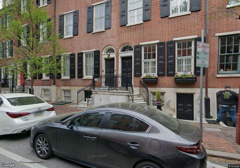
213 Spruce St Unit 1 Philadelphia, PA 19106
Society Hill NeighborhoodEstimated Value: $955,000 - $1,730,000
6
Beds
3
Baths
3,249
Sq Ft
$409/Sq Ft
Est. Value
About This Home
This home is located at 213 Spruce St Unit 1, Philadelphia, PA 19106 and is currently estimated at $1,327,887, approximately $408 per square foot. 213 Spruce St Unit 1 is a home located in Philadelphia County with nearby schools including General George A McCall Public School, Benjamin Franklin High School, and Mastery Charter High School Lenfest Campus.
Ownership History
Date
Name
Owned For
Owner Type
Purchase Details
Closed on
Oct 12, 2010
Sold by
Stanislaus Stephanie C and Estate Of Gregory Guz
Bought by
Graves Dana
Current Estimated Value
Home Financials for this Owner
Home Financials are based on the most recent Mortgage that was taken out on this home.
Original Mortgage
$417,000
Interest Rate
4.39%
Mortgage Type
New Conventional
Create a Home Valuation Report for This Property
The Home Valuation Report is an in-depth analysis detailing your home's value as well as a comparison with similar homes in the area
Home Values in the Area
Average Home Value in this Area
Purchase History
| Date | Buyer | Sale Price | Title Company |
|---|---|---|---|
| Graves Dana | $650,000 | None Available |
Source: Public Records
Mortgage History
| Date | Status | Borrower | Loan Amount |
|---|---|---|---|
| Closed | Graves Dana | $417,000 |
Source: Public Records
Tax History Compared to Growth
Tax History
| Year | Tax Paid | Tax Assessment Tax Assessment Total Assessment is a certain percentage of the fair market value that is determined by local assessors to be the total taxable value of land and additions on the property. | Land | Improvement |
|---|---|---|---|---|
| 2026 | $16,674 | $1,278,300 | $255,660 | $1,022,640 |
| 2025 | $16,674 | $1,278,300 | $255,660 | $1,022,640 |
| 2024 | $16,674 | $1,278,300 | $255,660 | $1,022,640 |
| 2023 | $16,674 | $1,191,200 | $238,240 | $952,960 |
| 2022 | $17,566 | $1,146,200 | $238,240 | $907,960 |
| 2021 | $18,196 | $0 | $0 | $0 |
| 2020 | $18,196 | $0 | $0 | $0 |
| 2019 | $17,608 | $0 | $0 | $0 |
| 2018 | $11,548 | $0 | $0 | $0 |
| 2017 | $11,548 | $0 | $0 | $0 |
| 2016 | $5,441 | $0 | $0 | $0 |
| 2015 | $13,496 | $0 | $0 | $0 |
| 2014 | -- | $825,000 | $92,820 | $732,180 |
| 2012 | -- | $126,528 | $17,203 | $109,325 |
Source: Public Records
Map
Nearby Homes
- 242 Locust St
- 283 Locust St
- 220 Locust St Unit 2D
- 220 Locust St Unit 26AS
- 210 Locust St Unit 16EW
- 210 Locust St Unit 21E
- 210 Locust St Unit 15EW
- 210 Locust St Unit 29EFW
- 210 Locust St Unit 29HW
- 202 Spruce St
- 302 S 2nd St
- 254 S 3rd St
- 200 Locust St Unit 27FN
- 200 Locust St Unit 24D
- 200 Locust St Unit 8A
- 2 Willings Alley Mews
- 211 25 S 4th St Unit 104
- 318 S 4th St
- 142R S Front St
- 410 S Front St Unit 209
- 211 Spruce St
- 215 Spruce St
- 209 Spruce St
- 217 Spruce St
- 219 Spruce St Unit 21
- 223 Spruce St
- 200 Spruce St
- 204 Spruce St Unit 3RD FL
- 204 Spruce St
- 206 Spruce St
- 232 Locust St
- 202 Spruce St Unit 2ND FL
- 202 Spruce St Unit 3RD FL
- 230 Locust St Unit 24
- 225 Spruce St Unit 27
- 201 Spruce St
- 220 Locust St Unit 26D
- 220 Locust St Unit 4C,D
- 220 Locust St Unit 14A
- 220 Locust St Unit 3DEF