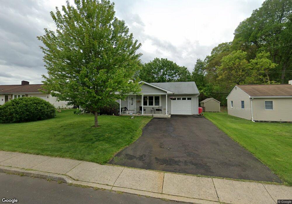
213 Stanford Rd Fairless Hills, PA 19030
Estimated Value: $383,000 - $418,000
3
Beds
1
Bath
1,320
Sq Ft
$303/Sq Ft
Est. Value
About This Home
This home is located at 213 Stanford Rd, Fairless Hills, PA 19030 and is currently estimated at $400,017, approximately $303 per square foot. 213 Stanford Rd is a home located in Bucks County with nearby schools including Oxford Valley Elementary School, William Penn Middle School, and Pennsbury High School.
Ownership History
Date
Name
Owned For
Owner Type
Purchase Details
Closed on
May 26, 2016
Sold by
Kirkpatrick Joyce S and Silvetti Joyce S
Bought by
Silvetti Lloyd A and Silvetti Joyce S
Current Estimated Value
Home Financials for this Owner
Home Financials are based on the most recent Mortgage that was taken out on this home.
Original Mortgage
$170,000
Outstanding Balance
$73,857
Interest Rate
2.85%
Mortgage Type
New Conventional
Estimated Equity
$326,160
Purchase Details
Closed on
Oct 15, 1987
Sold by
Kirkpatrick John R
Bought by
Kirkpatrick Joyce S and Kirkpatrick Michael J
Create a Home Valuation Report for This Property
The Home Valuation Report is an in-depth analysis detailing your home's value as well as a comparison with similar homes in the area
Home Values in the Area
Average Home Value in this Area
Purchase History
| Date | Buyer | Sale Price | Title Company |
|---|---|---|---|
| Silvetti Lloyd A | -- | Attorney | |
| Kirkpatrick Joyce S | -- | -- |
Source: Public Records
Mortgage History
| Date | Status | Borrower | Loan Amount |
|---|---|---|---|
| Open | Silvetti Lloyd A | $170,000 |
Source: Public Records
Tax History Compared to Growth
Tax History
| Year | Tax Paid | Tax Assessment Tax Assessment Total Assessment is a certain percentage of the fair market value that is determined by local assessors to be the total taxable value of land and additions on the property. | Land | Improvement |
|---|---|---|---|---|
| 2025 | $4,485 | $20,140 | $5,040 | $15,100 |
| 2024 | $4,485 | $20,140 | $5,040 | $15,100 |
| 2023 | $4,297 | $20,140 | $5,040 | $15,100 |
| 2022 | $4,164 | $20,140 | $5,040 | $15,100 |
| 2021 | $4,083 | $20,140 | $5,040 | $15,100 |
| 2020 | $4,083 | $20,140 | $5,040 | $15,100 |
| 2019 | $4,012 | $20,140 | $5,040 | $15,100 |
| 2018 | $3,962 | $20,140 | $5,040 | $15,100 |
| 2017 | $3,862 | $20,140 | $5,040 | $15,100 |
| 2016 | $3,841 | $19,420 | $5,040 | $14,380 |
| 2015 | $3,338 | $19,420 | $5,040 | $14,380 |
| 2014 | $3,338 | $19,420 | $5,040 | $14,380 |
Source: Public Records
Map
Nearby Homes
- 402 Stanford Rd
- 20 Trellis Rd
- 10 Thistle Rd
- 212 Apple St
- 125 Nursery Ave
- 59 Liberty Dr
- 61 Liberty Dr
- 180 Andover Rd Unit A
- 248 N Oxford Valley Rd
- 53 Crestwood Rd
- 24 Conifer Rd
- 78 Harmony Rd
- 657 S Queen Anne Dr
- 23 Crystal Place
- 11 Fieldstone Rd
- 75 Flamehill Rd
- 93 Flamehill Rd
- 01 Kyle Ln
- 0000000 Kyle Ln
- 0 Kyle Ln Unit PABU2095588
- 211 Stanford Rd
- 215 Stanford Rd
- 209 Stanford Rd
- 217 Stanford Rd
- 212 Stanford Rd
- 214 Stanford Rd
- 210 Stanford Rd
- 207 Stanford Rd
- 219 Stanford Rd
- 208 Stanford Rd
- 204 Yorkshire Rd
- 205 Stanford Rd
- 206 Stanford Rd Unit H111
- 221 Stanford Rd
- 203 Yorkshire Rd Unit H111
- 208 Wyandotte Rd
- 210 Wyandotte Rd
- 206 Wyandotte Rd Unit HIII
- 212 Wyandotte Rd
- 223 Stanford Rd