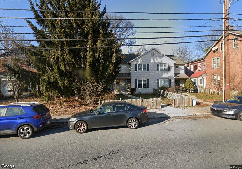
213 W High St Elizabethtown, PA 17022
Estimated Value: $235,000 - $282,959
3
Beds
2
Baths
1,336
Sq Ft
$188/Sq Ft
Est. Value
About This Home
This home is located at 213 W High St, Elizabethtown, PA 17022 and is currently estimated at $250,740, approximately $187 per square foot. 213 W High St is a home located in Lancaster County with nearby schools including East High Street Elementary School, Elizabethtown Area Middle School, and Elizabethtown Area Senior High School.
Ownership History
Date
Name
Owned For
Owner Type
Purchase Details
Closed on
Jun 22, 2006
Sold by
Hershey Joseph E and Hershey Nancy L
Bought by
Hershey Nicole L
Current Estimated Value
Purchase Details
Closed on
Oct 21, 1998
Sold by
Larry C Dombach Inc
Bought by
Hershey Joseph E and Hershey Nancy L
Home Financials for this Owner
Home Financials are based on the most recent Mortgage that was taken out on this home.
Original Mortgage
$75,900
Outstanding Balance
$16,388
Interest Rate
6.74%
Estimated Equity
$234,352
Create a Home Valuation Report for This Property
The Home Valuation Report is an in-depth analysis detailing your home's value as well as a comparison with similar homes in the area
Home Values in the Area
Average Home Value in this Area
Purchase History
| Date | Buyer | Sale Price | Title Company |
|---|---|---|---|
| Hershey Nicole L | -- | None Available | |
| Hershey Joseph E | $94,900 | -- |
Source: Public Records
Mortgage History
| Date | Status | Borrower | Loan Amount |
|---|---|---|---|
| Open | Hershey Joseph E | $75,900 |
Source: Public Records
Tax History Compared to Growth
Tax History
| Year | Tax Paid | Tax Assessment Tax Assessment Total Assessment is a certain percentage of the fair market value that is determined by local assessors to be the total taxable value of land and additions on the property. | Land | Improvement |
|---|---|---|---|---|
| 2025 | $4,153 | $147,900 | $31,900 | $116,000 |
| 2024 | $4,153 | $147,900 | $31,900 | $116,000 |
| 2023 | $3,996 | $147,900 | $31,900 | $116,000 |
| 2022 | $3,857 | $147,900 | $31,900 | $116,000 |
| 2021 | $3,609 | $147,900 | $31,900 | $116,000 |
| 2020 | $3,609 | $147,900 | $31,900 | $116,000 |
| 2019 | $3,537 | $147,900 | $31,900 | $116,000 |
| 2018 | $2,373 | $147,900 | $31,900 | $116,000 |
| 2017 | $3,020 | $103,300 | $25,100 | $78,200 |
| 2016 | $3,010 | $103,300 | $25,100 | $78,200 |
| 2015 | $954 | $103,300 | $25,100 | $78,200 |
| 2014 | $1,813 | $103,300 | $25,100 | $78,200 |
Source: Public Records
Map
Nearby Homes
- 25 & 31 N Poplar St
- 150 E Hummelstown St
- 203 E Park St
- 47 E College Ave
- 178 E Willow St
- 343 N Hanover St
- 120 N Locust St
- 28 Laurel Ave
- 15 Beech Ln
- 135 E Orange St
- 141 E Orange St
- 103 Mountainstone Dr
- 662 S Market St
- 105 Lake Rd
- 306 Cherry St
- 265 Maytown Rd
- 301 Decatur St
- 652 N Lime St
- 8 King Ct
- 175 Sun Valley Rd
- 211 W High St
- 209 W High St
- 215 W High St
- 205 W High St Unit 101
- 201 W High St
- 210 W High St
- 157 W High St
- 208 W High St
- 153 W High St Unit 201
- 204 W High St
- 151 W High St
- 149 W High St
- 156 W High St
- 145 W High St Unit 101
- 150 W High St
- 150 W High St Unit 101
- 212 W High St
- 164 W High St
- 139 W High St
- 148 W High St Unit 101