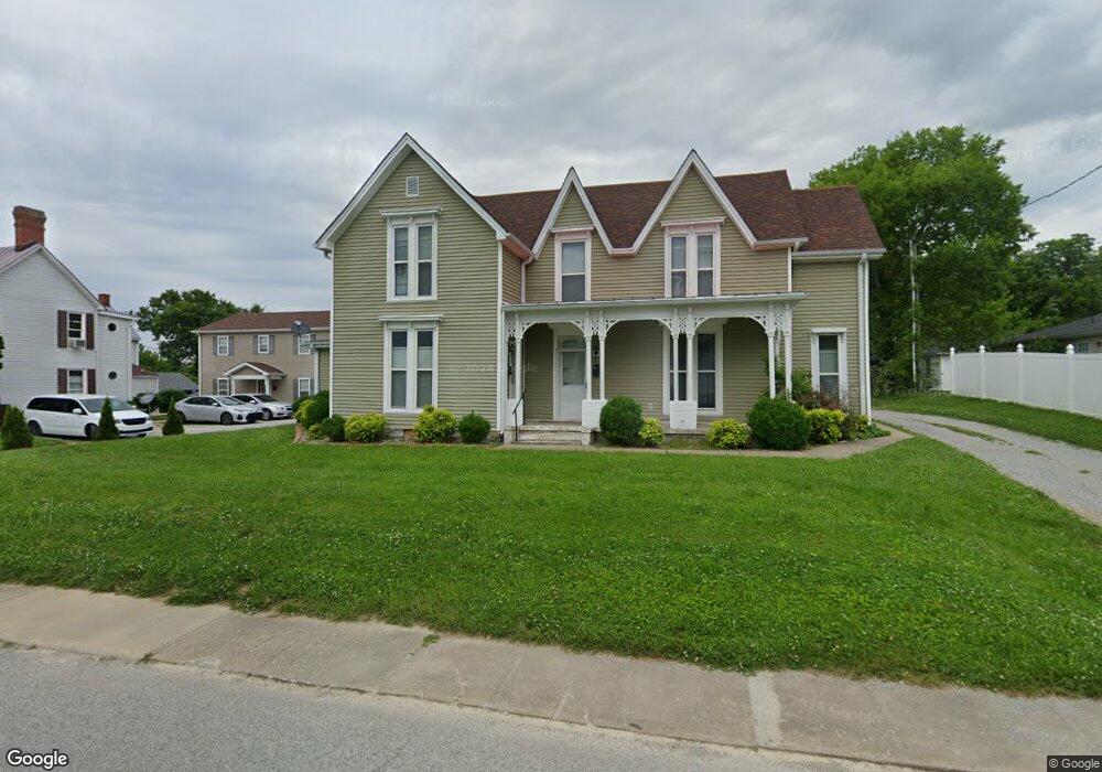
213 W High St Springfield, KY 40069
Estimated Value: $200,403 - $241,000
4
Beds
2
Baths
2,049
Sq Ft
$108/Sq Ft
Est. Value
About This Home
This home is located at 213 W High St, Springfield, KY 40069 and is currently estimated at $221,601, approximately $108 per square foot. 213 W High St is a home located in Washington County with nearby schools including Washington County Elementary School, North Washington Elementary School, and Washington County Middle School.
Ownership History
Date
Name
Owned For
Owner Type
Purchase Details
Closed on
Jan 1, 2016
Sold by
H R D Llc
Bought by
Cph Investments Lllp
Current Estimated Value
Purchase Details
Closed on
Dec 31, 2007
Sold by
Mandell Kenneth H
Bought by
Hrd Llc
Home Financials for this Owner
Home Financials are based on the most recent Mortgage that was taken out on this home.
Original Mortgage
$30,000
Interest Rate
6.15%
Mortgage Type
Purchase Money Mortgage
Create a Home Valuation Report for This Property
The Home Valuation Report is an in-depth analysis detailing your home's value as well as a comparison with similar homes in the area
Home Values in the Area
Average Home Value in this Area
Purchase History
| Date | Buyer | Sale Price | Title Company |
|---|---|---|---|
| Cph Investments Lllp | -- | None Available | |
| Hrd Llc | $300,000 | None Available |
Source: Public Records
Mortgage History
| Date | Status | Borrower | Loan Amount |
|---|---|---|---|
| Previous Owner | Hrd Llc | $30,000 |
Source: Public Records
Tax History Compared to Growth
Tax History
| Year | Tax Paid | Tax Assessment Tax Assessment Total Assessment is a certain percentage of the fair market value that is determined by local assessors to be the total taxable value of land and additions on the property. | Land | Improvement |
|---|---|---|---|---|
| 2024 | $1,468 | $150,000 | $0 | $0 |
| 2023 | $1,493 | $150,000 | $0 | $0 |
| 2022 | $1,509 | $150,000 | $0 | $0 |
| 2021 | $817 | $80,000 | $0 | $0 |
| 2020 | $671 | $65,000 | $0 | $0 |
| 2019 | $674 | $65,000 | $0 | $0 |
| 2018 | $672 | $65,000 | $0 | $0 |
| 2017 | $666 | $65,000 | $0 | $65,000 |
| 2016 | $669 | $65,000 | $0 | $0 |
| 2014 | $638 | $65,000 | $0 | $65,000 |
| 2010 | -- | $30,000 | $0 | $30,000 |
Source: Public Records
Map
Nearby Homes
- 105 N Locust Dr
- 220 W Main St
- 208 W Virginia Ave
- 327 W Main St
- Shalimar Subdivision
- 301 N Walnut St
- 305 N Walnut St
- 131 Armory Hill
- 210 E Virginia Ave
- 309 E Main St
- 608 Lincoln Park Rd
- 304 Covington Ave
- 119 Short St
- 314 E Grundy Ave
- 730 Lincoln Park Rd
- 105 Rizer Ave
- 306 Lebanon Hill
- 10001 Bloomfield Rd
- 608 Claybrook Ave
- 210 Rizer Ave
- 217 W High St
- 207 W High St Unit 205
- 303 N Locust St
- 212 W High St
- 206 W High St
- 301 W High St
- 210 W High St
- 208 W High St
- 302 N Locust St
- 305 N Locust St
- 203 N Locust St
- 204 N Locust St
- 203 W High St
- 204 W High St
- 303 W High St
- 218 W Mccord St
- 302 N Doctor St
- 202 N Locust St
- 201 N Locust St
- 201 W High St