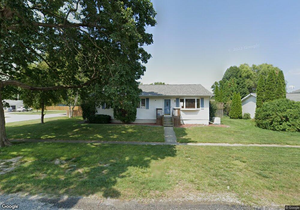
213 W Locust St Unit 1 Chatham, IL 62629
Estimated Value: $211,000 - $264,191
3
Beds
3
Baths
2,816
Sq Ft
$87/Sq Ft
Est. Value
About This Home
This home is located at 213 W Locust St Unit 1, Chatham, IL 62629 and is currently estimated at $245,798, approximately $87 per square foot. 213 W Locust St Unit 1 is a home located in Sangamon County with nearby schools including Chatham Elementary School, Glenwood Middle School, and Glenwood Intermediate School.
Ownership History
Date
Name
Owned For
Owner Type
Purchase Details
Closed on
Jul 5, 2022
Sold by
Uden Aaron L and Uden Kimberly K
Bought by
Deweese Kristen and Garner Kyle
Current Estimated Value
Home Financials for this Owner
Home Financials are based on the most recent Mortgage that was taken out on this home.
Original Mortgage
$207,900
Outstanding Balance
$198,031
Interest Rate
5.23%
Mortgage Type
New Conventional
Estimated Equity
$47,767
Purchase Details
Closed on
Jun 29, 2009
Purchase Details
Closed on
Dec 18, 1998
Purchase Details
Closed on
Sep 16, 1998
Create a Home Valuation Report for This Property
The Home Valuation Report is an in-depth analysis detailing your home's value as well as a comparison with similar homes in the area
Home Values in the Area
Average Home Value in this Area
Purchase History
| Date | Buyer | Sale Price | Title Company |
|---|---|---|---|
| Deweese Kristen | $231,000 | Fernandes David A | |
| -- | $141,000 | -- | |
| -- | -- | -- | |
| -- | -- | -- |
Source: Public Records
Mortgage History
| Date | Status | Borrower | Loan Amount |
|---|---|---|---|
| Open | Deweese Kristen | $207,900 |
Source: Public Records
Tax History Compared to Growth
Tax History
| Year | Tax Paid | Tax Assessment Tax Assessment Total Assessment is a certain percentage of the fair market value that is determined by local assessors to be the total taxable value of land and additions on the property. | Land | Improvement |
|---|---|---|---|---|
| 2024 | $3,824 | $53,318 | $6,076 | $47,242 |
| 2023 | $3,685 | $49,069 | $5,592 | $43,477 |
| 2022 | $3,167 | $47,259 | $5,386 | $41,873 |
| 2021 | $3,131 | $46,469 | $5,296 | $41,173 |
| 2020 | $3,044 | $45,336 | $5,167 | $40,169 |
| 2019 | $2,995 | $45,282 | $5,161 | $40,121 |
| 2018 | $2,913 | $44,749 | $5,100 | $39,649 |
| 2017 | $2,877 | $44,263 | $5,045 | $39,218 |
| 2016 | $2,821 | $43,349 | $4,941 | $38,408 |
| 2015 | $2,835 | $42,928 | $4,893 | $38,035 |
| 2014 | $2,817 | $42,440 | $4,837 | $37,603 |
| 2013 | $2,759 | $41,788 | $4,763 | $37,025 |
Source: Public Records
Map
Nearby Homes
- 26 Circle
- 530 S Grand Ave
- 309 Dewberry Trail
- 0 State Route 4
- 510 E Chestnut St Unit 1
- 448 Wintergreen Dr
- 68 Moonlight Ct
- 802 E Locust St
- 34 Buckingham Rd Unit 1
- 852 Oxford Dr Unit 1
- 856 Oxford Dr Unit 1
- 719 E Walnut St Unit 1
- 911 Mesa Dr
- 108 Kodiak Dr
- 337 Keystone Dr
- 300 Hodges Ct
- 315 Aspen Dr
- 327 Aspen Dr
- 305 Hodges Ct
- 1005 Campanella Dr
- 211 W Locust St Unit 1
- 200 S Church St Unit 1
- 205 W Locust St Unit 1
- 208 W Locust St Unit 1
- 301 W Locust St Unit 1
- 204 W Locust St Unit 1
- 115 S Church St Unit 1
- 300 W Locust St Unit 1
- 210 W Chestnut St
- 214 W Chestnut St
- 207 S Church St Unit 1
- 305 W Locust St Unit 1
- 101 S Church St Unit 1
- 304 W Locust St Unit 1
- 200 W Locust St Unit 1
- 309 W Locust St
- 109 S Market St
- 205 S Market St
- 205 W Spruce St Unit 1
- 313 W Locust St Unit 1