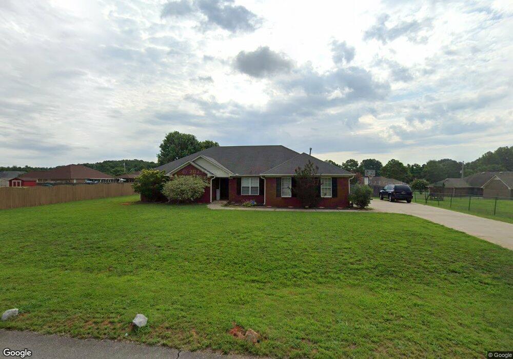
213 Waypoint Cir Harvest, AL 35749
Harvest-Cluttsville NeighborhoodEstimated Value: $311,537 - $342,000
4
Beds
2
Baths
1,923
Sq Ft
$171/Sq Ft
Est. Value
About This Home
This home is located at 213 Waypoint Cir, Harvest, AL 35749 and is currently estimated at $328,384, approximately $170 per square foot. 213 Waypoint Cir is a home located in Madison County with nearby schools including Harvest Elementary School, Sparkman Middle School, and Sparkman High School.
Ownership History
Date
Name
Owned For
Owner Type
Purchase Details
Closed on
Jan 22, 2010
Sold by
The United States Department Of Hud
Bought by
Watson Reginald E and Watson Benetra R
Current Estimated Value
Home Financials for this Owner
Home Financials are based on the most recent Mortgage that was taken out on this home.
Original Mortgage
$148,555
Outstanding Balance
$96,790
Interest Rate
4.8%
Mortgage Type
FHA
Estimated Equity
$231,594
Purchase Details
Closed on
Jan 8, 2010
Sold by
The United States Department Of Hud
Bought by
Watson Reginald E and Watson Benetra R
Home Financials for this Owner
Home Financials are based on the most recent Mortgage that was taken out on this home.
Original Mortgage
$148,555
Outstanding Balance
$96,790
Interest Rate
4.8%
Mortgage Type
FHA
Estimated Equity
$231,594
Purchase Details
Closed on
Jan 8, 2009
Sold by
Alabama Housing Finance Authority
Bought by
Secretary Of Hud
Purchase Details
Closed on
Aug 9, 2001
Sold by
Pean Sakina
Bought by
Alabama Housing Finance Authority
Create a Home Valuation Report for This Property
The Home Valuation Report is an in-depth analysis detailing your home's value as well as a comparison with similar homes in the area
Home Values in the Area
Average Home Value in this Area
Purchase History
| Date | Buyer | Sale Price | Title Company |
|---|---|---|---|
| Watson Reginald E | -- | -- | |
| Watson Reginald E | -- | -- | |
| Secretary Of Hud | -- | -- | |
| Alabama Housing Finance Authority | $133,625 | -- |
Source: Public Records
Mortgage History
| Date | Status | Borrower | Loan Amount |
|---|---|---|---|
| Open | Watson Reginald E | $148,555 | |
| Closed | Watson Reginald E | $148,555 |
Source: Public Records
Tax History Compared to Growth
Tax History
| Year | Tax Paid | Tax Assessment Tax Assessment Total Assessment is a certain percentage of the fair market value that is determined by local assessors to be the total taxable value of land and additions on the property. | Land | Improvement |
|---|---|---|---|---|
| 2024 | $875 | $25,760 | $5,780 | $19,980 |
| 2023 | $875 | $25,500 | $4,460 | $21,040 |
| 2022 | $783 | $23,140 | $4,460 | $18,680 |
| 2021 | $665 | $19,780 | $2,900 | $16,880 |
| 2020 | $616 | $18,430 | $2,890 | $15,540 |
| 2019 | $594 | $17,830 | $2,890 | $14,940 |
| 2018 | $560 | $16,900 | $0 | $0 |
| 2017 | $560 | $16,900 | $0 | $0 |
| 2016 | $560 | $16,900 | $0 | $0 |
| 2015 | $560 | $16,900 | $0 | $0 |
| 2014 | $550 | $16,620 | $0 | $0 |
Source: Public Records
Map
Nearby Homes
- 122 Emory Dr
- 308 Blue Creek Dr
- 132 Emory Dr
- 119 Twin Springs Dr
- 164 Fenwick Place
- 156 Fenwick Place
- 160 Fenwick Place
- 178 Fenwick Place
- 105 Glenhaven Ct
- 132 Sunshine Dr
- 110 Windledge
- 167 W Highlander Rd
- 266 Yarbrough Rd
- 166 Fenwick Place
- 125 Sager Cir
- 139 Thunderbird Dr
- 245 W Highlander Rd
- 140 Amelia Dr
- 108 Ashby Pond Dr
- Residence 1837 Plan at Highlands Trail - Townhomes
- 211 Waypoint Cir
- 215 Waypoint Cir
- 214 Waypoint Cir
- 102 Stadia Cir
- 204 Thunderbird Dr
- 202 Thunderbird Dr
- 212 Waypoint Cir
- 104 Stadia Cir
- 102 Emory Dr
- 200 Thunderbird Dr
- 218 Waypoint Cir
- 214 Thunderbird Dr
- 219 Waypoint Cir
- 106 Stadia Cir
- 103 Stadia Cir
- 205 Thunderbird Dr
- 105 Stadia Cir
- 105 Emory Dr
- 203 Thunderbird Dr
- 211 Thunderbird Dr