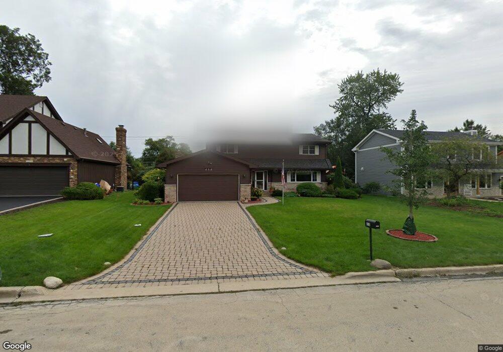
213 White Oak Dr Wheaton, IL 60187
West Wheaton NeighborhoodEstimated Value: $543,000 - $726,000
4
Beds
3
Baths
2,555
Sq Ft
$246/Sq Ft
Est. Value
About This Home
This home is located at 213 White Oak Dr, Wheaton, IL 60187 and is currently estimated at $629,285, approximately $246 per square foot. 213 White Oak Dr is a home located in DuPage County with nearby schools including Emerson Elementary School, Monroe Middle School, and Wheaton North High School.
Ownership History
Date
Name
Owned For
Owner Type
Purchase Details
Closed on
Jan 21, 2021
Sold by
Sender Donald A and Sender Ruth E
Bought by
Sender Donald A and Sender Ruth E
Current Estimated Value
Purchase Details
Closed on
May 8, 2001
Sold by
Sender Donald A and Sender Ruth E
Bought by
Sender Donald A and Sender Ruth E
Create a Home Valuation Report for This Property
The Home Valuation Report is an in-depth analysis detailing your home's value as well as a comparison with similar homes in the area
Home Values in the Area
Average Home Value in this Area
Purchase History
| Date | Buyer | Sale Price | Title Company |
|---|---|---|---|
| Sender Donald A | -- | None Available | |
| Sender Donald A | -- | Chicago Title Insurance Co |
Source: Public Records
Tax History
| Year | Tax Paid | Tax Assessment Tax Assessment Total Assessment is a certain percentage of the fair market value that is determined by local assessors to be the total taxable value of land and additions on the property. | Land | Improvement |
|---|---|---|---|---|
| 2024 | $10,870 | $184,656 | $29,268 | $155,388 |
| 2023 | $10,405 | $169,970 | $26,940 | $143,030 |
| 2022 | $10,362 | $160,630 | $25,460 | $135,170 |
| 2021 | $10,320 | $156,820 | $24,860 | $131,960 |
| 2020 | $10,285 | $155,360 | $24,630 | $130,730 |
| 2019 | $10,041 | $151,260 | $23,980 | $127,280 |
| 2018 | $9,897 | $147,650 | $22,590 | $125,060 |
| 2017 | $10,109 | $142,210 | $21,760 | $120,450 |
| 2016 | $9,595 | $136,530 | $20,890 | $115,640 |
| 2015 | $9,504 | $130,250 | $19,930 | $110,320 |
| 2014 | $7,974 | $109,340 | $16,570 | $92,770 |
| 2013 | $7,770 | $109,670 | $16,620 | $93,050 |
Source: Public Records
Map
Nearby Homes
- 315 S Morgan Ave
- 615 Polo Dr
- 524 Western Ave
- 1478 Timber Trail Unit 15C
- 1474 Timber Trail Unit D
- 705 S Gables Blvd
- 870 S Kilkenny Dr Unit D
- 606 W Franklin St
- 0N112 Leonard St
- 1037 Wheaton Oaks Dr
- 1327 Shagbark Ln
- 100 N Gary Ave Unit 408
- 933 Wheaton Oaks Dr
- 405 W Front St Unit 3207
- 0N105 Lot 1 Nepil Ave
- 0N105 Lot 2 Nepil Ave
- 26W548 Prairie Ave
- 536 W Evergreen St
- N405 Gary Ave
- 26W524 Jewell Rd
- 217 White Oak Dr
- 209 White Oak Dr
- 1608 Manchester Rd
- 210 N Pierce Ave
- 205 White Oak Dr
- 210 White Oak Dr
- 214 White Oak Dr
- 206 N Pierce Ave
- 206 White Oak Dr
- 202 N Pierce Ave
- 201 White Oak Dr
- 1762 Manchester Rd
- 1725 Maple Leaf Ct
- 130 N Pierce Ave
- 135 White Oak Dr
- 1766 Manchester Rd
- 1520 Manchester Rd
- 1745 Maple Leaf Ct
- 215 N Pierce Ave
- 211 N Pierce Ave
Your Personal Tour Guide
Ask me questions while you tour the home.