Estimated Value: $262,000 - $431,000
3
Beds
3
Baths
1,986
Sq Ft
$171/Sq Ft
Est. Value
About This Home
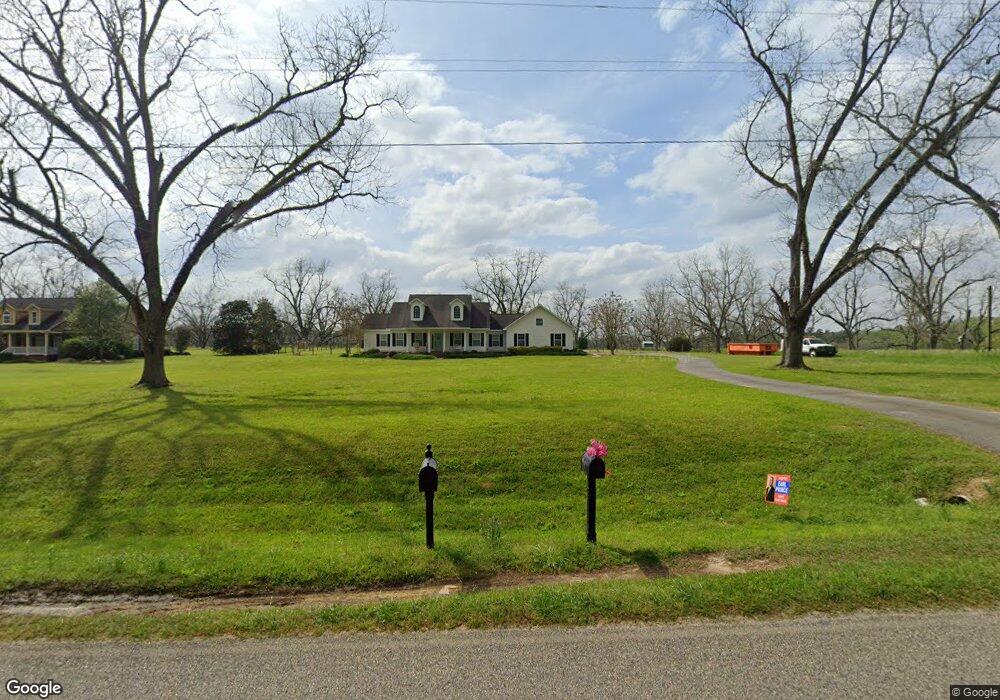
This home is located at 213 Woodland Rd, Cairo, GA 39827 and is currently estimated at $338,895, approximately $170 per square foot. 213 Woodland Rd is a home located in Grady County with nearby schools including Cairo High School.
Ownership History
Date
Name
Owned For
Owner Type
Purchase Details
Closed on
Apr 12, 2021
Sold by
Johnson Lauren Elizabeth
Bought by
Harrell Lauren Johnson
Current Estimated Value
Purchase Details
Closed on
Jan 30, 2017
Sold by
Ward John E
Bought by
Johnson Lauren Elizabeth
Home Financials for this Owner
Home Financials are based on the most recent Mortgage that was taken out on this home.
Original Mortgage
$166,920
Interest Rate
3.75%
Mortgage Type
FHA
Purchase Details
Closed on
May 27, 2010
Sold by
Ward Sandra B
Bought by
Ward John E
Purchase Details
Closed on
Apr 6, 2007
Sold by
Holton & Ward Llc
Bought by
M & W Development
Purchase Details
Closed on
Feb 10, 2005
Bought by
Holton & Ward Llc
Create a Home Valuation Report for This Property
The Home Valuation Report is an in-depth analysis detailing your home's value as well as a comparison with similar homes in the area
Home Values in the Area
Average Home Value in this Area
Purchase History
| Date | Buyer | Sale Price | Title Company |
|---|---|---|---|
| Harrell Lauren Johnson | -- | -- | |
| Johnson Lauren Elizabeth | $170,000 | -- | |
| Ward John E | -- | -- | |
| Ward Sandra B | -- | -- | |
| M & W Development | $70,000 | -- | |
| Holton & Ward Llc | -- | -- |
Source: Public Records
Mortgage History
| Date | Status | Borrower | Loan Amount |
|---|---|---|---|
| Previous Owner | Johnson Lauren Elizabeth | $166,920 |
Source: Public Records
Tax History Compared to Growth
Tax History
| Year | Tax Paid | Tax Assessment Tax Assessment Total Assessment is a certain percentage of the fair market value that is determined by local assessors to be the total taxable value of land and additions on the property. | Land | Improvement |
|---|---|---|---|---|
| 2024 | $3,750 | $123,888 | $12,000 | $111,888 |
| 2023 | $2,243 | $79,462 | $6,000 | $73,462 |
| 2022 | $2,243 | $79,462 | $6,000 | $73,462 |
| 2021 | $2,250 | $79,462 | $6,000 | $73,462 |
| 2020 | $2,257 | $79,462 | $6,000 | $73,462 |
| 2019 | $2,257 | $79,462 | $6,000 | $73,462 |
| 2018 | $1,780 | $78,364 | $6,000 | $72,364 |
| 2017 | $2,170 | $78,364 | $6,000 | $72,364 |
| 2016 | $1,865 | $66,957 | $6,000 | $60,957 |
| 2015 | $1,842 | $66,957 | $6,000 | $60,957 |
| 2014 | $1,845 | $66,957 | $6,000 | $60,957 |
| 2013 | -- | $85,144 | $9,600 | $75,544 |
Source: Public Records
Map
Nearby Homes
- 00 State Route 188
- 0 State Route 188
- 414 Woodland Rd
- 00 NW 9th Ave
- 0 20th St NE
- 00 20th St NE
- 1420 Parallel Dr NW
- 2975 U S 84
- 000 15th Ave Nw -- Tract 2
- 105 Woodridge Ln
- 000 15th Ave Nw -- Tract 1
- 0 NE Airport Rd Unit 145784
- 711 2nd Ave NE
- 158 Woodridge Ln
- 2600 U S 84
- 66 22nd St NE
- 00 6th St NW
- Lot #15, 3 64 Acres Oakbend Cir
- 78.6 Ac Strickland Rd
- 220 8th Ave NW
- 195 Woodland Rd
- 179 Woodland Rd
- 178 Woodland Rd
- 161 Woodland Rd
- 283 Woodland Rd
- 145 Woodland Rd
- 128 Woodland Rd
- 109 Woodland Rd
- Lot 4 State Route 188
- TRACT 4 State Route 188
- 34.88 +/ State Route 188
- 3126 hwy State Route 188
- TRACT 3 State Route 188
- TRACT 1 State Route 188
- TRACT 2 State Route 188
- 3199 State Route 188
- 344 Woodland Rd
- Lot 5 Woodland Lakes
- 347 Woodland Rd
- 000 Hwy 188 N