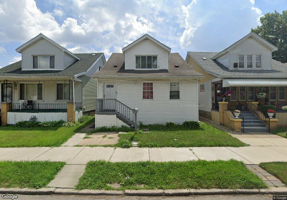
2130 Burnside St HamtraMcK, MI 48212
Campau-Banglatown NeighborhoodEstimated Value: $99,000 - $201,000
Studio
2
Baths
1,449
Sq Ft
$90/Sq Ft
Est. Value
About This Home
This home is located at 2130 Burnside St, HamtraMcK, MI 48212 and is currently estimated at $130,448, approximately $90 per square foot. 2130 Burnside St is a home located in Wayne County with nearby schools including Davison Elementary-Middle School, Charles L. Spain Elementary-Middle School, and Edward 'Duke' Ellington Conservatory of Music and Art.
Ownership History
Date
Name
Owned For
Owner Type
Purchase Details
Closed on
Mar 15, 2015
Sold by
Mohamed Mohamed
Bought by
Mohamed Fuad Ahmed
Current Estimated Value
Purchase Details
Closed on
Sep 20, 2010
Sold by
Mohamed Fuad Ahmed and Alyafai Shaima
Bought by
Mohamed Mohamed Ali Ali
Purchase Details
Closed on
Aug 31, 2010
Sold by
Shavers Melvin A and Shavers Ruby M
Bought by
Mohamed Fuad Ahmed
Purchase Details
Closed on
Oct 1, 2009
Sold by
Williams Carol Ann
Bought by
Shavers Melvin A
Create a Home Valuation Report for This Property
The Home Valuation Report is an in-depth analysis detailing your home's value as well as a comparison with similar homes in the area
Home Values in the Area
Average Home Value in this Area
Purchase History
| Date | Buyer | Sale Price | Title Company |
|---|---|---|---|
| Mohamed Fuad Ahmed | -- | None Available | |
| Mohamed Mohamed Ali Ali | $15,000 | None Available | |
| Mohamed Fuad Ahmed | $7,000 | None Available | |
| Shavers Melvin A | -- | None Available |
Source: Public Records
Tax History
| Year | Tax Paid | Tax Assessment Tax Assessment Total Assessment is a certain percentage of the fair market value that is determined by local assessors to be the total taxable value of land and additions on the property. | Land | Improvement |
|---|---|---|---|---|
| 2025 | $717 | $22,700 | $0 | $0 |
| 2024 | $852 | $19,300 | $0 | $0 |
| 2023 | $695 | $13,000 | $0 | $0 |
| 2022 | $749 | $13,100 | $0 | $0 |
| 2021 | $733 | $10,200 | $0 | $0 |
| 2020 | $727 | $9,200 | $0 | $0 |
| 2019 | $718 | $7,400 | $0 | $0 |
| 2018 | $630 | $6,700 | $0 | $0 |
| 2017 | $123 | $6,500 | $0 | $0 |
| 2016 | $1,096 | $17,000 | $0 | $0 |
| 2015 | $1,000 | $10,000 | $0 | $0 |
| 2013 | $978 | $12,427 | $0 | $0 |
| 2010 | -- | $18,220 | $399 | $17,821 |
Source: Public Records
Map
Nearby Homes
- 2438 Burnside St
- 2020 Halleck St
- 2358 Neibel St
- 2388 Neibel St
- 2393 Botsford St
- 12001 Saint Aubin St
- 11634 Saint Aubin St
- 11603 Lumpkin St
- 11614 Nagel St
- 12140 Mitchell St
- 11705 Mackay St
- 11756 Dyar St
- 11523 Fleming St
- 11727 Dyar St
- 11655 Mitchell St
- 12511 Gallagher St
- 11399 Lumpkin St
- 13479 Mackay St
- 12091 Sobieski St
- 12660 Gallagher St
- 2124 Burnside St
- 2136 Burnside St
- 2142 Burnside St
- 2112 Burnside St
- 2135 Mcpherson St
- 2123 Mcpherson St
- 2106 Burnside St
- 2139 Mcpherson St
- 2145 Mcpherson St
- 2129 Burnside St
- 2100 Burnside St
- 2121 Burnside St
- 2133 Burnside St
- 2141 Burnside St
- 2111 Burnside St
- 2099 Mcpherson St
- 2094 Burnside St
- 2408 Burnside St
- 2403 Mcpherson St
- 2088 Burnside St
Your Personal Tour Guide
Ask me questions while you tour the home.