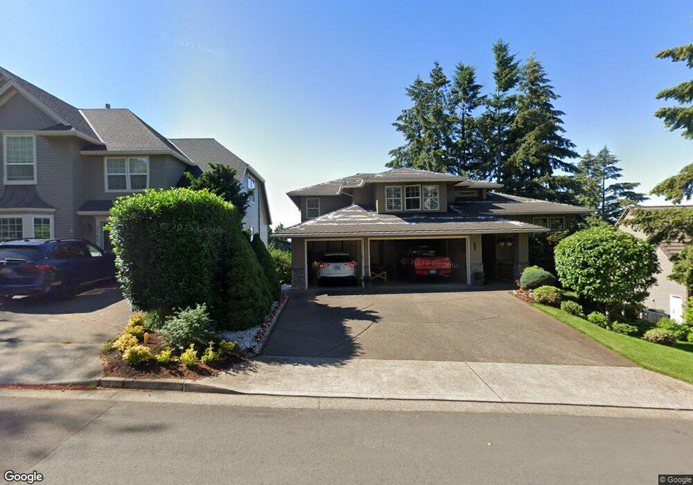
2130 Fircrest Dr West Linn, OR 97068
Tanner Basin NeighborhoodEstimated Value: $1,306,000 - $1,490,000
5
Beds
4
Baths
4,552
Sq Ft
$309/Sq Ft
Est. Value
About This Home
This home is located at 2130 Fircrest Dr, West Linn, OR 97068 and is currently estimated at $1,406,717, approximately $309 per square foot. 2130 Fircrest Dr is a home located in Clackamas County with nearby schools including Trillium Creek Primary School, Rosemont Ridge Middle School, and West Linn High School.
Ownership History
Date
Name
Owned For
Owner Type
Purchase Details
Closed on
Mar 9, 2005
Sold by
Merullo Richard F and Merullo Marie T
Bought by
Corry Thomas B and Corry Shelley K
Current Estimated Value
Home Financials for this Owner
Home Financials are based on the most recent Mortgage that was taken out on this home.
Original Mortgage
$600,000
Interest Rate
4.87%
Mortgage Type
Fannie Mae Freddie Mac
Purchase Details
Closed on
Oct 31, 2002
Sold by
Hargrave John K
Bought by
Merullo Richard F and Merullo Marie T
Home Financials for this Owner
Home Financials are based on the most recent Mortgage that was taken out on this home.
Original Mortgage
$670,000
Interest Rate
2.87%
Purchase Details
Closed on
Jul 12, 2001
Sold by
Oakridge Estates Development Corp
Bought by
Hargrave John K
Create a Home Valuation Report for This Property
The Home Valuation Report is an in-depth analysis detailing your home's value as well as a comparison with similar homes in the area
Home Values in the Area
Average Home Value in this Area
Purchase History
| Date | Buyer | Sale Price | Title Company |
|---|---|---|---|
| Corry Thomas B | $750,000 | First American Title Insuran | |
| Merullo Richard F | $670,000 | Fidelity National Title Co | |
| Hargrave John K | $98,900 | Pacific Nw Title |
Source: Public Records
Mortgage History
| Date | Status | Borrower | Loan Amount |
|---|---|---|---|
| Previous Owner | Corry Thomas B | $600,000 | |
| Previous Owner | Merullo Richard F | $670,000 |
Source: Public Records
Tax History Compared to Growth
Tax History
| Year | Tax Paid | Tax Assessment Tax Assessment Total Assessment is a certain percentage of the fair market value that is determined by local assessors to be the total taxable value of land and additions on the property. | Land | Improvement |
|---|---|---|---|---|
| 2025 | $16,526 | $857,538 | -- | -- |
| 2024 | $15,908 | $832,562 | -- | -- |
| 2023 | $15,908 | $808,313 | $0 | $0 |
| 2022 | $15,015 | $784,770 | $0 | $0 |
| 2021 | $14,191 | $761,913 | $0 | $0 |
| 2020 | $14,077 | $739,722 | $0 | $0 |
| 2019 | $13,502 | $718,177 | $0 | $0 |
| 2018 | $12,847 | $697,259 | $0 | $0 |
| 2017 | $12,076 | $676,950 | $0 | $0 |
| 2016 | $11,589 | $657,233 | $0 | $0 |
| 2015 | $11,107 | $638,090 | $0 | $0 |
| 2014 | $9,973 | $588,568 | $0 | $0 |
Source: Public Records
Map
Nearby Homes
- 2201 Satter St
- Allstone Plan at Savannah Summit
- Milton Plan at Savannah Summit
- 2285 Satter St
- 2258 Satter St
- 2134 Eleanor Rd
- 23000 Bland Cir
- 2155 Alpine Dr
- 22872 Weatherhill Rd
- 22998 Bland Cir
- 22994 Bland Cir
- 22990 Bland Cir
- 23073 Bland Cir
- 23019 Bland Cir
- 2025 De Vries Way
- 2037 De Vries Way
- 2050 Alpine Dr
- 2540 Kilkenny Ct
- 2485 Tipperary Ct
- 23136 Bland Cir
- 2140 Fircrest Dr
- 2225 Crestview Dr
- 2120 Fircrest Dr
- 2105 Fircrest Dr
- 2105 Fircrest Dr Unit 62
- 2215 Crestview Dr
- 2235 Crestview Dr
- 2150 Fircrest Dr
- 2125 Fircrest Dr
- 2135 Fircrest Dr
- 2110 Fircrest Dr
- 2155 Satter St
- 2211 Crestview Dr
- 2149 Satter St
- 2245 Crestview Dr
- 2167 Satter St
- 2167 Satter St Unit Lot 5
- 2115 Fircrest Dr
- 2220 Crestview Dr
- 2160 Fircrest Dr